Professional navigation chart centered on Senigallia
Senigallia
Region: Central Adriatic
| Position: 43.72, 13.221667 | Adriatic Sea / Jadransko more
43°43".2N 13°13'.3E Charts BA 220 The fishing port and 300-berth marina at Senigallia are surrounded by the hotels and crowded beaches of a popular holiday resort. The harbour itself is on the Fiume Miso, with a double basin and the interconnecting marina (entered from the river) to the 'IX'. There are plans to extend the W breakwater. The history
General
43°43".2N 13°13'.3E Charts BA 220 The fishing port and 300-berth marina at Senigallia are surrounded by the hotels and crowded beaches of a popular holiday resort. The harbour itself is on the Fiume Miso, with a double basin and the interconnecting marina (entered from the river) to the 'IX'. There are plans to extend the W breakwater. The history of the town pre-dates the Romans. Today there are a number of old buildings and museums, which can be seen, but the most famous is the fifteenth century fort, Rocca Roveresca.
Approach
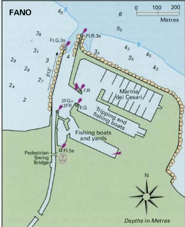
The coast between Fano and Senigallia is built up. The harbour at Senigallia can be identified by one tall brick chimney, located to the W of the entrance. A hort pier, with a distinctive round building on its end, lies a short distance to the SE of the harbour entrance. The entrance channel leading to the marina at Senigallia is narrow! The entrance lies between two breakwaters, of different lengths, each of which has a light on the end. The light structures are not conspicuous. Towards the root of the E breakwater there is a lighthouse painted with black and white bands. When approaching the entrance beware of comparatively shallow seas extending some distance offshore, and very shallow water on either side of the breakwaters. The channel is normally dredged to 3m but beware of the possibility of silting reducing the depths. When the river is in spate it can create sandbanks in the river and approaches. The entrance is dangerous in strong onshore winds. A swing bridge crosses the channel north of the entrance to the inner basin. During the day it is kept closed, but it will open on demand. Give at least five short blasts on your foghorn if you wish to pass through or contact the Darsena Turistico on VHF Ch 11. At night, the bridge is left open.
Lights
Senigallia LtHo LFl(2)15s17m15M W breakwater Fl.G.3s8m8M E breakwater Fl.R.3s8m8M Horn Mo(D)45s Aero beacon just S of the LtHo F.R Temporary light at end of new development F.R.
Berth
The best berth is in the marina. Alternatively, tie up in the first of the inner basins wherever there is space.
Shelter
Good shelter in the marina.
Officials
Harbourmaster's office is located on the E side of the river, opposite the entrance to the inner basins. The customs office is on the same side of the river, but beyond the rail bridge (the first fixed bridge). Police.
Facilities
Water, electricity, toilets and showers at the marina. Water is also laid onto the quays of the inner basins. Petrol and diesel from the fuel berth on the porthand side of the inner entrance to the marina. Italian gas and Camping Gaz. A good selection of shops where most provisions can be obtained. Fruit and vegetable market. Fish market. Launderette. Post Office, telephones, banks, ATMs. Doctors, dentists, hospital, pharmacies. Tourist information. Hotels, restaurants, cafe/bars, discos, etc. Cinemas, swimming pool, sports centre. Sailing club. Railway station, bus service, car hire, taxis. Repairs to hulls, engines, electrical/electronic installations and sails are possible. Bukh and Volvo Penta agents. Falconara Marittima Charts BA 220, 1444 (detailed)
Adriatic Navigation Guide Images for Senigallia
Adriatic Navigation Guide images and captions provide additional visual reference for this navigation location.
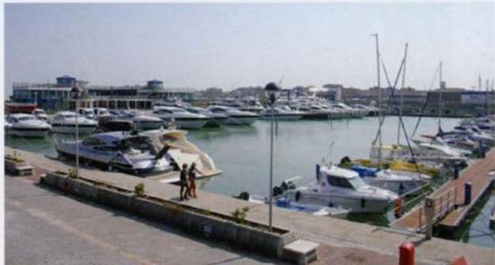
The modern Marina dei Cesari has excellent facilities, and makes an comfortable base forexploring the old town of Fano with its town walls and gates