Seget
Region: Central Adriatic
| Position: 43.516667, 16.233333 | Adriatic Sea / Jadransko more
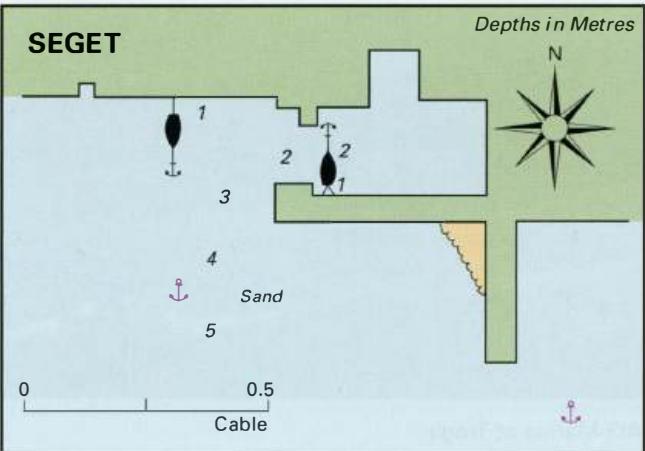
43°31.N 16°14'E Charts BA 2712, 2774, SC 5767, MK16, lmray M26 This small fishing village lies just over a mile W of Trogir, on the main road. The old part of the village clusters around the harbour. There is barely enough room for a small yacht to tie up, the harbour is so small. It is however possible to anchor off (keeping to the W of the pier)
General
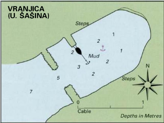
43°31.N 16°14'E Charts BA 2712, 2774, SC 5767, MK16, lmray M26 This small fishing village lies just over a mile W of Trogir, on the main road. The old part of the village clusters around the harbour. There is barely enough room for a small yacht to tie up, the harbour is so small. It is however possible to anchor off (keeping to the W of the pier) in 4-5m. The bottom is sand and good holding. Facilities ashore include a shop, hotel, restaurant, cafe/bar and a bus service to Trogir. The village has a 16th-century castle and an 18th-century church. Vranjica (Uvala Sasina)
Adriatic Navigation Guide Images for Seget
Adriatic Navigation Guide images and captions provide additional visual reference for this navigation location.