San Bartolomeo
Region: North Adriatic
| Position: 45.596667, 13.723333 | Adriatic Sea / Jadransko more
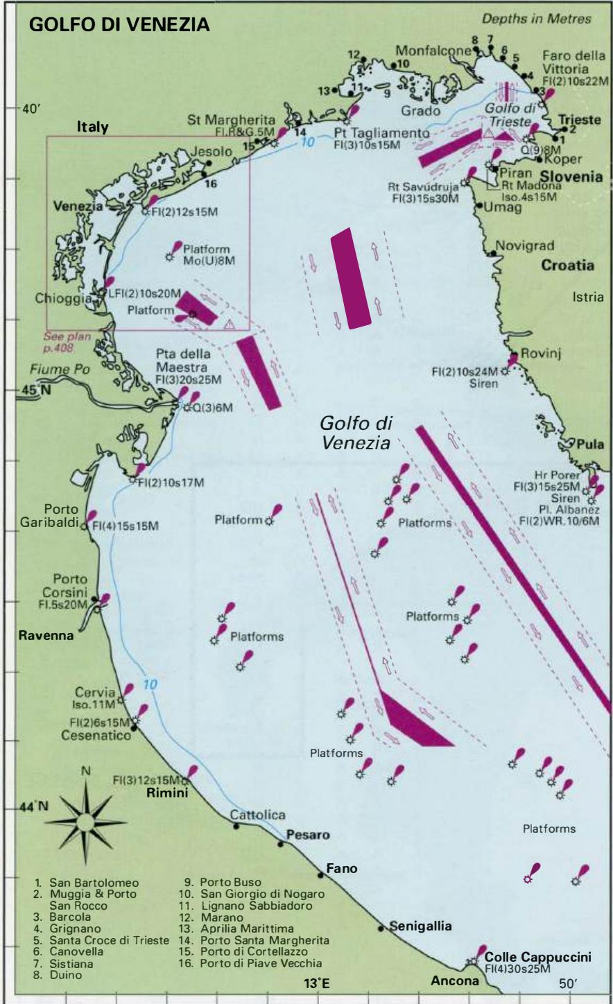
45°35'.8N 13°43'-4E Charts BA 1471, 1473 (detailed), MK 7, lmray M24 San Bartolomeo is the first Italian port after crossing the border with Slovenia. It lies on the E side of an attractive wooded bay through which the border passes. San Bartolomeo has served as Trieste's quarantine berth, which accounts for the name, Lazzaretto, also given to the
General
45°35'.8N 13°43'-4E Charts BA 1471, 1473 (detailed), MK 7, lmray M24 San Bartolomeo is the first Italian port after crossing the border with Slovenia. It lies on the E side of an attractive wooded bay through which the border passes. San Bartolomeo has served as Trieste's quarantine berth, which accounts for the name, Lazzaretto, also given to the locality. On the NE side of the bay there is a quay, which is part of a military area (berthing therefore prohibited). A small and crowded harbour lies to the S of the quay. Porto San Rocco, near Muggia, has the space to accommodate large yachts
Approach
San Bartolomeo is situated in a small bay between Debeli Rtic (Rt Grosa) to the S and Punta Sottile to the N. Shoals extend for approximately 2 cables off both headlands. A YBY beacon (lit) lies off Debeli Rtic, but the buoy off Punta Sottile has been removed. Beware of an extensive area of shell-fishing floats, which lies in the N part of the bay and extends for some distance to seaward. The floats are not lit in any way. A wreck lies just over 2 cables W of the harbour entrance. The harbour lies to the S of the quay, with its entrance facing S. Maximum depths in the harbour and its entrance are 3m.
Lights
Debeli Rtic (Rt Grosa) Q(9)15s8m8M Harbour mole Fl.R.3s7m3M
Berth
The tiny harbour is full of fishing boats and locally owned yachts. There may be room to squeeze in, bow-to the quay, amongst them, or alternatively anchor just outside the harbour. Depths in the harbour decrease from 3m at the entrance to 2m and less farther inside.
Shelter
Good shelter is available for small yachts within the harbour. In strong SW and W winds some swell does penetrate the harbour.
Facilities
Telephone, hotel and restaurant. Campsite where water is available. Porto San Rocco
Adriatic Navigation Guide Images for San Bartolomeo
Adriatic Navigation Guide images and captions provide additional visual reference for this navigation location.