Porto Baia Vallugola
Region: Central Adriatic
| Position: 43.964667, 12.785 | Adriatic Sea / Jadransko more
43°57'-88N 12°47'-10E Charts BA 220 The marina at Vallugola, which can accommodate yachts of up to 18m, lies between Cattolica and Pesaro at the foot of a tree covered hillside. The village is at the top of the hill -a long steep climb. The marina has a full range of facilities, including repair facilities, 3.5-ton crane and slip, but does not have
General
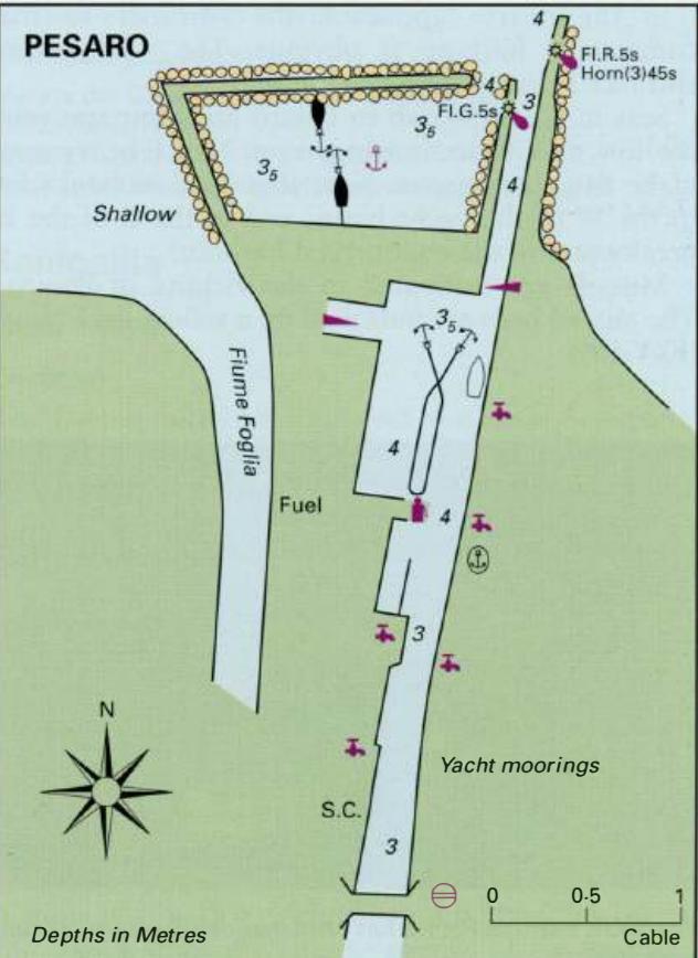
43°57'-88N 12°47'-10E Charts BA 220 The marina at Vallugola, which can accommodate yachts of up to 18m, lies between Cattolica and Pesaro at the foot of a tree covered hillside. The village is at the top of the hill -a long steep climb. The marina has a full range of facilities, including repair facilities, 3.5-ton crane and slip, but does not have a fuel berth. There are a couple of restaurants nearby. It can be a useful place to stop. Pesaro The marina entrance is marked by Fl.R and Fl.G lights. Depths within the marina range from 1.5 to 2-lm. The marina address is: Marina Porto Baia Vallugola, Localita Vallugola, 6101 1 Gabicce Mare (Pesaro) "&' (0541) 958134 Fax (0541) 838140 Email [email protected] Pesaro
Adriatic Navigation Guide Images for Porto Baia Vallugola
Adriatic Navigation Guide images and captions provide additional visual reference for this navigation location.