Pi ran
Region: North Adriatic
| Position: 45.525, 13.568333 | Adriatic Sea / Jadransko more
45°31'.5N 13°34"1E Charts BA 1471, MK 7, lmray M24 Piran, Pirano to the Italians, is the first port of entry in Slovenia if coming from Croatia to the S. The harbour lies on the S side of the peninsula, which ends in Rt Madona. On the top of the hill, overlooking the attractive old town and the harbour to the S, is a campanile modelled on the famou
General
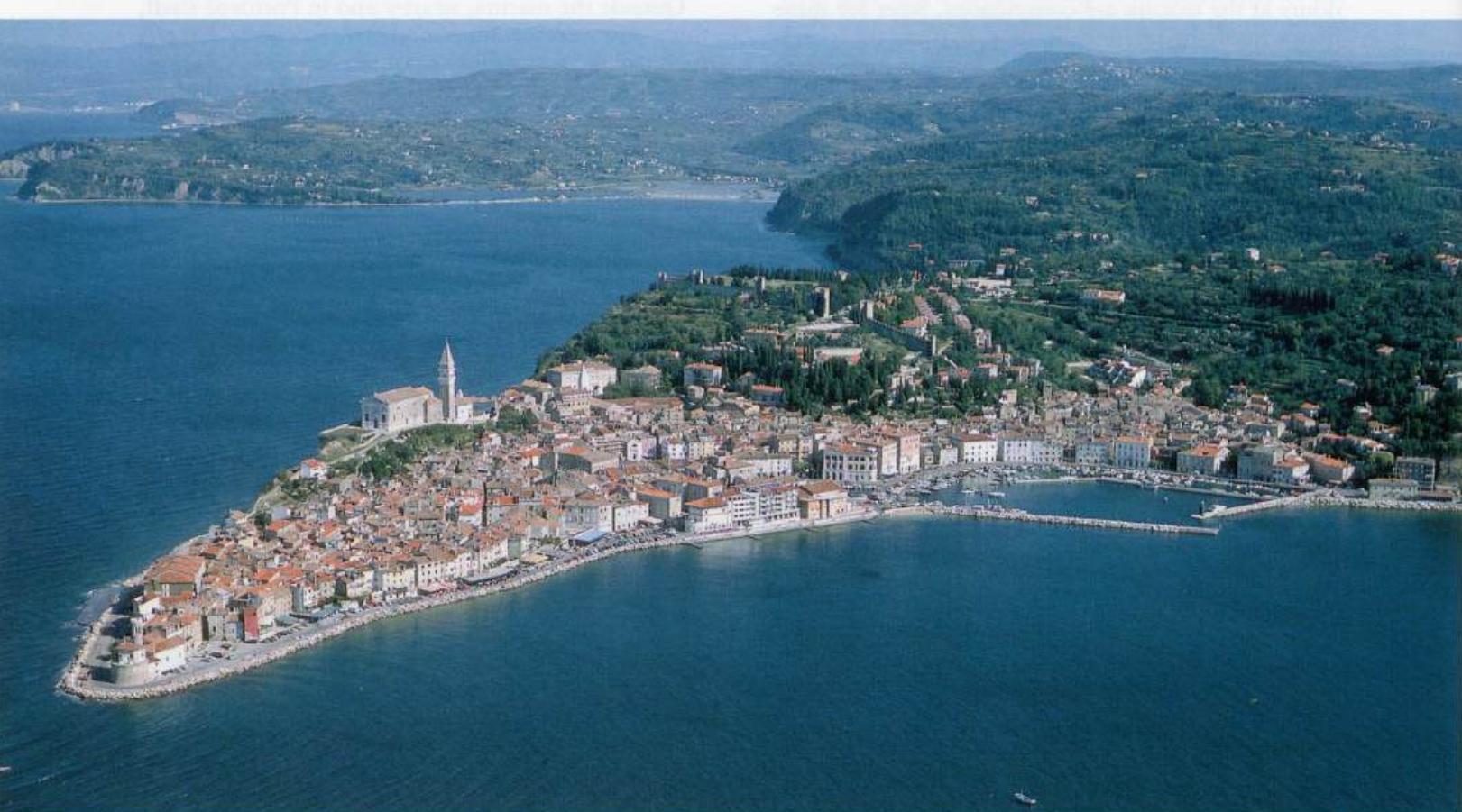
45°31'.5N 13°34"1E Charts BA 1471, MK 7, lmray M24 Piran, Pirano to the Italians, is the first port of entry in Slovenia if coming from Croatia to the S. The harbour lies on the S side of the peninsula, which ends in Rt Madona. On the top of the hill, overlooking the attractive old town and the harbour to the S, is a campanile modelled on the famous campanile in St Mark's Square, Venice.
Approach
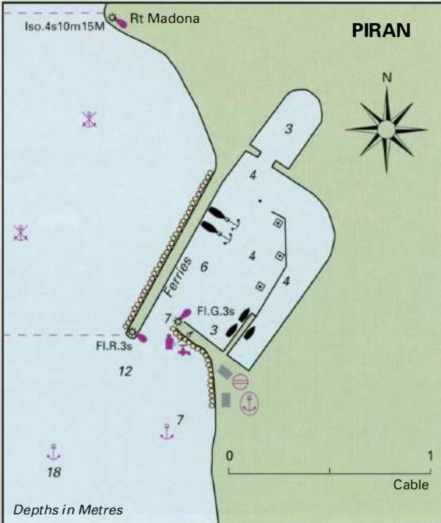
The town with its campanile is conspicuous from some distance. The entrance to the harbour itself is easily identified by the distinctive stone light tower, (painted green) on the end of the E breakwater. When approaching Piran keep at least 3 cables offshore to avoid a shallow and rocky bank, which fringes the peninsula on which Piran is built.
Lights
Rt Madona Iso.4s10m15M 351°-vis-253° W breakwater 14m from head Fl.R.3s7m3M E breakwater Fl.G.3s7m4M
Berth
It can be difficult finding a berth in the harbour, particularly during the height of the season. The SE end of the long breakwater (to port when entering) is used by ferries, but there may be room beyond the Pi ran ferry berth to lie alongside or bow/stern-to (4m depth). The shorter breakwater (to starboard) has fuel pumps and a water hose on it, but it is possible to tie up alongside here overnight and at weekends. Alternatively, tie up alongside the floating pontoon (3m). The entrance to Piran harbour, showing the distinctive light structures on the ends of the breakwaters, and the conspicuous campanile next to the church
Shelter
Shelter is good from all directions, although strong SW winds send a surge into the harbour.
Officials
Year-round port of entry. Harbourmaster's office at the root of the short breakwater. Customs and police officials have a hut on the short breakwater, near the floating pontoon.
Harbour Dues
Harbour dues are charged.
Facilities
Half of the visitors' berths have water and electricity. Water and fuel are available from the short breakwater. In the town are several well-stocked supermarkets, bakers, butchers, daily fruit and vegetable market, general hardware and engineering suppliers. Mechanical workshop. Several duty-free shops, bank (ATM at Banca Koper), Post Office, telephones, medical centre, pharmacy, tourist information, hotels, restaurants, cafe/bars, museum, aquarium, theatre. Excellent bus services to Koper, Trieste, etc. Ferry service and excursions. Car hire and taxis.
History
Piran was an important maritime trading centre, which resisted Venice for a long time, but eventually fell under Venetian control in 1283. Venetian rule lasted until 1797. Not surprisingly, the town's architecture owes much to the influence of Venice. The most striking example is the campanile, already mentioned above. It is possible to climb to the top of the tower. The view over the town, harbour, and coast are worth the effort involved. The main square near the harbour has a statue of the Italian violinist and composer, Giuseppe Tartini, who was born in Piran in 1692. The museum has an exhibition dedicated to him. Pi ran harbour. The church belfry dominates the town and harbour Rt Madena, Piran, seen from the south Izola
Adriatic Navigation Guide Images for Pi ran
Adriatic Navigation Guide images and captions provide additional visual reference for this navigation location.