Otranto
General
40°09'N 18°29".5E Charts BA 187, 188 The unspoilt medieval town of Otranto, still partially walled, stands on a rocky outcrop overlooking the harbour. The harbour _ is a convenient port for entering or leaving Italy, and is popular with yachts on passage across the Adriatic. Unfortunately it is not always easy to find a berth. Abandoned lighthouse Abandoned lighthouse Capo d'Otranto from North Capo d'Otranto from West 0.5 mile off
Approach
The lighthouse on Capo d'Otranto, approximately 3M south-southeast of Otranto, is a good guide to locating the harbour when approaching from south or seaward. The walled town of Otranto shows up well when closer to it. Approaching from S beware of rocky shoals fringing the coast between Capo d'Otranto and Otranto. Approaching from north beware of Secca Missipezza, a rocky shoal which extends almost a mile offshore approximately SM north-northeast of Otranto, between the harbour and San Andrea Torre. At night Secca Missipezza lies in the red sectors of the lights at San Andrea Torre and La Punta (Otranto). Beware also of the firing ranges between Brindisi and Otranto (see the entry above for the approach to Brindisi). Details of the ranges and operating times can be obtained from harbour offices in the area. When nearing Otranto give the headland to the of the harbour, La Punta, a good berth because of a shallow area extending from it. In strong N winds seas break over an area, where there are depths of 9m, lying just to the N of La Punta. The end of the main breakwater has underwater obstructions extending from it. When entering the harbour pass to the E of the lit green buoy which lies to the S of the head of the breakwater. There three large rusty mooring buoys lying in a between this buoy and the yacht pontoon. leading marks no longer exist, but the course to steer between the buoys is 125°. Within the harbour beware of the rocks and the shallow area on the SW side of the harbour underneath the castle walls. When the ferry is in beware of the rope, which stretches from its bow across the harbour to the hauling off buoy. This rope is almost impossible to see at night, and can be difficult to see in daylight.
Lights
Capo d'Otranto Fl.5s85m11M La Punta Fl(3)WR.10s12m13/9M 165°-R-183° over Secca di Missipezza, 183°-W-165° San Andrea Torre Fl(2)WR.7s24m15/12M 300°-R-343° over Secca di Missipezza, 343°-W-300° Otranto main breakwater Fl.R.3sllm8M G. light buoy in harbour Fl.G.3s3M
Berth
The main breakwater, Molo S. icola, is used by ships, fishing boats, ferries, and official boats such as guardia di finanza launches. There is therefore no room for visiting yachts. The sailing club has 2 pontoons in the S part of the harbour, but visiting yachts are not welcome here. Visitors should therefore moor at the town quay, between the fuel berth and the slipway at the root of Molo S. Nicola. Anchor In a convenient depth in the S part of the harbour clear of the rocks and the moorings. Alternatively, anchor in the NW part of the harbour. The holding in mud and sand is considered to be mediocre, although we found it to be good.
Shelter
Shelter is good except with winds from N and NE. Strong winds from these directions make entry difficult, if not dangerous, and create a surge in the harbour.
Officials
Guardia Costiera, customs and police all have offices on the SE quayside. Despite being a popular port of call for yachts crossing the Adriatic, Otranto has few berths for yachts in transit 5.3 Italy: Barletta to Santa Maria di Leuca
Facilities
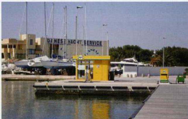
Water is available. Fuel from the fuel berth on the SE side of the harbour. Italian gas and Camping Gaz. Small covered fruit, vegetable and fish market. Various grocery shops, greengrocers, and a cantina selling wine from the barrel in the old town. Banks, ATM, Post Office, telephones. Doctor, veterinary surgeon, pharmacy. Tourist information, hotels, restaurants and cafe/bars. Sailing club. Railway station, bus service, car hire, taxis. Chandlers. Mobile crane, 40-ton travel hoist. Limited repairs to hull, engines and electrical/electronic equipment can be carried out.
History
From ancient times to the Middle Ages Otranto was an important trading centre and port, linking Italy with the east. After a massacre of the local population by the Turks in 1480 the town declined rapidly.
Visits
The 11th-century cathedral has a beautiful mosaic floor depicting the tree of life and signs of the zodiac, which is well worth seeing. Lecce, farther inland can be visited by public transport. It has a number of fine baroque buildings as well as a Roman amphitheatre. Porto Badisco and Porto Miggiano
Adriatic Navigation Guide Images for Otranto
Adriatic Navigation Guide images and captions provide additional visual reference for this navigation location.