Otok Levrnaka
Region: Central Adriatic
| Position: 43.823333, 15.258333 | Adriatic Sea / Jadransko more
43°49'-4N 15°15'.5E Charts BA 271 1, SC 5767, MK 14, lmray M25 Otok Levrnaka lies approximately 2M southeast of the lighthouse on 0. Sestrica Veliki. There are two anchorages on the island. The anchorage on the side of the island is popular. Depths however are too deep for lying to an anchor alone and shore lines are advisable. Beware of the possib
General
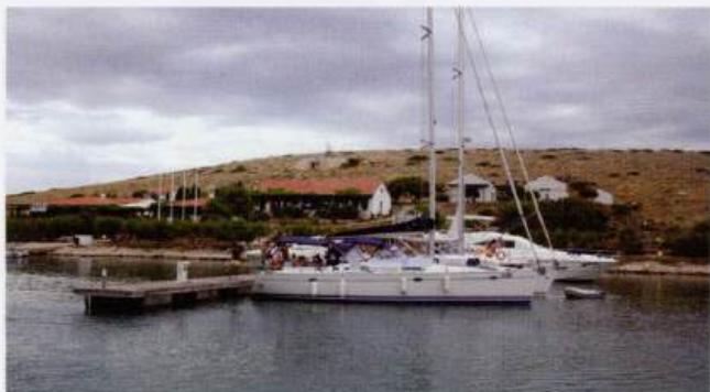
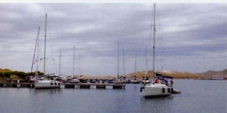
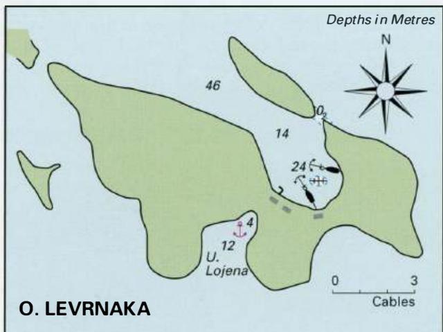
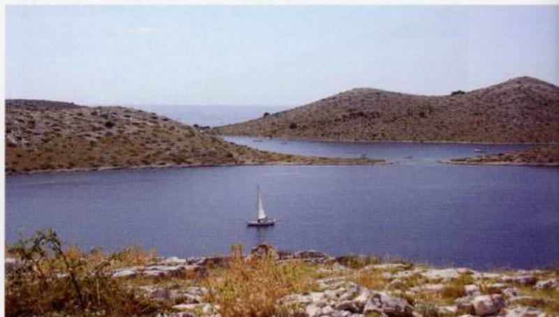
43°49'-4N 15°15'.5E Charts BA 271 1, SC 5767, MK 14, lmray M25 Otok Levrnaka lies approximately 2M southeast of the lighthouse on 0. Sestrica Veliki. There are two anchorages on the island. The anchorage on the side of the island is popular. Depths however are too deep for lying to an anchor alone and shore lines are advisable. Beware of the possibility of hooking your anchor on the submerged wreck at the head of this bay. There are a number of visitors' moorings on the SW side of the bay, and two restaurants. One of the restaurants has a quay where shallow draft craft can moor bows to. This anchorage is sheltered from all winds except NW. On entering this N bay, do not be tempted to pass between 0. Levrnaka and the island, which shelters the anchorage from N. Depths are about 0.2m in the gap! On the SW side of the island there is another bay, U. Lojena, where it is possible to anchor. Anchor in 6m, sand. This bay is separated from the anchorage mentioned above by a comparatively low isthmus on which there are some cottages. This anchorage is exposed to S winds. The view across the Kornatski Kanai from the vantage point of Tureta towards the anchorage on the N side of Otok Levrnaka DUGI OTOK Charts BA 271 1, 515, 2773 (detailed), SC 5767, MK 13, 14, lmray M25 Dugi Otok (which means Long Island) is a long narrow island with a number of attractive and shelteted anchorages along its shores. The island has a few hotels, holiday cottages, and a campsite, but it has not been spoilt by tourism. Dugi Otok is approximately 24M long (NW to SE) and about 2YzM wide at its widest point. The southwest-facing coast is mostly steep-to with cliffs, and offers little shelter. The northeast-facing coast on the other hand is lower, shallower, and has a number of anchorages and harbours. Both the N and S ends of Dugi Otok are forked, forming excellent havens where it is possible to find all-round shelter. A marina is being developed in Veli Rat. Most of the settlements are on the northeastfacing side of Dugi Otok. Up until recently the settlements were mainly linked by footpaths, but in the mid-1980s a road was constructed. Parts of the island are cultivated.The majority of the local people are engaged in agricultural work, fishing or in the fish processing plant at Sali. Unfortunately many of the younger people have moved to the mainland to find work, leaving behind an aging population. The village of Sali is the main settlement on Dugi Otok, and this is where the description of the harbours commences. The other harbours and anchorages are then described in clockwise order from Sali. Sali on Dugi Otok Sali 43"56".2N 15"103E Charts BA 2711, SC 5767, MK 13, 14, lmray M25 The village of Sali is located on the SE coast of Dugi Otok opposite the off-lying island of Otok Lavdara. The houses, some of which date from the 17th century and earlier, cluster around the harbour. There is a large fish-processing factory to the S of the harbour. Luka TelasCica is the name of a large natural harbour at the S end of Dugi Otok, which cuts approximately 4M northwest into the island. The inlet, which is divided into four basins, offers a number of anchorages. All-round shelter is available here. Luka TelasCica, N end Luka TelasCica used to be part of the Kornati National Park, but it now comes under its own park authority, the Telascica Nature Park. Wardens come round the anchorages by boat to collect a reasonable entry fee and your rubbish. The entry fee, which is levied on every adult visitor, also covers you for one day/night in the Kornati National Park. We have always found the wardens friendly and helpful.
Approach
The fish-processing factory with its tall chimney to the S of the harbour is conspicuous from a distance and helps identify Sali. There is also an aerial, with R and W bands, on the headland to the E of the entrance, which is visible when approaching from NW. The chapel on this E headland is also distinctive. The approach from S along the Lavdarski Kanal is straightforward with no hidden dangers. The entrance to Sali harbour. The main quay for visitors can be seen in the background The quay on the NE side of the harbour at Sali has laid lines, water and electricity Approaching from N or NE beware of the shallow patch with only 2.2m over it, marked by an unlit beacon, nearly 5 cables W of the light on Otok Lavdara. There are also rocks and shallows between the two small islands lying NW of the light on 0. Lavdara. There are no dangers in the immediate approach to Sali, but beware of ferry and fishing boat traffic. Approaching from W of Dugi Otok or SW is straightforward. The tall lighthouse on 0. Sestrica Veliki is a good mark by day or night. Approaching from the E side of Dugi Otok, it is better to come via the Prolaz Proversa Mala, see page 263. This passage has 4. 2m depth in the channel and is well marked and lit. Entry The main passage into Luka TelasCica passes to the W of 0. Aba Veliki. Beware of a shoal spit with 3.3m over it extending from Rt Vidilica (the southernmost headland of Dugi Otok). 2 cables to the W of Otok Katina are two rocks. The inner rock is marked by a beacon. The one to the W is marked by a light beacon (Fl.G.3s). The distinctive lighthouse on 0. Sestrica Veliki is a major landfall light
Lights
0. Lavdara Fl.3s7m5M obscured when approaching from Sor SE between 276° and 005° Rt Bluda Fl.G.3s7m3M Sali breakwater head Fl.R.3s7m4M Sali molehead F.G.5m3M 0. Sestrica Veliki Fl.8s47m20M
Berth
Berths for visiting yachts are provided on the E and SW sides of the harbour, where there are pick-up lines, water and electricity connections.
Shelter
Good shelter from all directions except SE.
Officials
Harbourmaster. Police. Summer port of entry.
Facilities
Water and electricity are laid on to the quays. Toilets on E side of harbour near Harbourmaster's office. Supermarkets, general hardware shop, fruit and vegetable market. Post Office, telephone, currency exchange office, ATM, internet, public library with books in various languages and tourist information. Medical service. Restaurants and cafe/bars. Bus service and scooter hire. Repairs to engine and hull can be undertaken locally. Uvala Cuscica 43"53".9N 15"13".3E Charts BA 2711, 2773 (detailed), SC 5767, MK 14, lmray M25 Uvala Cuscica is a sheltered bay on the SE end of Dugi Otok, W of Rt Cuska (on Dugi Otok) and N of Otok Katina. It is possible to obtain shelter here from all wind directions except for S and SE. Anchor towards the head of the bay in Sm. The holding in sand is good. There are no facilities ashore, in fact it is difficult to even walk on the karst terrain! This bay comes under the jurisdiction of the TelasCica Nature Park, and as such a reasonable entry fee is charged. The wardens will take away your rubbish for you. Approaching Uvala CusCica from N is straightforward. If approaching from W of Dugi Otok or SW, passage is best made through the Prolaz Proversa Mala, the channel to the N of Otok Katina. This channel is well marked and lit and has a minimum depth of 4.2m. The Prolaz Proversa Mala and the Prolaz Proversa Vela are described above in the section dealing with the Kornati Islands. Luka Telascica 43"54"N 15"10"E Charts BA 2711, 2773 (detailed), SC 5767, MK 14, lmray M25