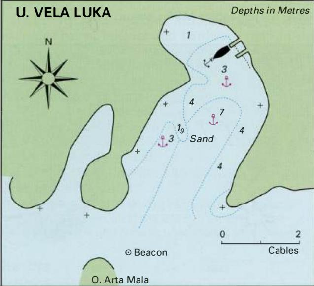
Professional navigation chart centered on Otocic Arta Mala
Otocic Arta Mala
Region: Central Adriatic
| Position: 43.851667, 15.563333 | Adriatic Sea / Jadransko more
43°51'.1N 15°33'.8E Charts BA 271 1, 2773 (detailed), SC 5767, MK 74, lmray M25 There is a popular anchorage in the bay on the S side of OtoCic Arta Mala. Approaching from N or E of the island, pass either E or W of Otocic Arta Mala depending on your draught. The narrow channel to the W has 3m, whereas the channel to the E between 0. Prifojak Mali
General
43°51'.1N 15°33'.8E Charts BA 271 1, 2773 (detailed), SC 5767, MK 74, lmray M25 There is a popular anchorage in the bay on the S side of OtoCic Arta Mala.
Approach
Approaching from N or E of the island, pass either E or W of Otocic Arta Mala depending on your draught. The narrow channel to the W has 3m, whereas the channel to the E between 0. Prifojak Mali and 0. Radelj has a minimum depth of 4m. Beware of the beacon marking the E extremity of a shoal extending off the E coast of OtoCic Arta Mala. From S the approach is straightforward . Anchor Anchor in 8 or 9m. The bottom is sand and the holding is good.
Shelter
The anchorage is well sheltered from W through N to SE. OTOK VRGADA Otok Vrgada lies just over 2M northwest of Otok Murter. It has two harbours on its coast, Uvala Luka and Uvala Sv. Andrija, which are separated by a headland. Uvala Luka is the main harbour for the village. Uvala Luka
Adriatic Navigation Guide Images for Otocic Arta Mala
Adriatic Navigation Guide images and captions provide additional visual reference for this navigation location.
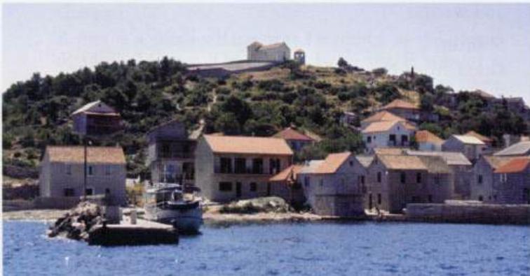
Uvala Luka, Otok Vrgada. The rain catchment area and the squat church on top of the hill help identify the harbour