Omisaljski Zaljev
Region: North Adriatic
| Position: 45.216667, 14.55 | Adriatic Sea / Jadransko more
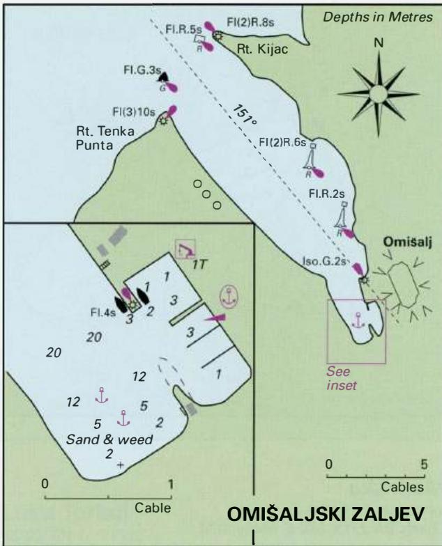
45°13'N 14°33'E separates the anchorage from the harbour. Visiting Charts BA 2719, 1996 (plan), MK 5, lmray M24 yachts should tie up alongside the pier or, space General permitting go bows one of the pontoons. Omi5aljski Zaljev is a deep inlet, which cuts almost 2M southeast into the north end of Otok Krk. It Within the harbour there is good all-ro
General
45°13'N 14°33'E separates the anchorage from the harbour. Visiting Charts BA 2719, 1996 (plan), MK 5, lmray M24 yachts should tie up alongside the pier or, space General permitting go bows one of the pontoons. Omi5aljski Zaljev is a deep inlet, which cuts almost
Shelter
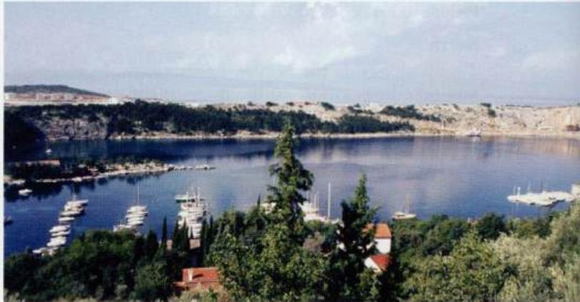
2M southeast into the north end of Otok Krk. It Within the harbour there is good all-round shelter. forms a natural harbour suitable for large ships, and The anchorage however is exposed to strong NW has a tanker berth on its W side serving the adjacent winds. oil refinery. At the far end of the inlet is the historic town of Omi5alj, with its harbour and a yacht Officials anchorage. Harbourmaster. Police.
Approach
The oil storage tanks on Rt Tenka Punta aid positive identification of Omi5aljski Zaljev. There are no dangers in the approach to Omi5aljski Zaljev. The whole area is well marked and lit for the tankers. Inside the inlet, keep at least 500m away from the tanker berths on the W shore.
Lights
Rt Tenka Punta Fl(3)10s9m7M Rt Kijac Fl(2)R.8s14m8M Ldg Lts 151° (mounted on white columns with orange coloured, diamond topmarks), are located at the head of the inlet. They are only lit when a tanker is expected. Front Iso.G.2s23m11M Rear 490m from front Oc.G.5s32m 1 lM Omifalj pier Fl.4s3M
Berth
The best berth for a yacht is at the S end of the inlet, where it is possible to anchor in 5-12m on a bottom of sand. The holding is good. It is also possible to tie
Facilities
Near the harbour are a cafe/bar and a restaurant. The small town of Omifalj is on top of the hill (82m high), reached by a footpath through the woods. In the tqwn are a supermarket, butcher, general hardware store, fruit and vegetable market, pharmacy, bank, ATM, Post Office, tourist information office, hotel, restaurant, and cafe/bars. There is a bus service to Rijeka, and to Krk. Rijeka international airport is close to Omisalj.
History
Omifalj was a fortified stronghold belonging to the Frankopan counts, who controlled the island in the Middle Ages. There was a Roman settlement here, and together with Krk it is one of the oldest settlements on the island. The 16th-century loggia, Romanesque church, remains of the feudal palace and fortifications have survived. Zaton Soline {Klimno)
Adriatic Navigation Guide Images for Omisaljski Zaljev
Adriatic Navigation Guide images and captions provide additional visual reference for this navigation location.