Region: South Adriatic
| Position: 42.726667, 17.675 | Adriatic Sea / Jadransko more
42°43'.6N 17°40'.5E Charts BA 1580, SC 5767, MK 24, 25, lmray M26 When we first cruised this area Okulklje was an attractive landlocked anchorage, surrounded by green wooded slopes. Unfortunately the bay has become a victim of its own charms: a number of holiday homes and restaurants have been built on its shores, it can be noisy, and it is very po
General
42°43'.6N 17°40'.5E Charts BA 1580, SC 5767, MK 24, 25, lmray M26 When we first cruised this area Okulklje was an attractive landlocked anchorage, surrounded by green wooded slopes. Unfortunately the bay has become a victim of its own charms: a number of holiday homes and restaurants have been built on its shores, it can be noisy, and it is very popular with visiting yachts, including flotillas. Most of the quay space is taken up by local craft. As a result it can be difficult finding space here during the season.
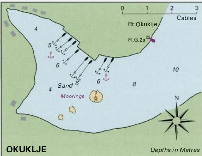
Approach
The anchorage is easily identified by the light structure on Rt Stoba, the headland to the E of the entrance. If approaching from Nor NW, beware of the shoals extending for 2 cables E and NE from Rt Maharac, approximately YiM northwest of Rt Stoba. As the entrance to Luka Okuklje opens up the light structure on the headland to the W of Rt Stoba comes into view. Keep to the centre of the entrance and then pass to the N of the rock with a beacon (unlit) on it. There are other rocks inshore and SW of this beacon. Okuklje is a popular anchorage but can be overcrowded during July and August
Lights
Rt Stoba Fl(2)5s10m6M Rt Okuklje (headland to the W of Rt Stoba) Fl.G.2s7m1M
Berth
If there is space go stern-to the quay on the NE side of the bay. There are laid lines to the former ferry quay. The restaurant quays (reserved for patrons) also have laid lines. Anchor Anchor in a suitable spot W of the beacon in 5m. The bottom is sand. Some parts of the inlet have good holding, in other parts the holding is unreliable so dig your anchor in well, and in a bora take a line ashore. The anchorage can be overcrowded.
Shelter
Good all-round shelter.
Facilities
One of the houses occasionally has local wine for sale. Restaurants, one of which has laid moorings for its customers SE of the quay. Uvala Saplunara
Adriatic Navigation Guide Images for Okuklje
Adriatic Navigation Guide images and captions provide additional visual reference for this navigation location.
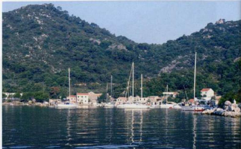
Okuklije is a popular anchorage but can be overcrowded during July and August