Njivice
Region: North Adriatic
| Position: 45.165, 14.546667 | Adriatic Sea / Jadransko more
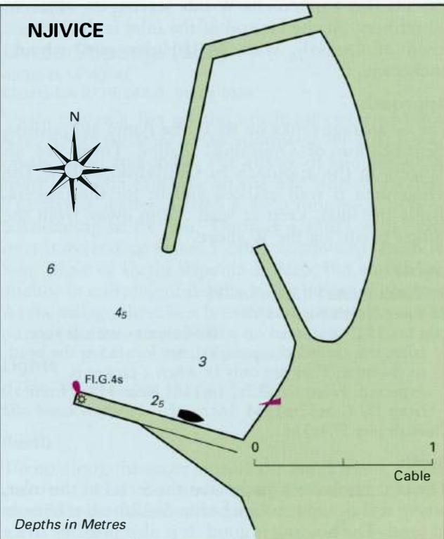
45°09'.9N 14°32'.8E Charts BA 2719, MK 5, lmray M24 The former fishing village of Njivice is popular with tourists. There is a small harbour and ferry quay here. There are no dangers in the approach. Njivice pier FLG.4s7m3M Tie up along the side of the pier with the light structure. Anchor It is possible to anchor in the bay just of the harbour in
General
45°09'.9N 14°32'.8E Charts BA 2719, MK 5, lmray M24 The former fishing village of Njivice is popular with tourists. There is a small harbour and ferry quay here.
Approach
There are no dangers in the approach.
Lights
Njivice pier FLG.4s7m3M
Berth
Tie up along the side of the pier with the light structure. Anchor It is possible to anchor in the bay just of the harbour in depths of 1 lm and less, but be careful not to anchor in the vicinity of the underwater pipeline. The bottom is mud and sand and the holding is good.
Shelter
Shelter is good from N through E to S, but the harbour and anchorage are exposed to NW and SW winds in particular.
Facilities
Supermarket, butchers, fruit and vegetable market. Post Office and telephones. Medical centre. Tourist information. Hotel, restaurants, and cafe/bars. Bus service. Uvala Sapan
Adriatic Navigation Guide Images for Njivice
Adriatic Navigation Guide images and captions provide additional visual reference for this navigation location.