Muo
Region: South Adriatic
| Position: 42.433333, 18.763333 | Adriatic Sea / Jadransko more
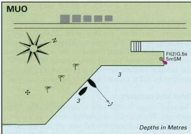
42°26'N 18°45'.8E Charts BA 1582, MK 27, lmray M27 Muo is a small village on the W shore of Kotorski Zaljev, less than a mile from Kotor, with a quay where it is possible to moor. The approach to Muo is straightforward with no off-lying dangers. There is a church with a short octagonal tower near the quay, which helps identify the village. Muo mole
General
42°26'N 18°45'.8E Charts BA 1582, MK 27, lmray M27 Muo is a small village on the W shore of Kotorski Zaljev, less than a mile from Kotor, with a quay where it is possible to moor.
Approach
The approach to Muo is straightforward with no off-lying dangers. There is a church with a short octagonal tower near the quay, which helps identify the village.
Lights
Muo mole head Fl(2)G.5s5m5M
Berth
Anchor and go bow/stern-to the quay.
Facilities
Bus service to Kotor. Prcanj
Adriatic Navigation Guide Images for Muo
Adriatic Navigation Guide images and captions provide additional visual reference for this navigation location.