Moscenicka Draga
Region: North Adriatic
| Position: 45.236667, 14.26 | Adriatic Sea / Jadransko more
45°14"2N 14°15'.6E Charts BA 2719, MK 5, lmray M24 Moscenicka Draga, a small bay on the east coast of !stria about 3M north-northeast of the light on Rt Sip and 3.2M south-southwest of Lovran, offers some shelter from SW through W to N. It is exposed to both the bora and the sirocco. Rabac There is a small harbour at Moscenicka Draga, which may hav
General
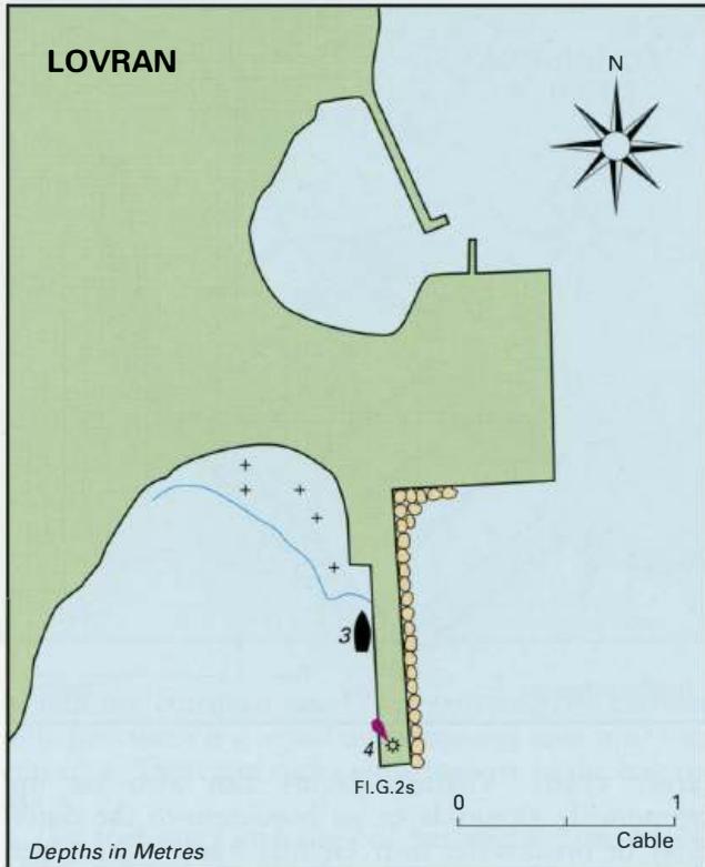
45°14"2N 14°15'.6E Charts BA 2719, MK 5, lmray M24 Moscenicka Draga, a small bay on the east coast of !stria about 3M north-northeast of the light on Rt Sip and 3.2M south-southwest of Lovran, offers some shelter from SW through W to N. It is exposed to both the bora and the sirocco. Rabac There is a small harbour at Moscenicka Draga, which may have enough room to allow a smaller yacht to squeeze in (depths of 2 to 3m inside). Alternatively, tie up alongside the quay just to the W of the light structure (F.G). In this position there are depths of about 3m. Do not leave the boat unattended here, since the ferry or tripper boats may wish to use this berth. To the W of the harbour are a number of moorings and a bathing area. It may be possible to anchor just outside the moorings in good weather, but move on if the weather shows any sign of deteriorating. This is a popular holiday village with the usual facilities for visitors. There is a supermarket close to the harbour, a Post Office and a water tap near the root of the W mole. Brestova
Adriatic Navigation Guide Images for Moscenicka Draga
Adriatic Navigation Guide images and captions provide additional visual reference for this navigation location.