Molfetta
Region: South Adriatic
| Position: 41.208333, 16.593333 | Adriatic Sea / Jadransko more
41°12'.5N 16°35'.6E Charts BA 186 Molfetta harbour is a busy fishing and commercial port. The modern town offers most facilities, whilst the old walled town overlooking the harbour should satisfy the enthusiast for such places. The twin flat-topped square towers close together and overlooking the harbour are the most easily recognisable features fo
General
41°12'.5N 16°35'.6E Charts BA 186 Molfetta harbour is a busy fishing and commercial port. The modern town offers most facilities, whilst the old walled town overlooking the harbour should satisfy the enthusiast for such places.
Approach
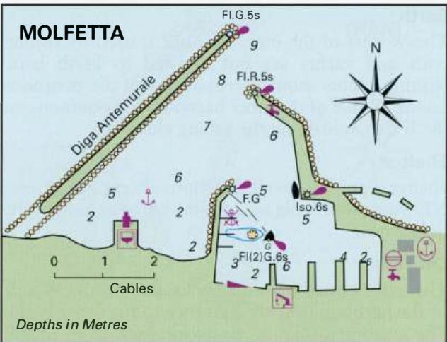
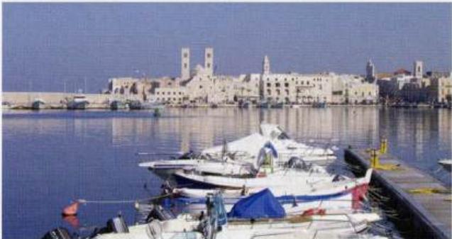
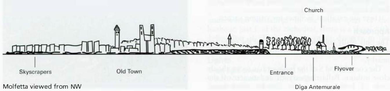
The twin flat-topped square towers close together and overlooking the harbour are the most easily recognisable features for identifying Molfetta. Approaching from an isolated church with a square belfry on the shore to the NW also shows up well. See the sketch showing Molfetta from seaward. The harbour should be entered by passing to the E of the breakwater, the Diga Antemurale, giving the ends of all the breakwaters a good berth because of underwater ballasting. Inside the harbour beware of a shoal area, Secca San Domenica, lying to the SE of the inner W mole. The statue of the Madonna, which the Admiralty pilot states is on the shoal, has been removed. The E The view across Molfetta harbour, showing the distinctive church towers. Note the green light buoy which marks the area of shallows between it and the central mole, from where the photograph was taken side of the shoal is marked by a lit G conical buoy. The harbour should not be approached in strong onshore winds, particularly from NE, when breaking waves occur in the entrance.
Lights
Molfetta LtHo (near the centre of the E mole) Iso.6s20ml 7M Diga Antemurale Fl.G.5s13m7M (difficult to distinguish) N end of the main E mole Fl.R.5s12m7M Inner W mole F.G.5m4M Secca S Domenica buoy Fl(2)G.6s3M
Berth
Tie up alongside the E mole near the main lighthouse, space permitting. The outer part of this mole is used by ships, and the inner part by fishing boats. It may also be possible to berth at one of the Molfetta viewed from NW Diga Antemurale sailing club pontoons on the E side of the central mole, avoiding the area of shallows marked by the G buoy.
Shelter
The shelter in the harbour is good, although strong winds from N and NW create a surge. Winds In summer the usual winds encountered in the Molfetta area are from the W at night and from the E or SE during the day.
Officials
The harbourmaster's office is at the root of the E mole. The customs post is on the E quay. Police in the town.
Facilities
Water is available from standpipes on the E mole (ask at the harbour office), or from the sailing club pontoons. Fuel from the fuel berth in the outer part of the harbour. Italian gas and Camping Gaz. There are some grocery and greengrocery stores just inside the gate of the old town, near the harbour, but the majority of the shops are in the new part of the town. Fish market near the harbour. Fruit and vegetable market. Chandlers, hardware stores, engineering supplies. Banks, ATMs, Post Office, telephones. Doctors, dentists, hospital, pharmacies. Tourist information, hotels, restaurants, cafe/bars. Railway station, bus service, car hire, taxis. Fishing boat repair yard where yachts can be slipped and repairs carried out to the hull. Mobile crane. Mechanical, electrical and electronic repairs are possible. Sailing club. Giovinazzo