Lumbarda
Region: South Adriatic
| Position: 42.923333, 17.176667 | Adriatic Sea / Jadransko more
Uvala Prvi Zal 42°55'-4N 17°10'.6E Uvala Tatinja 42°55'.5N 17°10'.9E Charts BA 1574, 683 (detailed), SC 5767, MK 22, 23, lmray M26 The village of Lumbarda on the NE coast of Otok Koreula has two bays, where it is possible to anchor or moor. The larger bay with a beach at its head is Uvala Prvi Zal. This is the location of Lumbarda Marina, a secure,
General
Uvala Prvi Zal 42°55'-4N 17°10'.6E Uvala Tatinja 42°55'.5N 17°10'.9E Charts BA 1574, 683 (detailed), SC 5767, MK 22, 23, lmray M26 The village of Lumbarda on the NE coast of Otok Koreula has two bays, where it is possible to anchor or moor. The larger bay with a beach at its head is Uvala Prvi Zal. This is the location of Lumbarda Marina, a secure, sheltered and more reasonably priced alternative to the ACI marina in Koreula. It has been recommended to us as a good base for a yacht wintering in this area, with advantages over the ACI marina at Koreula. Shelter is excellent, and it was considered to offer exceptionally good value. The marina is open throughout the year. The harbourmaster is extremely helpful. Uvala Tatinja, the bay to the E, is separated from Prvi Zal by a small headland. Uvala Tatinja has a better beach, and a harbour wall behind which it is possible to obtain some shelter from NE. Lumbarda Marina on Otok Korcula has become very popular, and with good reason. It is exceptionally well sheltered, and Koreula town is easily accessible by bus
Approach
Approach from N can be made either through Kana! Jdevica to the W of 0. Badija and 0. Vrnik, in which case the details of the approach given for 0. Vrnik apply, or can be made to the E of 0. Vrnik. If approaching from this direction note: the shallow patch with 2m over it E of 0. Badija; Greben Krastovica, the shoal and rocky patch between 0. Planjak and 0. Vrnik which extends E; and the rock and shoal patch, marked by an unlit beacon, which extends N of OtoCic Gubavac, the island E of 0. Vrnik. Approaching from E or SE pass between Hrid Knezic, the low-lying island NE of Uvala Tatinja, and OtoCic Gubavac, the larger island N of it. Note that 4 cables E of Hrid Knezic there is a shoal with Sm over it (see plan). Uvala Prvi Zal and Lumbarda Marina The anchorage and marina lie on the SE side of the bay. There is a rock and shallow area extending SE to the centre of the bay from the W entrance point, marked by an unlit green beacon. A breakwater with a light on the end has been built out from the E entrance point.
Lights
Lumbarda marina breakwater head Fl.R.3s7m3M Rt Rafojic Fl.6s13m9M
Berth
Tie up bow/stern to the pontoons, where space 1s available, picking up the lines provided. Anchor Anchor in 3 to Sm, sand. Go bow/stern-to the mole near the end in 3.5m.
Shelter
Good all-round shelter. Although the hara blows strongly here, there is no fetch. In these conditions, the best berths are on the S sides of the pontoons. Good shelter from W through S to E. There is some shelter from E behind the wall.
Facilities
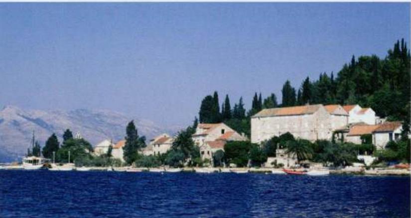
The marina has water and electricity laid onto the pontoons. Supermarket, butcher, fruit and vegetable market. Post Office and telephone. Hotel, restaurants, cafe/bars. Bus service to Koreula. The marina address is: Marina Lumbarda (020) 712 380 Fax (020) 712 155. Stone tower Rt Rafojic from North The small harbour of Uva la Tatinja is close to the village of Lumbarda on Otok Koreula Uvala Tatinja Entering Uvala Tatinja is straightforward. Anchor Anchor in 6m, just outside the harbour, or in 4m inside the harbour. Telephone and cafe/bar at the harbour. Other facilities in Lumbatda.
History
Lumbarda was the site of a Greek colony, the settlers coming from Otok Vis. Various artefacts have been found dating from that time, including the so-called Lumbarda psephisma, a written record of the names of the colonists in the area and a register of their land. The original is now in a museum in Zagreb. Uvala Przina
Adriatic Navigation Guide Images for Lumbarda
Adriatic Navigation Guide images and captions provide additional visual reference for this navigation location.