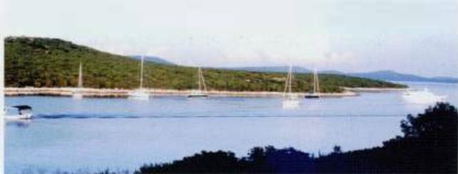
Luka Unije
Region: North Adriatic
| Position: 44.636667, 14.25 | Adriatic Sea / Jadransko more
44°38'.2N 14°15'E Charts BA 202, MK 8, lmray M24 Approaching from S keep at least 3 cables offshore because of a shallow bank which fringes the SW shore of Otok Unije. Luka Unije is entered by passing to the N of Hrid Skoljic, an above-water rock which lies 3 cables N of Rt Narr, the S headland of this bay. There is a shallow area beteween Rt Narr
General
44°38'.2N 14°15'E Charts BA 202, MK 8, lmray M24
Approach
Approaching from S keep at least 3 cables offshore because of a shallow bank which fringes the SW shore of Otok Unije. Luka Unije is entered by passing to the N of Hrid Skoljic, an above-water rock which lies 3 cables N of Rt Narr, the S headland of this bay. There is a shallow area beteween Rt Narr and Hrid Skoljic. At night, Hrid Skoljic lies in the red sector of the light on Rt Vnetak. Approaching from N beware of the rocks off the northwest-facing coast of Unije. An unlit W cardinal buoy marks Greben Samuncel.
Lights
Rt Vnetak Fl(3)WR.10sl 7m10/7M 158°-R-176° Unije pierhead Fl.R.3s6m3M
Berth
If space allows tie up bow/stern to the ferry pier, keeping clear of the ferry berth. The ferry timetable is posted on the noticeboard. There are depths of 3m alongside. Anchor Anchor in the bay to the W, SW, or SE of the ferry pier in 6m. The bottom is sand, good holding. There is a current in the bay, which can make a boat lie broadside onto the wind.
Shelter
Luka Unije is comparatively open, although it provides good shelter from N through E to S. The bay is open to W and NW winds.
Facilities
Grocery store. Post Office. Medical centre (ambulanta), restaurant, cafe/bar, small airfield. Ferry service to Mali Losinj. Uvala Vognisca, Uvala Podkujni and Uvala Maracol
Adriatic Navigation Guide Images for Luka Unije
Adriatic Navigation Guide images and captions provide additional visual reference for this navigation location.