Luka Sobra
Region: South Adriatic
| Position: 42.738333, 17.605 | Adriatic Sea / Jadransko more
42°44'.3N 17°36'.3E Charts BA 1580, SC 5767, MK 24, 25, Rt. Pusti lighthouse lmray M26 Luka Sabra is the harbour for Babino Polje, the main settlement on the island of Mljet. The harbour is located in a large bay, open NE. Depths in most of the bay are deep, or the bottom is rocky. It is therefore not a good yacht anchorage. The small hamlet, with
General
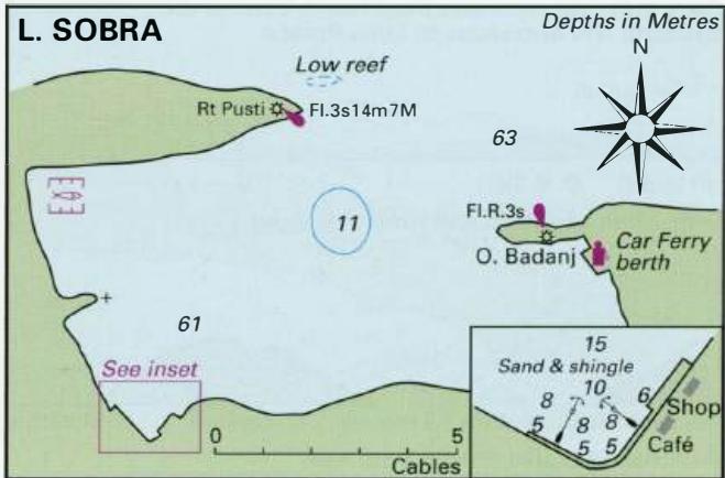
42°44'.3N 17°36'.3E Charts BA 1580, SC 5767, MK 24, 25, Rt. Pusti lighthouse lmray M26 Luka Sabra is the harbour for Babino Polje, the main settlement on the island of Mljet. The harbour is located in a large bay, open NE. Depths in most of the bay are deep, or the bottom is rocky. It is therefore not a good yacht anchorage. The small hamlet, with a quay where it is possible to moor, lies in the SW corner of the bay. 0. Badanj (on the E side of the entrance) has been joined to the main island, giving shelter to the car ferry berth and fuel quay.
Approach
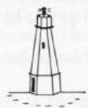
Luka Sobra is easily identified from seaward by the lighthouse on Rt Pusti. Approaching from NW give Rt Pusti a good berth to avoid a shallow spit and a low reef. On the opposite side of the entrance there is a small island, 0. Badanj. The ferry berth lies S of 0. Badanj.
Lights
Rt Pusti Fl.3s14m7M 156°-vis-043° Car ferry jetty head Fl.R.3s7m3M 294°-vis-130°
Berth
Tie up bow/stern-to the quay, in the SW corner of the bay. Alternatively, tie up at the quay near the car ferry jetty. Anchor The inlet is too deep to anchor, but it is possible to anchor and take a line ashore in the NW part of the bay, avoiding the fish farm. Note however that there is a rock off the small promontory on the W side of the inlet.
Shelter
The SW quay is sheltered from NW through W to S. The bay is exposed to both the bora and the sirocco. The best shelter from the bora and the sirocco is to be found on the E side of Luka Sobra, near the car ferry jetty.
Facilities
There is a shop near the SW quay, and a small bar/cafe. Fuel and water from the quay near the car ferry berth. The fuel berth has Sm alongside, and is open between 0800 and 2000. Other facilities, such as Post Office, tourist information office, medical centre are to be found in the main village of Babino Polje, which can be reached by bus. Luka Prozura
Adriatic Navigation Guide Images for Luka Sobra
Adriatic Navigation Guide images and captions provide additional visual reference for this navigation location.