Luka Racisce
Region: South Adriatic
| Position: 42.973333, 17.025 | Adriatic Sea / Jadransko more
42°58'-4N 17°01'.5E Charts BA 1574, SC 5767, MK 22, lmray M26 Luka RaCisce, not to be confused with Uvala RaCisce on the E side of Otok Koreula, is an attractive village built on a hillside around a harbour, It is nearly 5M west of Koreula town. There are no dangers in the immediate vicinity. The village only comes into sight as the harbour opens u
General
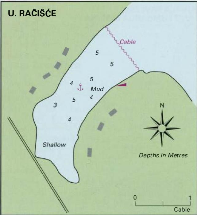
42°58'-4N 17°01'.5E Charts BA 1574, SC 5767, MK 22, lmray M26 Luka RaCisce, not to be confused with Uvala RaCisce on the E side of Otok Koreula, is an attractive village built on a hillside around a harbour, It is nearly 5M west of Koreula town.
Approach
There are no dangers in the immediate vicinity. The village only comes into sight as the harbour opens up.
Lights
Racisce breakwater head Fl.G.3s7m4M Otocic Knefa Vela Fl(2)6s13m8M
Berth
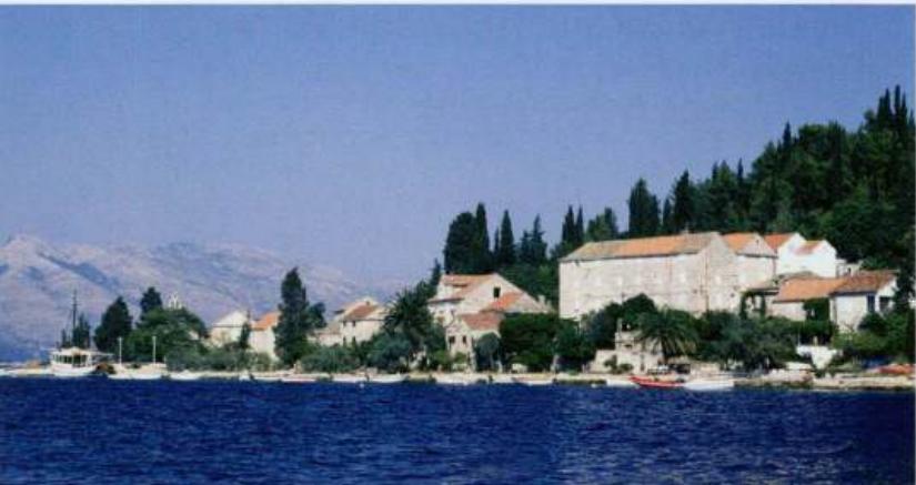
Tie up bow/stern-to the breakwater amongst local boats if space allows, alternatively moor bow/sternto the quay. Beware, however, of fouling your anchor on old mooring chains or discarded engines in the middle of the harbour. Luka Racisce harbour on the north coast of Otok Korcula
Facilities
Telephone box and a shop amongst the houses on the SW side of the bay. Bus service to Korcula. Uvala Vrbovica
Adriatic Navigation Guide Images for Luka Racisce
Adriatic Navigation Guide images and captions provide additional visual reference for this navigation location.