Luka Papranica
Region: Central Adriatic
| Position: 44.39, 14.685 | Adriatic Sea / Jadransko more
44°23'-4N 14°41'.1E Charts BA 575, MK 9, 77, lmray M25 Luka Papranica is a quiet bay on the west coast of Otok Silba, just lM north-northwest of the light on the end of the pier at Sidriste Zalic. It can be recognised by a few cottages on the E side. The water in the bay is clean and clear, ideal for swimming. The bay is straightforward to enter wi
General
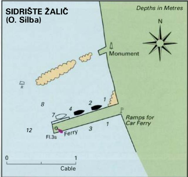
44°23'-4N 14°41'.1E Charts BA 575, MK 9, 77, lmray M25 Luka Papranica is a quiet bay on the west coast of Otok Silba, just lM north-northwest of the light on the end of the pier at Sidriste Zalic. It can be recognised by a few cottages on the E side. The water in the bay is clean and clear, ideal for swimming. The bay is straightforward to enter with no off-lying dangers. Anchor towards the head of the bay in Sm. The holding in sand is good. The bay offers shelter from W through N to E, but is exposed to S winds. OTOK OLIB Charts BA 575, MK 9, 77, lmray M25 The island of Olib lies E of Otok Silba. Like Silba, Otok Olib has been inhabited since the time of the Romans. In the 15th century Olib became a possession of Venice, which leased land on the island to various families from Zadar. The island's population increased in 1476 with an influx of people fleeing from the Turks. Turkish and pirate raids continued over the centuries to be a real danger. The fortified tower dating from the 17th century, which still stands in the village, was built to protect the islanders from pirate raids. The inhabitants of Otok Olib bought the island in 1900. Today various undertakings on the island are run on a cooperative basis. The only settlement on the island is in the area around the harbour. Luka Olib
Adriatic Navigation Guide Images for Luka Papranica
Adriatic Navigation Guide images and captions provide additional visual reference for this navigation location.