Luka Lovisce
Region: South Adriatic
| Position: 43.095, 16.706667 | Adriatic Sea / Jadransko more
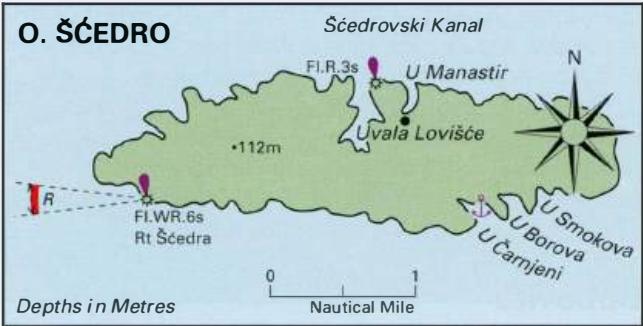
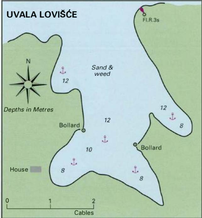
43°05'.7N 16°42'-4E Charts BA 2712, SC 5767, MK 79, 21, lmray M26 The anchorage at Lovisce is particularly popular. It is easily located by the light structure (Fl.R.3s10m3M) on the headland to the E. There are no dangers in the approach. Anchor in one of the side inlets, in 8-lOm. The bottom is sand and weed. The shelter is good from all direction
General
43°05'.7N 16°42'-4E Charts BA 2712, SC 5767, MK 79, 21, lmray M26 The anchorage at Lovisce is particularly popular. It is easily located by the light structure (Fl.R.3s10m3M) on the headland to the E. There are no dangers in the approach. Anchor in one of the side inlets, in 8-lOm. The bottom is sand and weed. The shelter is good from all directions with the exception of . This is a traditional bora haven, although it has been reported that only marginal shelter from the bora will be available in the W arm of the bay. There are some bollards ashore for lines. There are several bistros to cater for the needs of the visiting yachtsmen. 3.2 Croatia Tucepi to Tribunj The area covered by this chapter includes the mainland from Podgora (described in the previous chapter) NW to Tribunj, a small village W of Vodice, as well as the islands lying off this coast. The main islands (from S) are Brae, Solta, Drvenik Veli, Drvenik MaJi, Zlarin, Prvic, Tijat, Zmajan, Kaprije, Kakan and Zirje.
Local Weather Effects
The local weather effect most likely to be met by the visitor to this area is the afternoon sea breeze, which is strongest during July and August. The sea breeze starts at around midday and continues until early evening. It is usually a W wind and can reach Force 5 or 6 at times, although it is usually only Force 3 or The sirocco (from the SE) can occasionally make life uncomfortable in this area. It increases the westgoing currents and raises a big sea, particularly off Supetar, although Supetar is on the N coast of Otok Brae. The bora (from the NE) can be violent. Its greatest power is felt in the winter months, but on occasion it can blow strongly in the summer. The bora is particularly strong in the Braeki Kanai, the channel between the mainland and Otok Brae, where it is funnelled down the mountain valleys on the mainland. Within the Braeki Kanal the bora blows most strongly in the vicinity of Uvala Vrulja (43°24'N l6°53'.4E) and near the mouth of the Cetina river at Omis. At Skradin the bora can also blow strongly down the valley of the river Krka. Magnetic variation and anomalies
Adriatic Navigation Guide Images for Luka Lovisce
Adriatic Navigation Guide images and captions provide additional visual reference for this navigation location.