Luka Budava
Region: North Adriatic
| Position: 44.89, 14 | Adriatic Sea / Jadransko more
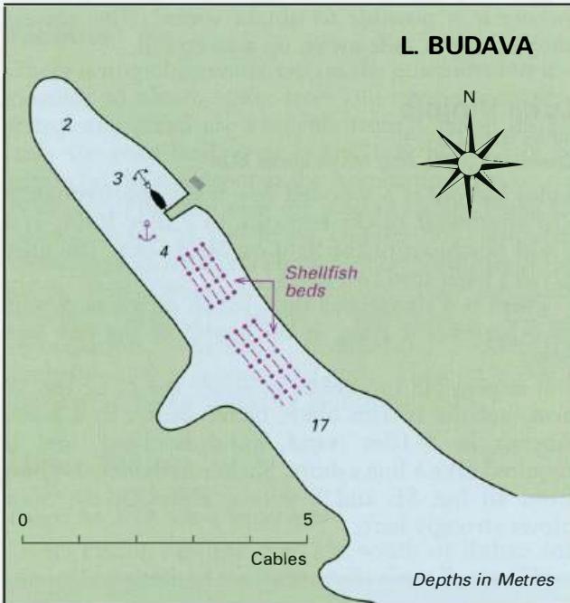
44°53"4N 14°00'E Charts BA 2719, 202, MK 4 Luka Budava lies approximately 4M southwest of the entrance to Zaljev Ra5a, When approaching from NE or E beware of the low rocks off Rt Seka which are marked by a light beacon, Much of Luka Budava is given over to shellfish farming, and a side inlet to the W was a prohibited area, The prohibited area was
General
44°53"4N 14°00'E Charts BA 2719, 202, MK 4 Luka Budava lies approximately 4M southwest of the entrance to Zaljev Ra5a, When approaching from NE or E beware of the low rocks off Rt Seka which are marked by a light beacon, Much of Luka Budava is given over to shellfish farming, and a side inlet to the W was a prohibited area, The prohibited area was marked by two metal towers and two buoys, Lights (F) are occasionally shown from the towers, To reach the anchorage, pass beyond the mussel beds, Towards the head of the bay there is a house with a pier. There may be room to tie up bow or stern-to the pier, otherwise anchor in 3 to 4m. The bottom is mud and the holding good. This far up the inlet there is good shelter. Unfortunately, Luka Budava lies under the flight path to and from Pula Airport. Luka Kuje
Adriatic Navigation Guide Images for Luka Budava
Adriatic Navigation Guide images and captions provide additional visual reference for this navigation location.