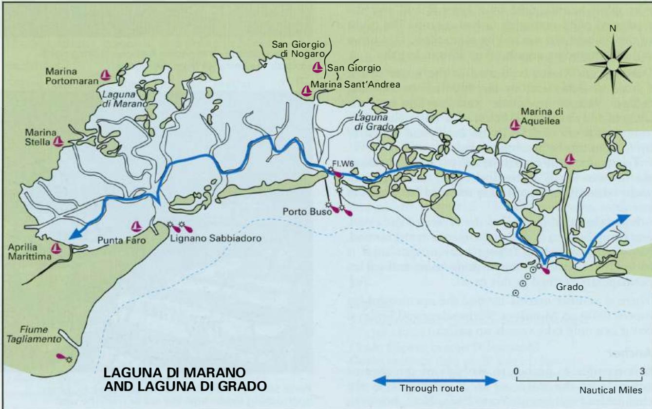
LAGUNA DI GRADO AND LAGUNA DI MARANO
Region: North Adriatic
| Position: 45.716667, 13.25 | Adriatic Sea / Jadransko more
45°43"N 13°15'E Charts BA 1471 Porto Buso is the easternmost entrance to the Laguna di Marano from seaward, and is located approximately 5-4M northwest of the entrance to Grado. There is a restaurant at Porto Buso and a few houses, but nothing else. The entrance to Porto Buso is used by large cargo ships bound for the industrial zone at Porto Nogar
General
45°43"N 13°15'E Charts BA 1471 Porto Buso is the easternmost entrance to the Laguna di Marano from seaward, and is located approximately 5-4M northwest of the entrance to Grado. There is a restaurant at Porto Buso and a few houses, but nothing else. The entrance to Porto Buso is used by large cargo ships bound for the industrial zone at Porto Nogaro on Fiume Como to the N. There is an excellent marina and boatyard, Cantieri Marina San Giorgio, approximately 4M inland on Fiume Como, beyond the commercial harbour at Porto Nogaro and two smaller marinas. It is highly recommended, particularly as a base for launching trailer/sailers.
Approach
Depths of less than Sm extend over a mile offshore in the vicinity of Porto Buso, and there are drying mudbanks to the E and SE of the entrance. This area should not be approached in strong onshore winds, particularly with winds from the SE. Nor should any attempt be made to enter or leave Porto Buso in these conditions. Occasionally currents of up to 5 knots may be encountered in the entrance. Porto Buso can be difficult to locate from seaward, but two low rubble breakwaters extending approximately 6 cables to seaward from either side of the entrance aid identification when closer in. Lights are located on the seaward end of each breakwater, and a sectored light leads through the entrance. There are trees on the islands at the roots of the breakwaters. Two pairs of R and G light buoys and a pair of unlit posts mark the channel leading up to the breakwater heads from seaward. The entrance channel is dredged to 7.5m. After periods of strong onshore winds, however, depths in the channel may be considerably less. There is a tendency for a bar to build up across the entrance near the breakwaters. Depths of less than 1 .5m over this bar have been known!
Lights
W breakwater Fl.R.5s5m4M E breakwater Fl.G.5s5m4M Root of E breakwater Fl(2)G.7s8m4M
Adriatic Navigation Guide Images for LAGUNA DI GRADO AND LAGUNA DI MARANO
Adriatic Navigation Guide images and captions provide additional visual reference for this navigation location.