Kozarica
Region: South Adriatic
| Position: 42.776667, 17.468333 | Adriatic Sea / Jadransko more
42°46'.6N 17°28'.1E Charts BA 1580, SC 5767, MK 24, 25, lmray M26 Kozarica is a tiny settlement at the base of steep wooded hills, clustered around the harbour. It is rarely (if ever!) visited by yachts or tourists. The inhabitants were very friendly towards us, coming to take our lines. The harbour is located 1 .4 M east-southeast of Hr id Kula (a
General
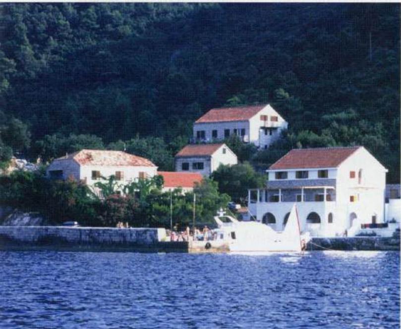
42°46'.6N 17°28'.1E Charts BA 1580, SC 5767, MK 24, 25, lmray M26 Kozarica is a tiny settlement at the base of steep wooded hills, clustered around the harbour. It is rarely (if ever!) visited by yachts or tourists. The inhabitants were very friendly towards us, coming to take our lines.
Approach
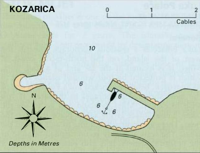
The harbour is located 1 .4 M east-southeast of Hr id Kula (at the entrance to Luka Palace). The hamlet of Kozarica is the only group of houses on the coast Kozarica harbour on the north coast of Otok Mljet between Hrid Kula and Luka Sabra, 7M further SE. There are no dangers in the approach to the harbour. No lights are exhibited at the harbour.
Berth
Tie up bow/stern-to the breakwater as space allows.
Shelter
The quay provides some shelter from NE and NW. Good shelter from W through S to E.
Facilities
None. Luka Sobra
Adriatic Navigation Guide Images for Kozarica
Adriatic Navigation Guide images and captions provide additional visual reference for this navigation location.