Kastel Sucurac
Region: Central Adriatic
| Position: 43.545, 16.431667 | Adriatic Sea / Jadransko more
43°32'.7N 16°25'.9E Charts BA 2712, 269 (detailed), SC 5767, MK 16, lmray M26 Kastel Sucurac lies lM due north of Luka Lora. The village is surrounded by the industrial area of Split, with a big plastics factory, Jugovinil, on M west of the quay. The plastics factory has four posts offshore. Passage between the posts and the N shore is prohibited.
General
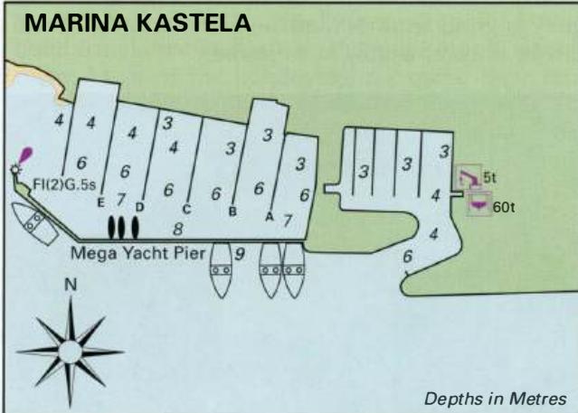
43°32'.7N 16°25'.9E Charts BA 2712, 269 (detailed), SC 5767, MK 16, lmray M26 Kastel Sucurac lies lM due north of Luka Lora. The village is surrounded by the industrial area of Split, with a big plastics factory, Jugovinil, on M west of the quay. The plastics factory has four posts offshore. Passage between the posts and the N shore is prohibited. Near the belfry and village is a quay with depths of 3m alongside on its W end. Note however that there is a rocky patch on the far W extremity of the quay. The quay, which is used by fishing boats, is exposed and only sheltered from winds. It is possible to anchor off the quay in depths of between 4m and 6m. The bottom is mud. One reason for visiting Kastel Sucurac would be to refill gas bottles from the nearby INA-Plin depot at Partizanski put, although use of a bicycle or trolley would be helpful. A baker's and a grocer's shop are located near the quay. Other facilities are just a short walk away. Marina Kastela
Adriatic Navigation Guide Images for Kastel Sucurac
Adriatic Navigation Guide images and captions provide additional visual reference for this navigation location.