Kastel Gomilica
Region: Central Adriatic
| Position: 43.548333, 16.4 | Adriatic Sea / Jadransko more
43°32"9N 16°24'E Charts BA 2712, 269 (detailed), SC 5767, MK 16, lmray M26 The small-boat harbour at Kastel Gomilica is protected from seaward by the castle, Kastelac, which is connected to the mainland by a narrow stone bridge. The castle is still inhabited. It looks far more impressive and castle-like seen from the shore than it does seen from se
General
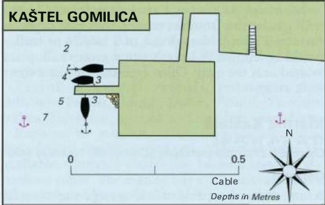
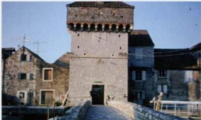
43°32"9N 16°24'E Charts BA 2712, 269 (detailed), SC 5767, MK 16, lmray M26 The small-boat harbour at Kastel Gomilica is protected from seaward by the castle, Kastelac, which is connected to the mainland by a narrow stone bridge. The castle is still inhabited. It looks far more impressive and castle-like seen from the shore than it does seen from seaward! To the W of the castle is a quay where it is possible to tie up overnight.
Approach
There are no immediate dangers in the approach to Kastel Gomilica. The quay lies on the W side of the castle.
Berth
Tie up either on the inner side of the quay if there is space, or on the outer side. There are depths of between 2m and 3m alongside. Anchor Anchor, either to the SW or SE of the castle, in 7m. The bottom is mud, good holding.
Shelter
Shelter is good from N, and on the inner side of the quay is good from NW through N to S. The berth can be uncomfortable in westerlies.
Facilities
The public water tap near the harbour no longer works. In the village are a grocery shop, Post Office, telephone, tourist information office, cafe/bar, restaurant and a campsite nearby. Fresh bread is sold at the newspaper kiosk. There is a frequent bus service {Split-Trogir).
History
The land around Gomilica was given to an order of Benedictine nuns in 1078. In the 16th century the threat of Turkish raids led to the construction of the castle on an off-lying islet, where the inhabitants of the village and the estate workers could seek refuge. Kastel Kambelovac