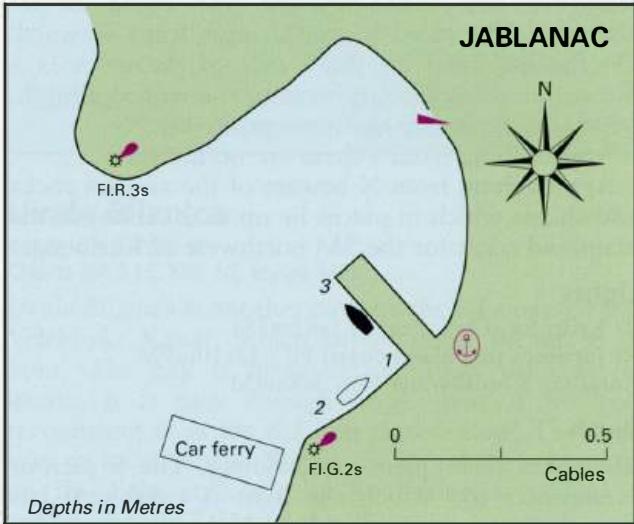
Professional navigation chart centered on Jablanac
Jablanac
Region: North Adriatic
| Position: 44.705, 14.9 | Adriatic Sea / Jadransko more
44°42'.3N 14°54'E Charts BA 202, MK 9, lmray M25, M24 Jablanac is an attractive village and harbour on the mainland coast of the Velebitski Kanai. The harbour is spoilt by the fumes, dust and noise of the traffic using the ferry to Otok Rab. At times, the queue for the ferry stretches all the way up the hillside above the village. The harbour is ea
General
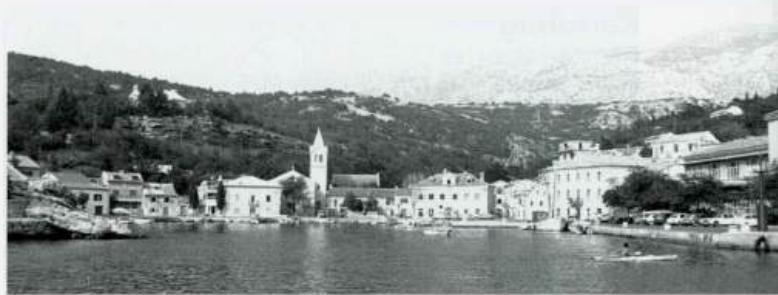
44°42'.3N 14°54'E Charts BA 202, MK 9, lmray M25, M24 Jablanac is an attractive village and harbour on the mainland coast of the Velebitski Kanai. The harbour is spoilt by the fumes, dust and noise of the traffic using the ferry to Otok Rab. At times, the queue for the ferry stretches all the way up the hillside above the village.
Approach
The harbour is easily identified by the light structure on Rt Stokic to the NW of the harbour. If approaching from Otok Rab beware of the rock and shoal, Pl. Glavina (marked by a light), which lies approximately IM southwest of the harbour. There are no dangers in the immediate approach to the harbour, but beware of the car ferries.
Lights
Plicina Glavina Fl(2)10s7m4M
Adriatic Navigation Guide Images for Jablanac
Adriatic Navigation Guide images and captions provide additional visual reference for this navigation location.