← Back to navigation map
Professional navigation chart centered on Excursions
Excursions
Region: South Adriatic
| Position: 42.84, 17.721667 | Adriatic Sea / Jadransko more
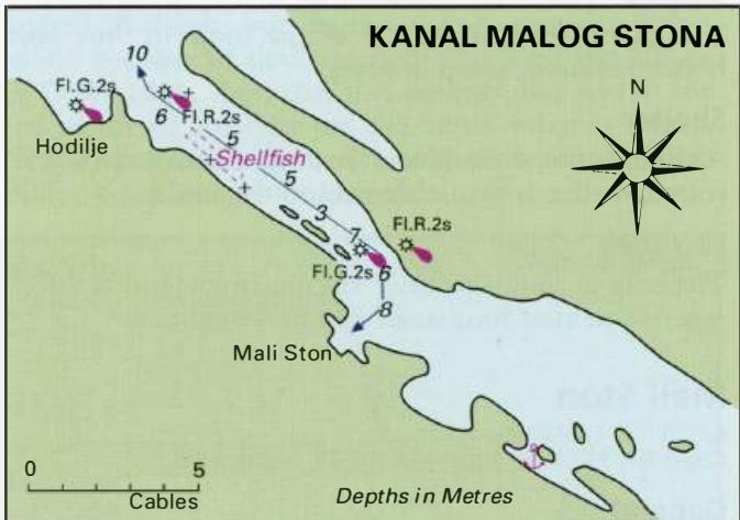
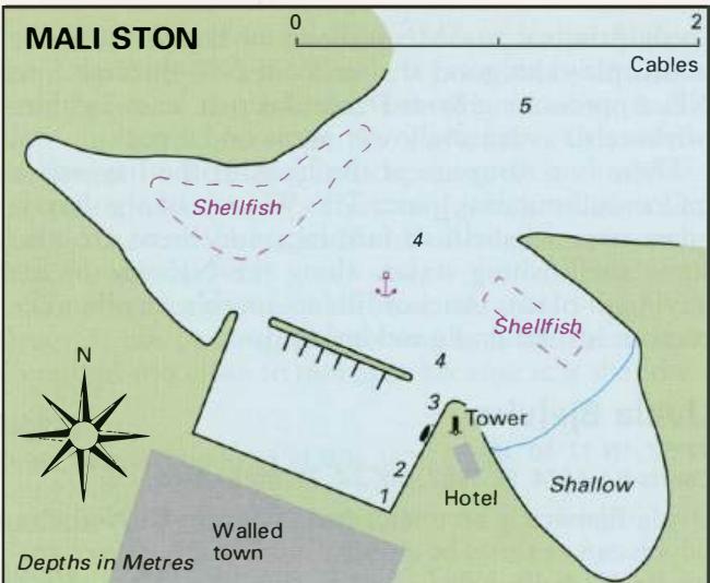
42°50'-4N 17°43'.3E Charts BA 1574, SC 5767. MK 25. lmray M26 The anchorage W and SW of 0. Skrpan, 7 cables SE of Mali Stan, shown on the charts, is now largely taken over by oyster beds and is therefore not recommended. It is however possible to find a suitable anchorage in this area SE of Mali Stan. Choose a spot clear of the oyster beds, and in
General
42°50'-4N 17°43'.3E Charts BA 1574, SC 5767. MK 25. lmray M26 The anchorage W and SW of 0. Skrpan, 7 cables SE of Mali Stan, shown on the charts, is now largely taken over by oyster beds and is therefore not recommended. It is however possible to find a suitable anchorage in this area SE of Mali Stan. Choose a spot clear of the oyster beds, and in a suitable depth. The bottom is mostly mud and good holding. Uvala Bistrina
Adriatic Navigation Guide Images for Excursions
Adriatic Navigation Guide images and captions provide additional visual reference for this navigation location.