Drage
General
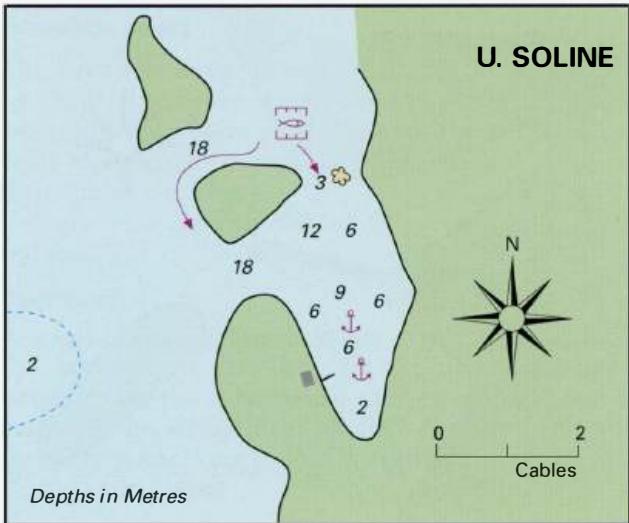
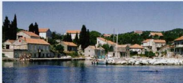
44°03''4N 15°06'-SE Charts BA 271 1, 515, SC 5767, MK 13, Im ray M25 The small and picturesque village of Drage is built around a quayed inlet called Uvala Maslincica. There is room in the harbour for a few small yachts.
Approach
There are no dangers in the immediate approach. The harbour is less than M north of Iz Veli. The village is the first coastal settlement seen when approaching from N, although it does not come into view until the headland opens up.
Berth
Tie up bow/stern to one of the piers within the harbour. There are depths of 2 to 3m here.
Shelter
Shelter is good from S through W to NE.
Facilities
There is a shop in the village. THE KORNATI ISLANDS INCLUDING OTOK ZUT Charts BA 277 7, SC 5767, MK 14, 15, lmray M25 The Kornati Islands have a unique beauty, which draws yachtsmen and other visitors to them. The landscape has a lunar quality about it, the sea is crystal clear, and, although there are boats and people around, there is an awe-inspiring air of desolation. The Kornati Archipelago consists of four groups of islands (the Sit, Zut, Kornat and Piskera groups), which are made up of islands, islets, rocks, reefs and shoals lying S of Otok Pasman. The Kornati Archipelago lies within 1 lM of the mainland coast and runs parallel to it. There are well over a hundred islands and islets, but the exact number is debatable. The islands are mostly rocky, consisting of shell limestone. They have no permanent surface streams and in general only have a thin covering of gfass. In the past the islands were covered with thick forests, but over the centuries the trees have been destroyed by fire. Shepherds deliberately started fires to increase the grazing for sheep and goats. There was a disastrous fire in the 17th century, which devastated large tracts of land. Then in 1850 a forest fire, which raged for 40 days, destroyed the remaining forest. Today there are a few small trees, mostly holm oak, in some of the more sheltered bays and _valleys amongst the islands. Grapes, figs and olives are also cultivated. The bare landscape supports insects, reptiles (including snakes) and birds, but very few mammals. In contrast, the surrounding seas are rich in fish and plant life. Nowadays there are no permanent settlements on the islands. The few houses are only occupied during the summer months by fishermen and farmers from Otok Murter and Dugi Otok. The islands were once occupied by Neolithic people, the Illyrians, the Romans, and from the Middle Ages, by Croats. A few ruins can be seen from earlier times. A number of Roman remains, some of which are now below sea level, have been discovered amongst the islands. The most prominent relic from the past is a hilltop castle near Turanj on Otok Kornat. The castle dates from the early Middle Ages, maybe even earlier. On the seashore near the castle there is a medieval church built on the site of an early Christian church. The church, which has a Roman votive inscription built into it, is still used. Every year on 2 August a fleet of boats arrives carrying worshippers to the church for a special mass. The view SE along the Kornatski Kanai from the ruined castle, Tureta, on Otok Kornat is breathtaking, as is the climb up to the castle. The climb is only for the fit or foolhardy The castle on Otok Kornat is a conspicuous landmark. The tripper boat is alongside a quay, having just disembarked visitors to the castle and nearby chapel The Kornati Islands were designated a National Park in 1980. Originally Luka TelasCica on Dugi Otok was included in the Kornati National Park, but in the 1988 changes to the park boundaries it was separated from it. It is now administered separately as the Telascica ature Park. Technically Otok Zut is not part of the Kornati National Park, but we have included it in this section. To protect the unique environment of the islands a number of regulations are in force. Most of the regulations are obvious, such as not disturbing or damaging the flora or fauna, no fishing with spear guns or hunting, no excessive noise, and only leaving rubbish in designated collection sites. Conspicuous large rubbish bins are provided in these areas. In addition, fishing is only allowed after purchasing a permit. Permits are also required for scuba diving, which is only allowed in recognised groups, organised by one of three diving centres. Walking or hiking is restricted to marked paths. Visitors have to pay an admission charge for each day spent in the islands. Admission tickets can be bought from the park reception areas, park patrol launches, or from a number of marinas, including Marinas Hramina, Betina, Kremik (Primosten), Frapa (Rogoznica), Punat (Otok Krk), Kornati Ilirija (Biograd na Moru), and Tankokomerz Zadar. If you have already paid for admission to the TelasCica Nature Park this covers you for one day spent in the Kornati ational Park. The reception areas are at Ravni Zakan, ACI Marina Piskera, Vrulje (centrally located on the SW side of Otok Kornat) and Spraljin stan (in Uvala Tomasovac) on the NW extremity of Otok Kornat). Yachts can explore most of the islands, although access to certain areas is restricted to protect them. Vessels are not allowed to approach or anchor within 500m of OtoCic Purara and the nearby rocks of Klint and Volic, which lie 1.7M south of Ra vni Zakan. Stopping in the area around the islands of Klobuear in the S and Mrtvac, Veli and Mali Obruean in the N is also prohibited. There are two ACI marinas in this area in Luka Zut and Piskera. Many of the bays and anchorages have restaurants, with piers and mooring buoys for customers. Some of the restaurants regularly win awards. Besides the marinas, yachts are allowed to stay overnight in the following anchorages, some of which have restaurants: Uvala Stiniva 43°48'.5N l5°20'.7E Uvala Statival 43°51'.6N l5°15'.7E Mala Lupe5ka 43°52'.2N l5°15'.2E Uvala Tomasovac 43°52'.3N l5°13'.7E Uvala Sipnate 43°5l'.ON 15°15'.0E Uvala LuCica 43°50'.3N l5°15'.6E Uvala Kravljacica 43°49'-4N l5°1 6'.8E Strifoa 43°49'.3N 15°1 T.2E Vrulje 43°48'.6N l5°18'.5E Uvala Opat 43°44'.3N 15°2T-4E Gujak (Uvala Lopatica) 43°4T-2N 15°20'-4E Smokvica Vela 43°43'.5N 15°28'.9E The Kornati Islands has a surprising number of restaurants, many of which (such as this one at Strifoa) have provided quays or moorings for their customers The various anchorages, diving zones, reception areas and specially protected areas are shown on the admission tickets. Where depths are too great for lying to one anchor alone, take lines ashore. We describe the most sheltered anchorages below. OTOK ZUT Charts BA 2711, SC 5767, MK 74, Im ray M25 Otok Zut is the second largest island in the Kornati group. It is just over 6M long (NW to SE) and lies to the E of Otok Kornat. There are two anchorages on Otok Zut which are of interest to yachts; Luka Zut and Uvala Hiljaca. Luka Zut 43"53'N 15"18'.6E Charts BA 271 1, SC 5767, MK 74, lmray M25 Luka Zut is a large bay on the NE coast of Otok Zut where it is possible to find shelter from most winds. In this area the bora blows from the E. Approaching Luka Zut requires care because of the various dangers lying off the shores of Otok Zut and in the Sitski Kanal. A chart of the area is essential. This area should only be approached during daylight. On entering Luka Zut note that a shallow area with 5.4m over it extends E from the NW headland. It is possible to anchor in one of the two inlets on the SW side of the bay (see plan) or to berth at the marina in the NW part of the bay. The marina is part of the ACI group. It is open from April until the end of October. Water and electricity are laid onto the berths. Water is available from 0800-1 000, electricity from 0800-1200 and 1800-2359. The marina has toilets, showers, a supermarket, telephones, currency exchange office, and a restaurant. The marina address is: ACI Marina Zut, 22242 Jezera, Croatia VHF Ch 17"a' (022) 786 0278 or (099) 470 028 Fax (022) 786 0279 Email [email protected] Uvala Hiljaca
Adriatic Navigation Guide Images for Drage
Adriatic Navigation Guide images and captions provide additional visual reference for this navigation location.