Region: Central Adriatic
| Position: 44.266667, 12.358333 | Adriatic Sea / Jadransko more
44°16'N 12°21'.5E Charts BA 220, 204, 1467 The small river port of Cervia, approximately 13YiM south of Porto Corsini, was an important salt producing town. It still has salt pans, a visitor centre at the salt marshes, and a museum in the 'Torre' salt warehouse located in the town. Today the town is a holiday resort with a marina. The harbour entra
General
44°16'N 12°21'.5E Charts BA 220, 204, 1467 The small river port of Cervia, approximately 13YiM south of Porto Corsini, was an important salt producing town. It still has salt pans, a visitor centre at the salt marshes, and a museum in the 'Torre' salt warehouse located in the town. Today the town is a holiday resort with a marina. The harbour entrance is protected by a short mole to the N and the marina breakwater to the S. The marina lies on the S side of the entrance, but is entered from within the entrance channel to Cervia. Technically, Cervia lies on the S side of the port, and the town of Milano Marittima lies to the N.
Approach
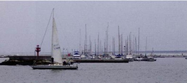
The entrance to the harbour is difficult to distinguish from seaward, although in the closer approach yacht masts in the marina can be seen. Lights are exhibited from the ends of both breakwaters. Approach the entrance with care. There is a tendency for a sandbar to build up across the entrance, and depths over this can be lm or less. Normally the entrance is kept dredged to 3m. Advice can be sought from the harbour office on VHF Ch 16 or the marina on VHF Ch 10 on the Gurrent situation if necessary. Shallow depths extend some way offshore, and no attempt should be made to enter or leave Cervia in strong onshore winds.
Lights
Cervia LtHo (within the town) Iso.2s16m1 1M N breakwater Fl.G.3s8m4M S breakwater Fl.R.3s8m4M Horn Mo(U)45s SE corner of the marina 2F.R(vert)3M
Berth
The public harbour is a quayed river. It is busy with local craft and fishing boats tied alongside the quays, and finding space to berth is difficult. The marina is entered from within the harbour as shown on the plan. The marina can accommodate yachts of up to 22m in length. Berth as directed by marina staff.
Shelter
Excellent all-round shelter is available in the marina.
Officials
Harbourmaster's office on the S quay of the public harbour, near the fish market. Customs and police.
Facilities
Water, electricity, toilets and showers at the marina. There are also taps (in metal boxes) on the NW quay of the public harbour. Some are equipped with hose pipes. Petrol and diesel are available from the fuel berth within the marina. Italian gas and Camping Gaz. There are the usual kind of shops you would expect to find in a holiday town, as well as chandlers, hardware shops, Post Office, banks, ATMs and a market. Launderette. Hospital, first-aid post, doctors, dentists, pharmacies. Tourist information, hotels, restaurants, cafe/bars. Bus service. Railway station. Repairs to hull, engine, and electrical/electronic installations can be carried out. Agents for Mercury, OMC, Volvo Penta, amongst others. The marina has a travel-hoist and cranes, restaurant, bar and chandlers. Sailing clubs. The marina address is: Porto Turistico Marina di Cervia, Lungomare G. D'Annunzio1, 48015 Cervia (RA) -a-(0544) 71709 Fax (0544) 973 845 Email [email protected] traditional craft moored.in the port. ich,was desiqned by Leonardo da Vinci Lcesenatico
Adriatic Navigation Guide Images for Cervia
Adriatic Navigation Guide images and captions provide additional visual reference for this navigation location.