Budva
Region: South Adriatic
| Position: 42.28, 18.843333 | Adriatic Sea / Jadransko more
42°16'.8N 18°50'.6E Charts BA 1582, MK27, 28, lmray M27 Budva is a pleasant holiday town 13M northwest of Bar, which has all the facilities required by a cruising yacht close at hand. The harbour is sheltered from all directions, but can be difficult to enter in strong onshore winds. The town was devastated by the 1979 earthquake, but has now been
General
42°16'.8N 18°50'.6E Charts BA 1582, MK27, 28, lmray M27 Budva is a pleasant holiday town 13M northwest of Bar, which has all the facilities required by a cruising yacht close at hand. The harbour is sheltered from all directions, but can be difficult to enter in strong onshore winds. The town was devastated by the 1979 earthquake, but has now been completely restored.
Approach
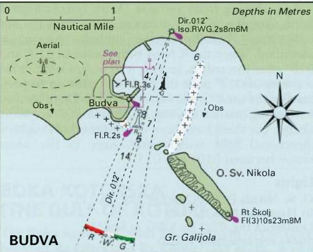
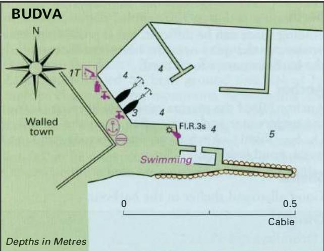
The approach to Budva is more straightforward than it at first appears. The town is easily identified by the wedge-shaped island of Sv. Nikola lying to the SE and by the aerial to the W of the town. New wall 0. Sv. Nikola is virtually joined to the mainland by 2 ridges of above-and below-water rocks running NW and N from the N extremity of the island. There are also a number of rocks off the southwest-facing side of 0. Sv. Nikola. Stretching nearly 2 cables WNW of the S extremity of the island is a rock, Greben Galijola, with 1 .8m over it, which is only apparent in rough weather. NW of Greben Galijola, approximately 4 cables distant, there are two more dangerous rocks. Entrance New Marina The entrance to Budva harbour
Adriatic Navigation Guide Images for Budva
Adriatic Navigation Guide images and captions provide additional visual reference for this navigation location.