Božava
Region: Central Adriatic
| Position: 44.14, 14.911667 | Adriatic Sea / Jadransko more
44°08'-4N 14°54'.7E Charts BA 515, 2773 (detailed), MK 13, lmray M25 Bofava is located on the NE coast of Dugi Otok, W of the S extremity of the off-lying island of Otok Zverinac, and SW of Rt Sv. Nedjelja on Dugi Otok. The village is a popular port of call for the 'hotel' boats, and it can be very crowded with visiting yachts in the summer. Approa
General
44°08'-4N 14°54'.7E Charts BA 515, 2773 (detailed), MK 13, lmray M25 Bofava is located on the NE coast of Dugi Otok, W of the S extremity of the off-lying island of Otok Zverinac, and SW of Rt Sv. Nedjelja on Dugi Otok. The village is a popular port of call for the 'hotel' boats, and it can be very crowded with visiting yachts in the summer.
Approach
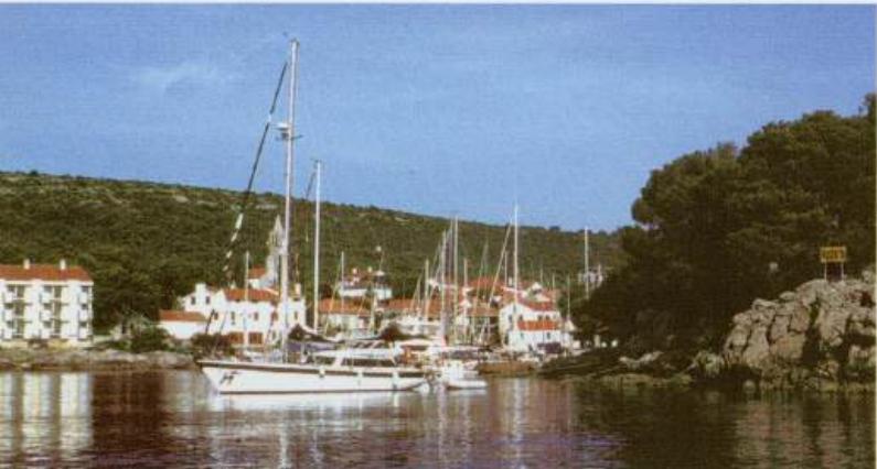
Approaching from SE or E the large white hotel building on the SW side of the inlet is conspicuous from some distance. When approaching from NW through the Zverinacki Kanal beware of the dangerous rocks and shoals at the NW end of the channel. One of these rocks is marked by a light beacon (Fl(2)6s), but the shoals, one with 1.7m located 2 cables NW of the beacon and the other with 4.8m lying just under 2 cables NE of the beacon, are not marked. The position of these dangers is best seen from the chart. The light structure on Rt Sv. Nedjelja just NE of Bofava helps locate and identify the bay. A sign post 'Bofava' is further confirmation. There are no dangers in the immediate approach.
Lights
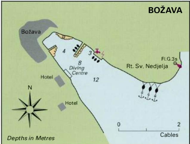
Rt Sv. Nedjelja Fl.G.3s8m4M There are no navigational lights in the harbour.
Berth
Moor bow/stern to the inner side of the pier where depths range from 2 to 8m or at the quay to the SE. There are laid lines. It is also possible to anchor and take lines to the N shore inside the entrance to Bofava. Good shelter from all directions except SE.
Officials
Summer port of entry. Harbourmaster, police.
Facilities
Water and electricity on the quay. Several shops including a grocery store. Fruit and vegetable market. Post Office and telephones. Medical centre. Hotel, restaurants and several cafe/bars. Uvala Dumboka