Region: North Adriatic
| Position: 44.968333, 14.766667 | Adriatic Sea / Jadransko more
44°58'.1N 14°46'E Charts BA 2779, MK 7, lmray M24 Baska is a holiday town situated on the shores of a wide bay on the SE coast of Otok Krk, immediately N of Otok Prvic. The harbour is protected by two walls, but is poorly sheltered if there is any S in the wind. There are no dangers in the approach. Rt Strazica (0. Prvi,) Fl.6s21m9M Rt Skuljica (0.
General
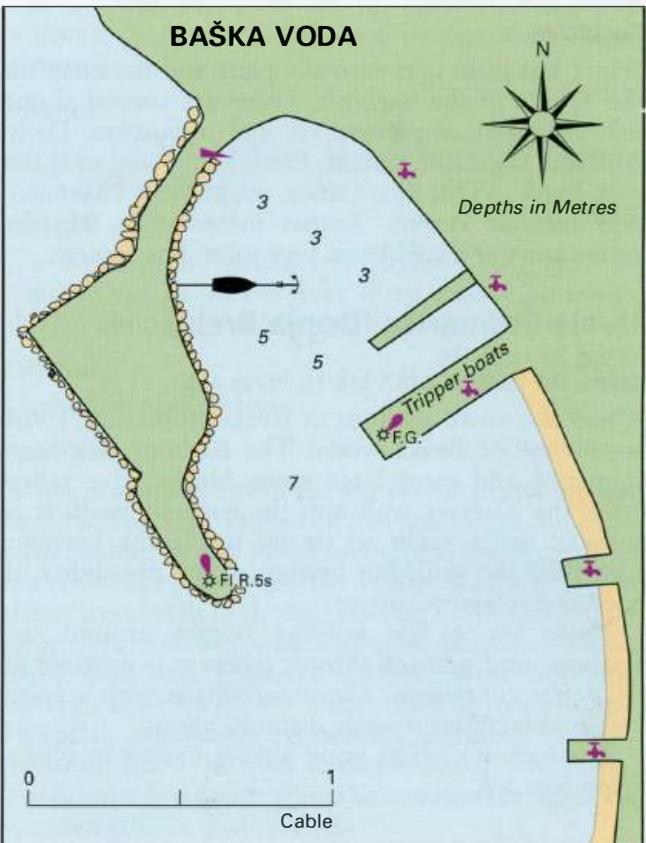
44°58'.1N 14°46'E Charts BA 2779, MK 7, lmray M24 Baska is a holiday town situated on the shores of a wide bay on the SE coast of Otok Krk, immediately N of Otok Prvic. The harbour is protected by two walls, but is poorly sheltered if there is any S in the wind.
Approach
There are no dangers in the approach.
Lights
Rt Strazica (0. Prvi,) Fl.6s21m9M Rt Skuljica (0. Krk) Fl.R.3s18m6M Baska SE breakwater Fl.G.2s10m4M Baska W breakwater Fl.R.3s7m3M
Berth
Secure bow/stern-to the outer third of the SE breakwater. Depths immediately alongside are 2 to 3m, but are deeper farther out into the harbour. The area at the root of this breakwater is reserved for ferries. It is also possible to anchor in the W part of the harbour in 4-7m, or to tie up alongside the W breakwater, clear of the tripper boats. The head of the bay to the W of the harbour is foul with rocks.
Shelter
Shelter is good from W through N to E. S winds make the harbour very uncomfortable.
Officials
Harbourmaster. Police.
Facilities
The public water taps have been disconnected. There is no fuel station at Baska. There are several shops in the town, including a supermarket, general grocer, butcher, hardware store, fish market, fruit and vegetable market. Post Office and telephones. Pharmacy. Hotels, restaurants, cafe/bars, campsite. Bus service and ferry service to Lopar (Rab). Punat
Adriatic Navigation Guide Images for Baška
Adriatic Navigation Guide images and captions provide additional visual reference for this navigation location.
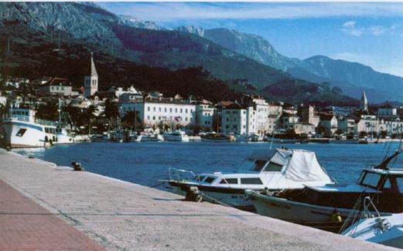
Makarska, a busy holiday resort, lies at the foot of the Biokovo mountain range