Banj
Region: Central Adriatic
| Position: 44.001667, 15.301667 | Adriatic Sea / Jadransko more
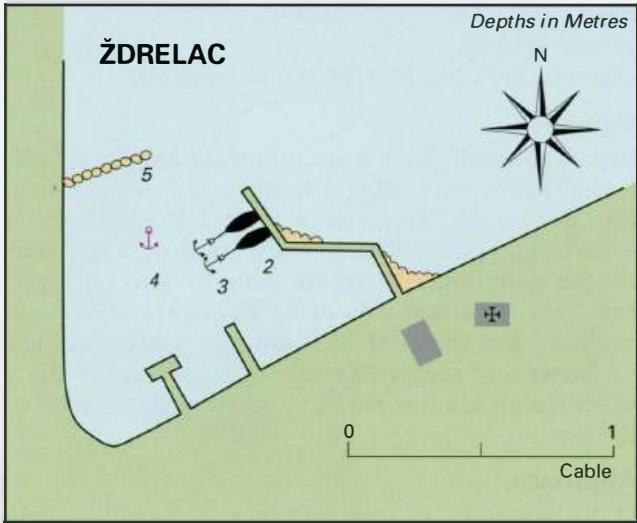
44°00'.1N 15°18'.1E Charts BA 271 1, 515, SC 5767, MK 14, lmray M25 Banj lies approximately lM southeast of Zdrelac. There is a small shallow harbour, which has depths of 2m just inside the breakwater and only 3m in the approach. It is only suitable for small yachts and is not recommended. There are small harbours or piers between Banj and the vill
General
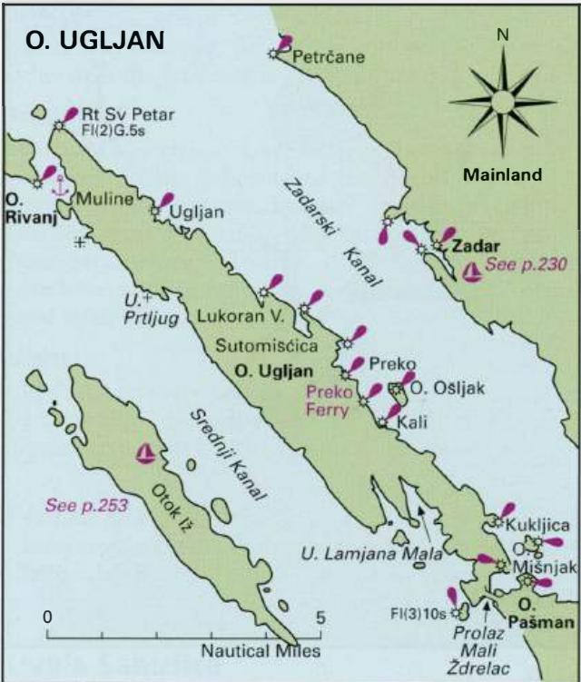
44°00'.1N 15°18'.1E Charts BA 271 1, 515, SC 5767, MK 14, lmray M25 Banj lies approximately lM southeast of Zdrelac. There is a small shallow harbour, which has depths of 2m just inside the breakwater and only 3m in the approach. It is only suitable for small yachts and is not recommended. There are small harbours or piers between Banj and the village of Pasman, at Dobropoljana (43°59'.6N 15°19'.7E), Nevidane (43°58'.8N 15°20'.8E) and Mrljane (43°58'.1N l5°21'.6E). Shallow-draught vessels can tie up at these harbours, although most yachts will find them too shallow and unsuitable. If you do have shallow draught and decide to visit one of them, proceed with caution. Note that at Mrljane there is a submerged rock just NW of the harbour entrance. OTOK UGLJAN Otok Ugljan lies parallel to the mainland coast, separated from it by the Zadarski Kanal. The island, which is approximately lH\M long (NW to SE) and 2M wide (SW to NE), has a number of small harbours, two new marinas, and anchorages along its shores. Most of the settlements are on the northeast-facing side of the island. Otok Ugljan has been continuously inhabited since the late Neolithic age, and was a populous and prosperous part of the Roman Empire. Historic remains can be seen in various parts of the island. The islanders are increasingly making a living from tourism, but agriculture and fishing have always been important. The chief settlement on Otok Ugljan is Preko, where there are two small harbours as well as the ferry terminal. The description of the harbours and anchorages commences with Preko, and then follows the coast round in clockwise order. Preko
Adriatic Navigation Guide Images for Banj
Adriatic Navigation Guide images and captions provide additional visual reference for this navigation location.