Uvala Lucice Beach - Punta Križa, Croatia
Uvala Lucice is a small, sheltered cove located in Punta Križa on the Adriatic coast of Croatia. This beach is defined by its natural landscape, featuring a narrow entrance flanked by rocky outcrops that create a protected environment. The shoreline consists of small gray pebbles, with the sea floor gradually sloping into deeper waters. Its dimensions—30 meters wide and 20 meters deep—make it a compact yet distinct coastal feature. The beach is explicitly noted as suitable for camping travelers and nudists, with a designated equipped camping area nearby.
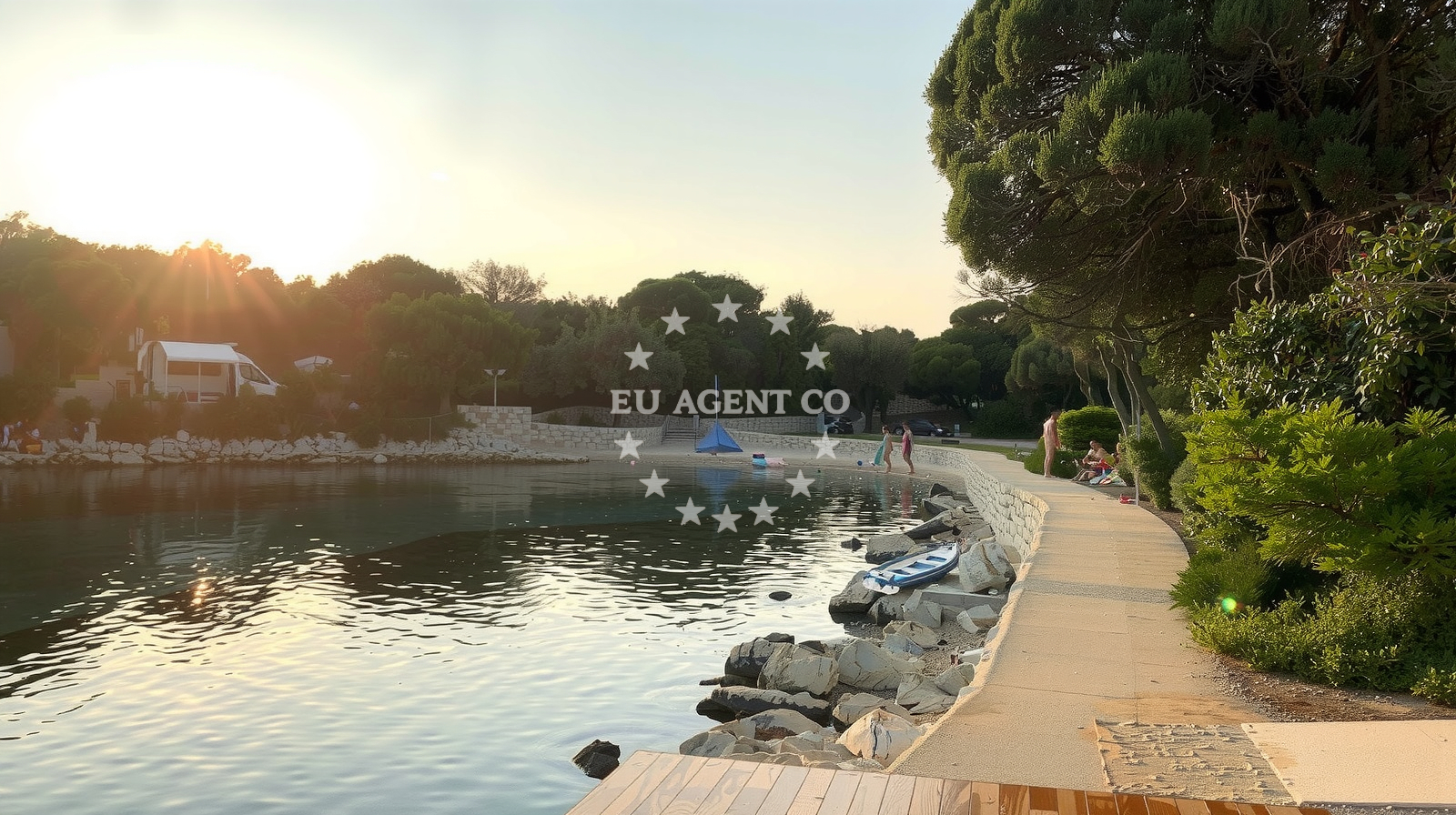
Beach character
The beach’s most striking characteristic is its natural shade, provided by the surrounding rock formations that form its entrance. This creates a microclimate that offers respite from direct sunlight. The pebble composition of the shore is consistent with the nearby sea floor, which is also covered in pebbles. The depth increases smoothly, making it a relatively safe area for water activities despite the rocky terrain. The beach’s orientation and sheltered position suggest it may be less exposed to strong waves, though this is not explicitly confirmed in the catalog.
Swimming and shore
Swimming conditions at Uvala Lucice are influenced by its pebble shoreline. While the smooth gradient of the sea floor may allow for easier entry into the water, the pebbles could make prolonged barefoot swimming uncomfortable. The beach’s cove-like structure may reduce wave action, though this is not explicitly stated. Water entertainment activities are listed as available, though specific types (e.g., kayaking, snorkeling) are not detailed. The absence of structured amenities means visitors should prepare for a more natural, unspoiled experience.
Facilities and activities
No formal facilities such as showers, restrooms, or parking are listed in the catalog. However, the beach is explicitly associated with an equipped camping area, suggesting it is a destination for those seeking overnight stays. The 'water entertainment' activity is noted, though specifics are not provided. The beach’s designation for nudists indicates a tolerant attitude toward such practices, though this may vary depending on local customs and seasonal factors.
Access and location
Uvala Lucice is situated in Punta Križa, a coastal area on the island of Brač, part of the Central Dalmatia region. The nearby town of Bol, known for its connection to the island of Hvar via the famous bridge, is approximately 10 kilometers northeast. The beach’s proximity to Brač’s main settlements and the broader Adriatic sailing routes suggests it could be a stop for charter guests exploring the region. However, no specific access routes, road connections, or parking details are provided in the catalog.
What to expect
Visitors to Uvala Lucice should expect a compact, sheltered beach with a pebble shoreline and natural shade from surrounding rocks. The area is equipped for camping travelers and nudists, though no formal facilities are listed. Water-based entertainment is available, though specifics are not detailed. The beach’s small size and cove-like structure suggest it may be less crowded than larger coastal areas, though the 'busy' crowd index during high season indicates potential for congestion. The good cleanliness rating implies reasonable maintenance, though the absence of structured amenities means visitors should prepare for a more rustic experience.
Practical tips
Bring sturdy footwear for the pebble shoreline, as barefoot walking may be uncomfortable. The camping area’s availability makes it a viable option for overnight stays, though no details about permits or facilities are provided. Visitors should be aware of the beach’s nudist designation and respect local customs. Due to the lack of formal signage or services, it is advisable to confirm the beach’s status with local authorities or Euro-Agent’s nautical maps for the most current information.
Exploring the coast by yacht
For yacht charter guests exploring the Adriatic, Uvala Lucice’s location in Punta Križa offers proximity to Brač’s sailing routes and the broader Central Dalmatia region. The area is part of a network of anchorages and marinas that cater to motor yachts and sailing boats, with nearby options including Bol’s marina and the island of Hvar’s ports. Charterers may find this beach useful as a stopover, though the absence of formal docking facilities means anchoring in nearby bays may be necessary. Euro-Agent’s yacht search tool can help identify vessels available for exploration of this region.
Regional Context and Nearby Settlements
Punta Križa is a coastal area on Brač, an island known for its limestone landscapes and connection to the Adriatic’s sailing routes. The nearby town of Bol, located on the island’s northern coast, is a hub for tourism and offers access to the famous bridge linking to Hvar. The broader region of Central Dalmatia includes other notable sailing destinations such as Split, the island of Šolta, and the Kornati archipelago. These areas are popular with charter guests due to their protected waters and cultural heritage.
Anchorages in the surrounding area
Anchorages near Pogana and Cres offer convenient stops for vessels exploring the area around Uvala Lucice.
- Anchorage — pogana — cres — 0.6 NM from beach
- Baldarin — pogana — cres — 0.6 NM from beach
- Meli — cres — 1.1 NM from beach
- Anchorage — cres — 1.3 NM from beach
- Anchorage — punta kriza — cres — 1.3 NM from beach
- Anchorage — punta kriza — cres — 1.4 NM from beach
- Anchorage — punta kriza — cres — 1.8 NM from beach
- Luka Ul — punta kriza — cres — 1.8 NM from beach
Distances are straight-line geographic distances, not sailing routes.
Mooring buoys in the surrounding area
- Buoy field Jadrišćica — pogana — cres — 0.6 NM from beach
- Anchorage Jadriscica — pogana — cres — 0.7 NM from beach
- Buoy field — punta kriza — cres — 1.4 NM from beach
- Buoy field — punta kriza — cres — 1.7 NM from beach
- Jetty — cunski — losinj — 4.5 NM from beach
Distances are straight-line geographic distances, not sailing routes.
Marine fuel stations
Marine fuel stations in Mali Losinj and Rab supply refueling points for vessels traveling to Uvala Lucice.
- Adria Oil — mali losinj — 4.8 NM from beach
- Ina — mali losinj — 5.2 NM from beach
- Tifon — nerezine — losinj — 6.3 NM from beach
- Ina — rab — 13.7 NM from beach
Distances are straight-line geographic distances, not sailing routes.
Harbours in the surrounding area
- Ul — punta kriza — cres — 1.8 NM from beach
- Za Osirom — cunski — losinj — 4.5 NM from beach
- Sveti Martin — mali losinj — 5.0 NM from beach
- Mali Lošinj — mali losinj — 5.1 NM from beach
- Rovenska — veli losinj — 5.5 NM from beach
- Rovenska — veli losinj — 5.5 NM from beach
Distances are straight-line geographic distances, not sailing routes.
Marinas in the surrounding area
- Y/C Marina Mali Lošinj — mali losinj — 4.8 NM from beach
- Marina Lošinj — mali losinj — 4.8 NM from beach
- Marina Nerezine — losinj — 5.7 NM from beach
- ACI Marina Rab — 13.7 NM from beach
- ACI Marina Supetarska Draga — rab — 14.5 NM from beach
Distances are straight-line geographic distances, not sailing routes.
Restaurants near the beach
Restaurants in Pogana and Mali Losinj serve local cuisine for visitors to Uvala Lucice.
- Pogana — cres — 0.4 NM from beach
- Pogana — cres — 0.6 NM from beach
- Marina — losinj — 4.7 NM from beach
- Restaurant Kadin — mali losinj — 4.8 NM from beach
- Klub Kapetana — mali losinj — 4.8 NM from beach
- Konoba Kate — mali losinj — 4.9 NM from beach
- Konoba Lanterna — mali losinj — 5.0 NM from beach
Distances are straight-line geographic distances, not sailing routes.
Navigation guides for the surrounding area
Navigation guides for Luka Jadriscica (Pogana) and Uvala Martinscica assist in planning routes to Uvala Lucice.
- Luka Jadriscica (Pogana) — 0.3 NM from beach
- Uvala Majiska/Uvala Kolorat — 2.3 NM from beach
- Uvala Martinscica — 2.4 NM from beach
- Luka Sv. Martin — 4.9 NM from beach
- Mali Losinj — 5.0 NM from beach
Distances are straight-line geographic distances, not sailing routes.
Yachts from nearby departure bases
Yachts departing from Mali Lošinj offer convenient access to Uvala Lucice and surrounding waters.
Sailing yachts
- Dufour 412 Grand large (Eva) — Mali Lošinj — 4.7 NM from departure base to beach
- Bavaria 37 Cruiser (Alani) — Mali Lošinj — 4.7 NM from departure base to beach
- Elan 344 Impression (Helios) — Mali Lošinj — 4.7 NM from departure base to beach
- Elan 35 Impression (Essi) — Mali Lošinj — 4.7 NM from departure base to beach
- Elan 40 Impression (Laali) — Mali Lošinj — 4.7 NM from departure base to beach
Motor boats
- Antares 36 (Joia) — Mali Lošinj — 4.7 NM from departure base to beach
- Galeon Galia 630 (287670ML) — Mali Lošinj — 4.7 NM from departure base to beach
- Antares 36 (JOIA) — Mali Lošinj — 4.7 NM from departure base to beach
- Galeon Galia 630 — Mali Lošinj — 4.7 NM from departure base to beach
- Barracuda 530 RIB (Hvar) — Mali Lošinj — 4.7 NM from departure base to beach
Distances are straight-line geographic distances, not sailing routes.