Tanki rt sjever, Lopar (Rab) Beach, Croatia
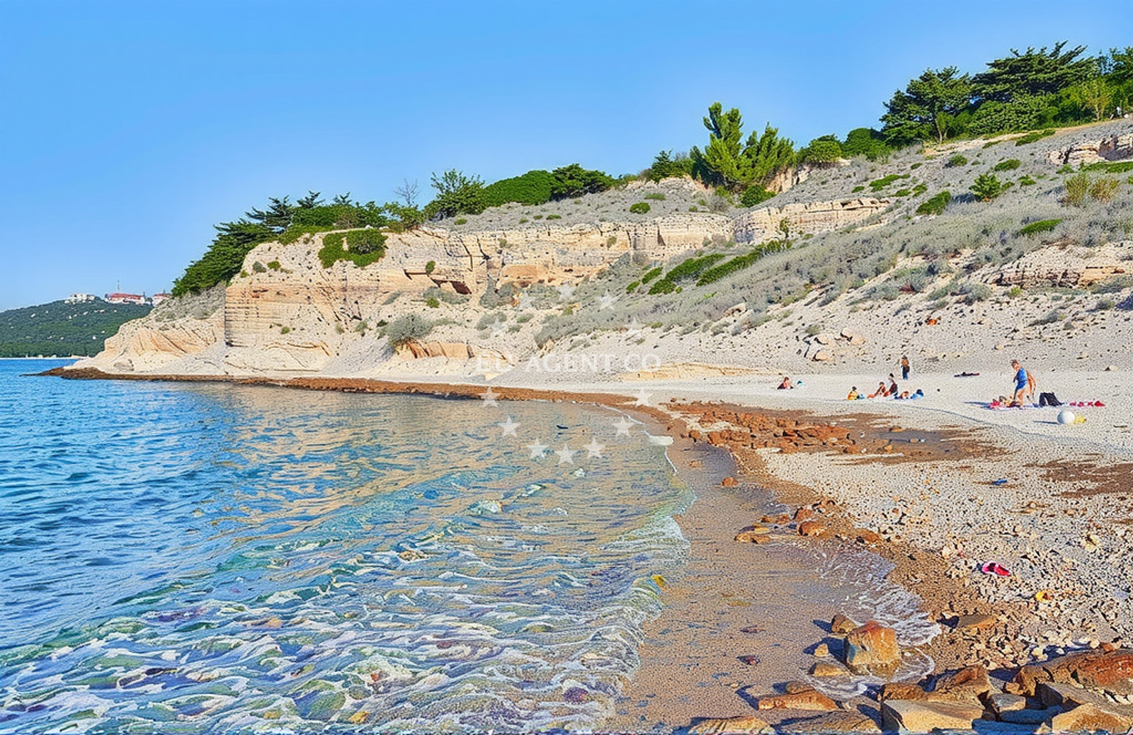
Tanki rt sjever, located in Lopar on the island of Rab, is a gravel beach that offers a unique coastal experience along Croatia’s northern Adriatic shore. Situated near the western coast of Rab, the beach is part of a rugged landscape shaped by the sea and wind, typical of the island’s northern cliffs. While not a traditional sandy shore, its gravel composition reflects the geological character of the region, where rocky outcrops and pebbles dominate the coastline. The beach’s position near the village of Lopar connects it to the island’s historic fishing communities and the broader cultural heritage of the Kvarner Gulf.
About this beach
Tanki rt sjever, Lopar (Rab)
Beach: Tanki rt sjever
Location: Lopar (Rab)
Characteristics and facilities
Gravel
Beach character
The gravel composition of Tanki rt sjever is its defining feature. Unlike the soft sands of southern Croatian shores, this beach consists of coarse, angular stones that create a distinct texture underfoot. The gravel likely originates from the erosion of nearby limestone formations, a common geological process on Rab’s northern coast. The beach’s shoreline is relatively exposed, with minimal natural shelter from waves, making it more suitable for those seeking a rugged, unspoiled coastal environment rather than a tranquil swimming spot. The surrounding area is marked by low-lying terrain and sparse vegetation, typical of Rab’s northern regions, which are less developed than the island’s southern resorts.
Swimming and shore
Swimming conditions at Tanki rt sjever are influenced by its gravelly shore and the open exposure to the Adriatic Sea. The beach lacks natural barriers such as cliffs or dunes, meaning wave action can be more pronounced during windier periods. The gravel substrate may make prolonged swimming less comfortable, though the clear waters of the Kvarner Gulf provide visibility for those who venture into the sea. The shore itself is largely unaltered, with no artificial structures or facilities, preserving its raw, natural character. This makes it an appealing spot for visitors seeking solitude and a connection to the island’s untamed coastal landscape.
Facilities and activities
Tanki rt sjever does not feature formal amenities such as showers, restrooms, or parking areas, as no such facilities are documented in the beach’s authoritative records. The absence of infrastructure aligns with its status as a remote, less-developed stretch of Rab’s coastline. Activities here are limited to passive enjoyment of the scenery, such as walking along the shore or observing marine life in the clear waters. The gravel surface may not be ideal for sunbathing, but it offers a stable base for exploring the beach’s natural contours. The area’s lack of tourism development means it remains largely untouched, catering to those who prefer a minimalist coastal experience.
Access and location
Access to Tanki rt sjever is via the village of Lopar, located on the western coast of Rab. The beach is positioned near the northernmost point of the island, where the coastline becomes more rugged and less accessible. Visitors arriving by car would need to navigate the narrow, winding roads of Lopar, which connect to the broader Rab road network. The beach’s proximity to the village suggests it is within walking distance for locals, though its remote nature may make it less frequented by tourists. The coordinates (44.849001, 14.733527) place it near the intersection of the Adriatic Sea and the island’s northern cliffs, a location that offers panoramic views of the Kvarner Gulf and the mainland coast of Croatia.
What to expect
Visitors to Tanki rt sjever should expect a raw, unspoiled coastal environment defined by its gravelly shore and exposed position along Rab’s northern coast. The beach lacks modern amenities, making it more suitable for those seeking solitude and a connection to nature than for families or groups requiring comfort and convenience. The clear waters of the Kvarner Gulf provide an inviting backdrop, though the gravel substrate may not be ideal for extended swimming. The area’s minimal development ensures that the beach remains a quiet, under-the-radar destination, offering a contrast to the more crowded resorts of southern Rab. Those visiting should be prepared for a rugged, natural setting that emphasizes the island’s geological and coastal character.
Practical tips
For visitors planning to explore Tanki rt sjever, consider the following: the gravel surface may be uncomfortable for prolonged sunbathing, so lightweight clothing and a mat may be useful. The beach’s exposure to the sea means wind can be a factor, particularly in the afternoons. Parking options in Lopar are limited, so arriving early is advisable. The beach’s remote location makes it less likely to be crowded, but its lack of facilities means visitors should bring their own supplies. The clear waters are ideal for snorkeling, though the gravel may make wading challenging.
Exploring the coast by yacht
Tanki rt sjever’s position on the northern coast of Rab places it within a region popular with yacht charter guests exploring the Kvarner Gulf. The nearby marina in Rab town, located approximately 15 kilometers to the south, serves as a common base for sailors venturing to the island’s northern shores. Yacht charter guests may find Tanki rt sjever an appealing stop for anchoring or a brief shore excursion, particularly during the summer months when the sea is calm. The surrounding waters offer scenic sailing routes to nearby islands such as Pag and the mainland coast, with Rab’s northern cliffs providing a dramatic backdrop. While the beach itself is not a traditional anchorage, its proximity to Lopar and the open waters of the Gulf make it a viable option for those seeking a quiet coastal interlude during a sailing trip.
Geological and Historical Context
The gravel composition of Tanki rt sjever is a product of the island’s geological history, shaped by millennia of erosion from the Adriatic Sea. Rab’s northern coast, including Lopar, has long been influenced by maritime activity, with the village serving as a hub for fishing and boatbuilding. The beach’s rugged character reflects the resilience of the island’s landscape, which has withstood the forces of wind and water. Historically, the area’s limited development has preserved its natural state, offering a glimpse into the coastal environments that have existed for centuries.