Skrovada, Zverinac (Zverinac) Beach, Croatia
About this beach
Skrovada, Zverinac (Zverinac)
Beach: Skrovada
Location: Zverinac (Zverinac)
Beach character
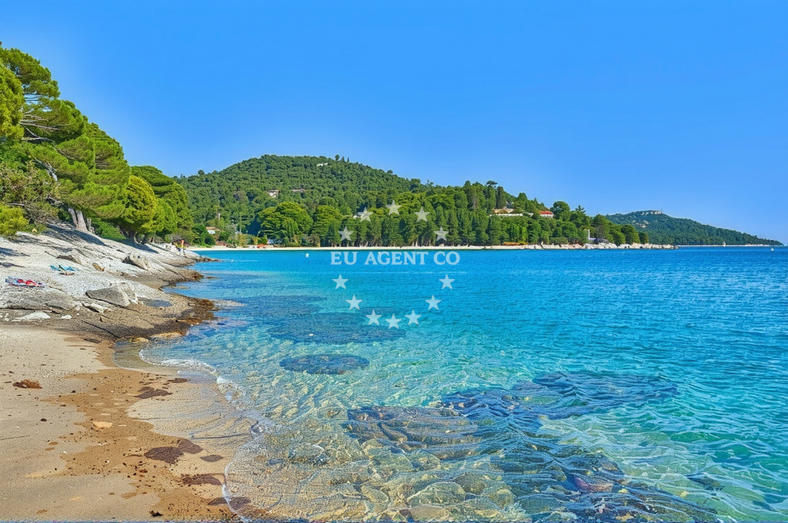
The beach is characterized by its unspoiled, natural setting. The Zadar archipelago, where Skrovada is situated, is known for its dramatic cliffs, pebbled shores, and dense vegetation. While specific details about Skrovada's shoreline are not documented, the general area is marked by rocky outcrops and shallow, turquoise waters typical of the region. The absence of formal facilities means the beach retains its raw, untouched appeal.Swimming and shore
The waters surrounding Skrovada are part of the Adriatic's famed clarity, offering safe swimming conditions for those who venture into the shallows. The shorelines are likely composed of pebbles and small rocks, common to the Zadar archipelago's coastal profile. The area's marine environment supports diverse wildlife, making it a spot for snorkeling or simply observing the interplay of sea and land.Facilities and activities
There are no official amenities or structures at Skrovada, Zverinac (Zverinac) Beach. Visitors should assume the need for self-sufficiency, bringing provisions for food, water, and shade. The beach's isolation means it is not a hub for organized activities, but its proximity to the Zadar archipelago's sailing routes makes it a potential starting point for boat trips to nearby islands or anchorages.Access and location
Skrovada is accessible via boat from nearby ports such as Zadar or the island of Zverinac. The Zadar archipelago is a popular sailing destination, with well-established routes connecting its islands. Visitors arriving by yacht may find the area's natural beauty and relative seclusion appealing, though anchoring and mooring must comply with local regulations.What to expect
Expect a remote, natural coastline with minimal human intervention. The beach's character is defined by the Zadar archipelago's rugged terrain and clear waters. While no formal facilities exist, the area's appeal lies in its tranquility and integration with the surrounding maritime environment. This makes it suitable for visitors seeking solitude or a base for exploring the region's sailing routes.Practical tips
Bring all necessary supplies, as there are no on-site facilities. Check local maritime regulations for anchoring or mooring. The beach's isolation means it is best suited for those with their own boats or who plan to travel by yacht.Exploring the coast by yacht
The Zadar archipelago, where Skrovada is located, is a well-known sailing region within Croatia. Yacht charterers may find the area's proximity to other islands, such as Zverinac and the larger islands of Vis and Hvar, appealing for extended cruising. The region's sheltered bays and open waters provide opportunities for both relaxed sailing and more adventurous routes.Regional Context: The Zadar Archipelago
The Zadar archipelago, comprising over 100 islands, is a mosaic of natural beauty and historical significance. Its islands range from uninhabited rocks to larger settlements with cultural landmarks. Skrovada's position within this network places it near key sailing routes and historical sites, such as the ancient ruins on the island of Velika Plava. The region's waters are protected by the Adriatic's natural currents, making it a favored area for both leisure and professional sailors.Anchorages in the surrounding area
Anchorages in the surrounding area include Zverinac North and locations on Dugi Otok.
- Zverinac North — 0.2 NM from beach
- Anchorage — dugi otok — 0.7 NM from beach
- Anchorage — zverinac — 1.4 NM from beach
- Anchorage — dugi otok — 1.4 NM from beach
- Anchorage — soline — dugi otok — 1.7 NM from beach
- Lučica — soline — dugi otok — 2.0 NM from beach
- Sakarun — soline — dugi otok — 2.2 NM from beach
- Anchorage — dugi otok — 2.2 NM from beach
Distances are straight-line geographic distances, not sailing routes.
Mooring buoys in the surrounding area
- Buoy field Sakarun — soline — dugi otok — 2.2 NM from beach
- Buoy field — verunic — dugi otok — 2.2 NM from beach
- Jetty — verunic — dugi otok — 2.3 NM from beach
- Jetty — verunic — dugi otok — 2.4 NM from beach
- Slatine cove — dugi otok — 2.9 NM from beach
Distances are straight-line geographic distances, not sailing routes.
Marine fuel stations
Marine fuel stations are located in Preko, Zadar, Zaglav, and Sukosan in the region.
- Ina — preko — ugljan — 13.6 NM from beach
- Ina — zadar — 14.3 NM from beach
- Ina — zaglav — dugi otok — 16.5 NM from beach
- Fuel station — sukosan — 18.3 NM from beach
Distances are straight-line geographic distances, not sailing routes.
Harbours in the surrounding area
Harbours in the surrounding area include Zverinac, Božava, and Veli Rat on Dugi Otok.
- Zverinac — 0.6 NM from beach
- Božava — bozava — dugi otok — 1.4 NM from beach
- Veli Rat — dugi otok — 2.5 NM from beach
- Harbour Marina Molat — 3.2 NM from beach
- Hrvatin — sestrunj — 4.0 NM from beach
- Brgulje — molat — 4.6 NM from beach
Distances are straight-line geographic distances, not sailing routes.
Marinas in the surrounding area
- Marina Veli Rat — dugi otok — 2.6 NM from beach
- Marina Veli Iž — iz veli — 11.2 NM from beach
- Olive Island Marina — sutomiscica — ugljan — 12.3 NM from beach
- Marina Preko — ugljan — 13.3 NM from beach
- Marina Borik — zadar — 13.4 NM from beach
Distances are straight-line geographic distances, not sailing routes.
Restaurants near the beach
Restaurants near the beach include Ristorante Zverinac and dining options in Bozava and Soline on Dugi Otok.
- Ristorante Zverinac — 0.6 NM from beach
- Gostionica Oleander — bozava — dugi otok — 1.4 NM from beach
- Restaurant — bozava — dugi otok — 1.4 NM from beach
- Veli Kamik — bozava — dugi otok — 1.4 NM from beach
- Boxavia — bozava — dugi otok — 1.4 NM from beach
- Restaurant Konoba Kadulja — bozava — dugi otok — 1.5 NM from beach
- Amarcord — soline — dugi otok — 2.3 NM from beach
Distances are straight-line geographic distances, not sailing routes.
Navigation guides for the surrounding area
Navigation guides for the surrounding area cover Zverinac, Božava, and Luka Soliscica.
- Zverinac — 0.7 NM from beach
- Božava — 1.4 NM from beach
- Luka Soliscica — 1.6 NM from beach
- Dugi Otok -Bozava — 1.6 NM from beach
- Uvala Lucina (Molat) Fl.R.3s6m4M — 3.6 NM from beach
Distances are straight-line geographic distances, not sailing routes.
Yachts from nearby departure bases
Yachts depart from bases in Brbinj Marina, Ugljan Sutomišćica, and Zadar Marina Borik.
Sailing yachts
- Elan Impression 40 (Val) — Ugljan Sutomišćica Olive Island — 12.3 NM from departure base to beach
- Dufour 560 (Anatoli) — Zadar Marina Borik — 13.4 NM from departure base to beach
Catamarans
- Leopard 50 (Solaia) — Zadar Marina Borik — 13.4 NM from departure base to beach
Motor yachts
- Prestige 460 (Adudu 2) — Zadar Marina Borik — 13.4 NM from departure base to beach
Motor boats
- Adria 28 Luxus (Ana) — Brbinj Marina — 6.2 NM from departure base to beach
- Quicksilver Activ 905 (Galeb) — Ugljan Sutomišćica Olive — 12.3 NM from departure base to beach
- Rancraft RM21 (Dugi otok) — Zadar Diklo Port — 13.0 NM from departure base to beach
- Rancraft RS Cinque.5 — Zadar Diklo Port — 13.0 NM from departure base to beach
- Rancraft RM19 (Daycruiser) — Zadar Diklo Port — 13.0 NM from departure base to beach
- Merry Fisher 795 (Jura 3212ZD) — Zadar Marina Borik — 13.4 NM from departure base to beach
Distances are straight-line geographic distances, not sailing routes.