Škarić jug, Kolan (Pag) Beach, Croatia
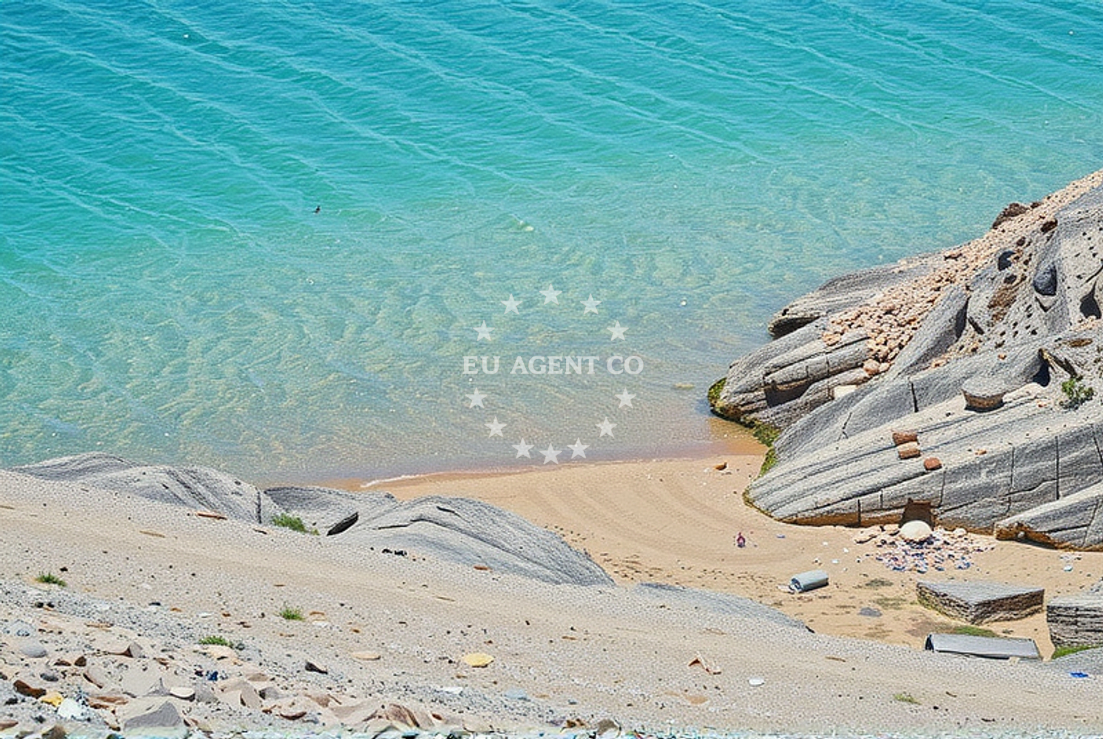
About this beach
Škarić jug, Kolan (Pag)
Beach: Škarić jug
Location: Kolan (Pag)
Characteristics and facilities
Sand
10 m
Beach character
The beach consists of fine sand, typical of Pag's coastal profile, which is shaped by the Adriatic's winds and waves. Its 10-meter depth suggests a gradual slope into the water, making it potentially suitable for swimmers seeking a balance between shallow and deeper zones. The shoreline's orientation on the island's southern tip means it faces the open sea, offering views of the horizon and the opportunity to observe maritime activity in the distance. Pag's geology, characterized by limestone and salt flats, influences the beach's composition and the surrounding landscape's stark beauty.Swimming and shore
With a depth of 10 meters, the beach provides a transition from shallow to deeper waters, which may appeal to swimmers looking for a gradual entry into the sea. The absence of detailed water quality reports means conditions should be assessed on-site, though Pag's coastal waters are generally clear due to the island's low population density and minimal industrial activity. The shore's sand is likely firm and stable, though the exact texture is not specified in available records.Facilities and activities
No specific facilities are documented for Škarić jug, Kolan (Pag) Beach. Visitors should assume standard beach amenities may not be present unless confirmed locally. The beach's natural setting suggests it is unspoiled by commercial infrastructure, aligning with Pag's reputation as a relatively untouched destination. Activities associated with the beach are not explicitly listed, but the island's broader appeal includes hiking through its salt pans, cycling along coastal roads, and exploring traditional stone houses in nearby villages.Access and location
Škarić jug, Kolan (Pag) Beach is located on Pag, an island accessible by ferry from Zadar or by car via the mainland's coastal road. The beach's position on the island's southern coast places it near the village of Kolan, which is part of Pag's network of small settlements. Travelers arriving by yacht may find anchorage options in nearby bays, though specific marina or mooring details are not provided in the beach's catalog. The Adriatic's maritime routes make Pag a logical stop for sailors exploring Croatia's eastern coast.What to expect
Visitors to Škarić jug, Kolan (Pag) Beach should anticipate a natural, minimally developed shoreline with a sandy beach and 10-meter depth. The area's appeal lies in its integration with Pag's broader landscape, which includes salt flats, olive groves, and historic architecture. While no facilities are explicitly listed, the beach's location on Pag—a destination known for its tranquility and scenic drives—suggests a setting focused on immersion in the island's environment. The absence of detailed activity listings means visitors should plan for self-directed exploration, whether through hiking, photography, or simply enjoying the coastal vistas.Practical tips
Given Pag's limited infrastructure, visitors are advised to bring essentials such as sunscreen, water, and a picnic if planning an extended stay. Parking details are not specified in the beach's catalog, so local inquiries may be necessary. The beach's orientation on the island's southern coast means it may be exposed to stronger winds, particularly in the afternoon. Those arriving by yacht should consult Euro-Agent's anchorage maps for nearby mooring options.Exploring the coast by yacht
For yacht charter guests, Pag's coastline offers a mix of sheltered bays and open sea vistas. Škarić jug's location on the island's southern tip places it within reach of sailing routes connecting Zadar, the mainland, and other Dalmatian islands. Euro-Agent's yacht search platform can help identify vessels available for exploring Pag's waters, from motor yachts suited for day trips to sailboats ideal for longer cruises. The island's proximity to the Adriatic's main shipping lanes also makes it a strategic point for sailors navigating Croatia's eastern coast.Pag's Cultural and Natural Significance
Pag is one of Croatia's oldest inhabited islands, with a history dating back to prehistoric times. Its economy has long relied on salt production, a tradition still visible in the island's salt pans. The island's landscape, shaped by millennia of erosion, features dramatic cliffs, caves, and limestone plateaus. Škarić jug's beach, like many on Pag, benefits from the island's isolation, which has preserved its natural state and limited modern development.Anchorages in the surrounding area
Anchorages in Mandre and Novalja on Pag offer nearby options for mooring.
- Anchorage — mandre — pag — 1.6 NM from beach
- Anchorage — novalja — pag — 1.7 NM from beach
- Anchorage — mandre — pag — 1.9 NM from beach
- Anchorage — mandre — pag — 2.2 NM from beach
- Straško — novalja — pag — 3.1 NM from beach
- Anchorage — cesarica — 3.7 NM from beach
- Anchorage — stara novalja — pag — 3.9 NM from beach
- Anchorage — cesarica — 4.0 NM from beach
Distances are straight-line geographic distances, not sailing routes.
Mooring buoys in the surrounding area
- Jetty — zubovici — pag — 1.4 NM from beach
- Jetty — zubovici — pag — 1.6 NM from beach
- Buoy field — novalja — pag — 3.7 NM from beach
- Jetty — simuni — pag — 3.9 NM from beach
- Drljanda — stara novalja — pag — 5.7 NM from beach
Distances are straight-line geographic distances, not sailing routes.
Marine fuel stations
- Ina — rab — 16.1 NM from beach
- Ina — mali losinj — 20.6 NM from beach
- Adria Oil — mali losinj — 21.0 NM from beach
- Tifon — nerezine — losinj — 25.1 NM from beach
Distances are straight-line geographic distances, not sailing routes.
Harbours in the surrounding area
Harbors in Žigljen and Novalja on Pag are situated close to the beach area.
- Žigljen — zigljen — pag — 3.4 NM from beach
- Novalja — pag — 3.5 NM from beach
- Prizna — 4.8 NM from beach
- Stara Novalja — pag — 5.3 NM from beach
- Karlobag — 5.4 NM from beach
- Pag — 6.5 NM from beach
Distances are straight-line geographic distances, not sailing routes.
Marinas in the surrounding area
ACI Marina Šimuni in Simuni on Pag is a nearby marina for yacht berthing.
- ACI Marina Šimuni — simuni — pag — 3.2 NM from beach
- ACI Marina Rab — 16.0 NM from beach
- ACI Marina Supetarska Draga — rab — 19.2 NM from beach
- Y/C Marina Mali Lošinj — mali losinj — 20.7 NM from beach
- Marina Lošinj — mali losinj — 21.0 NM from beach
Distances are straight-line geographic distances, not sailing routes.
Restaurants near the beach
Restaurants in Novalja on Pag are located within a short distance of the beach.
- Margarita — novalja — pag — 2.9 NM from beach
- Restaurant — novalja — pag — 2.9 NM from beach
- Konoba Grill Matulo — novalja — pag — 3.0 NM from beach
- Restaurant — novalja — pag — 3.1 NM from beach
- Konoba Reful — novalja — pag — 3.1 NM from beach
- Restaurant — novalja — pag — 3.1 NM from beach
- La Tortilla — novalja — pag — 3.1 NM from beach
Distances are straight-line geographic distances, not sailing routes.
Navigation guides for the surrounding area
Navigation guides for Caska and Novalja on Pag assist with local route planning.
- Caska — 1.6 NM from beach
- Novalja — 3.1 NM from beach
- Uvala Prizna — 4.8 NM from beach
- Uvala Bliznica — 8.8 NM from beach
- Uvala Jakisnica — 10.0 NM from beach
Distances are straight-line geographic distances, not sailing routes.
Yachts from nearby departure bases
Sailing yachts
- First 45 (Egeria) — Šimuni Kolan ACI Marina — 3.1 NM from departure base to beach
- Elan 344 Impression (Helios) — Mali Lošinj — 20.8 NM from departure base to beach
- Dufour 360 Grand (Vanila) — Mali Lošinj — 20.8 NM from departure base to beach
Motor yachts
- Absolute 50 Fly (Acrobat) — Rab ACI Marina — 16.0 NM from departure base to beach
Motor boats
- Balt 818 Titanium (Valentina 2) — Novalja — 3.4 NM from departure base to beach
- Balt 818 Titanium (Valentina) — Novalja — 3.4 NM from departure base to beach
- BWA Sport 22GT (BWA ) — Pag City Port — 6.6 NM from departure base to beach
- Merry Fisher 895 — Povljana Marina — 12.6 NM from departure base to beach
- Galeon Galia 630 (Kali) — Mali Lošinj — 20.8 NM from departure base to beach
- Antares 36 (Joia) — Mali Lošinj — 20.8 NM from departure base to beach
Distances are straight-line geographic distances, not sailing routes.