Šibenik, Novigrad (Zadarska županija) Beach, Croatia
About this beach
Šibenik, Novigrad (Zadarska županija)
Beach: Šibenik
Location: Novigrad (Zadarska županija)
Characteristics and facilities
Gravel, concrete / stone slabs, rocks
50 m
Natural shade
Beach character
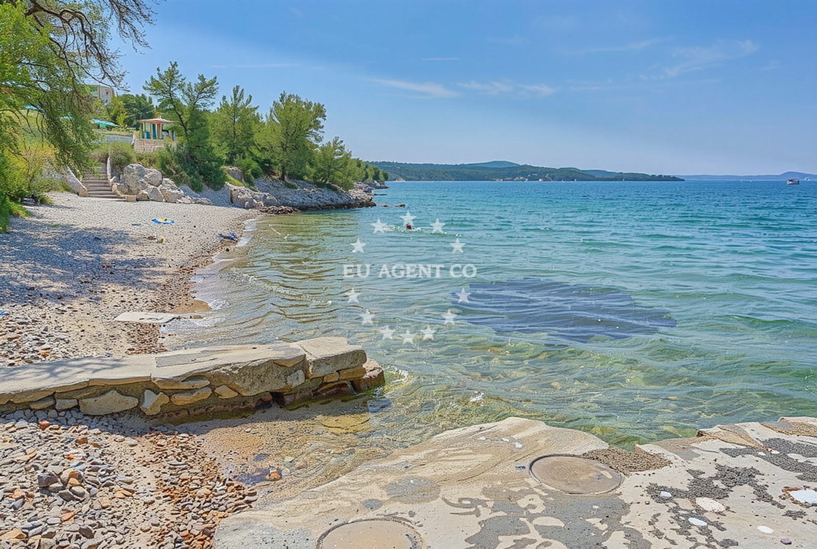
The beach’s surface is predominantly composed of gravel, concrete slabs, and exposed rock, creating a terrain that is more suited to casual walks than sunbathing. The 50-meter length of the shore is flanked by natural shade, likely provided by overhanging cliffs or vegetation. This configuration suggests the beach is part of a coastal area with minimal artificial development, preserving its raw, unaltered character. The lack of structured amenities or facilities indicates it is not a destination for large-scale tourism, but rather a spot for those seeking a quiet, undeveloped shoreline.Swimming and shore
Swimming conditions here are influenced by the rocky and gravelly seabed, which may make entry into the water challenging. The shore’s uneven surface could pose difficulties for those unaccustomed to such terrain. The absence of explicit information about water depth or current patterns means visitors should approach with caution, particularly if unfamiliar with the area. The natural shade along the shore provides limited relief from direct sunlight, though it is not sufficient to classify the beach as family-friendly or suitable for extended sun exposure.Facilities and activities
No formal facilities are listed for this beach, including restrooms, showers, or parking. The gravel and rock composition suggest there are no designated picnic areas or seating. Activities associated with the beach are not explicitly mentioned in the catalog, though the surrounding region of Šibenik offers opportunities for hiking, historical exploration, and boat excursions. The beach itself appears to be more of a passive observation point than an active recreational site.Access and location
Access to the beach is likely via local roads leading to Novigrad in Zadarska županija. The town of Šibenik, located approximately 15 kilometers to the northeast, serves as a nearby hub for transportation, dining, and cultural attractions. The beach’s coordinates (44.184641, 15.539158) place it in a region known for its rugged coastline and maritime history. Visitors may need to navigate unpaved paths or use local knowledge to reach the shore, given the absence of detailed access information in the catalog.What to expect
Expect a beach that prioritizes natural landscapes over modern comforts. The gravel and rocky terrain make it unsuitable for sunbathing or lounging, but ideal for those seeking a secluded, undeveloped shoreline. The 50-meter length and natural shade provide limited space for casual exploration. The area’s proximity to Šibenik means visitors can combine a visit to the beach with trips to nearby historical sites, such as the Šibenik Cathedral or Krka National Park. No amenities are available on-site, so self-sufficiency is required.Practical tips
Wear sturdy footwear to navigate the gravel and rocky terrain. Bring water and snacks, as there are no on-site facilities. Arrive early to secure a spot on the shore, which may be less crowded than more developed beaches in the region. Be mindful of the uneven surface when entering or exiting the water.Exploring the coast by yacht
For yacht charter guests, the Šibenik area offers a gateway to the Adriatic’s diverse sailing routes. The nearby town of Šibenik is a common starting point for charters exploring the islands of Šolta, Vis, and Hvar. While this specific beach lacks marina infrastructure, the broader region is dotted with harbors and anchorages suitable for motor yachts and sailboats. Charterers may consider the surrounding coastline as part of a larger itinerary that includes historical ports, scenic anchorages, and access to the Krka River’s inland waterways.Regional Context and Coastal Features
The Šibenik coastline is characterized by its dramatic cliffs, limestone formations, and a mix of rocky and sandy beaches. The area is part of the Adriatic’s ‘Emerald Coast,’ renowned for its clear waters and maritime heritage. Nearby, the Krka River flows into the sea, creating a unique ecosystem that supports both terrestrial and marine life. The region’s sailing appeal lies in its combination of sheltered bays, open sea routes, and proximity to cultural landmarks.Historical and Cultural Proximity
Šibenik itself is a UNESCO-protected town with a rich medieval history. Its historic center, including the Šibenik Cathedral, is a short drive from the beach. The town’s position on the Adriatic has made it a strategic point for trade and maritime activity for centuries. Visitors to the beach may find it rewarding to explore Šibenik’s old town, museums, and waterfront promenades as part of a broader coastal experience.Anchorages in the surrounding area
- Anchorage — maslenica — 2.0 NM from beach
- Anchorage — novigrad — 2.8 NM from beach
- Anchorage — karin — 4.6 NM from beach
- Karin dock — 4.8 NM from beach
- Anchorage — vinjerac — 5.5 NM from beach
- Anchorage — ljubac — 11.2 NM from beach
- Anchorage — ljubac — 11.3 NM from beach
- Anchorage — rtina — 12.0 NM from beach
Distances are straight-line geographic distances, not sailing routes.
Mooring buoys in the surrounding area
Mooring buoys at Ljubac and Sukosan are located in proximity to Šibenik, Novigrad (Zadarska županija) Beach.
- Jetty — ljubac — 11.5 NM from beach
- Šibuljina Point — sibuljina point — 12.5 NM from beach
- Buoy field — sukosan — 12.9 NM from beach
- Buoy field — sukosan — 13.0 NM from beach
- Jetty — zadar — 14.2 NM from beach
Distances are straight-line geographic distances, not sailing routes.
Marine fuel stations
Marine fuel stations in Sukosan and Zadar are situated near Šibenik, Novigrad (Zadarska županija) Beach.
- Fuel station — sukosan — 13.1 NM from beach
- Ina — zadar — 14.0 NM from beach
- Ina — biograd na moru — 15.4 NM from beach
- Ina — preko — ugljan — 16.2 NM from beach
Distances are straight-line geographic distances, not sailing routes.
Harbours in the surrounding area
Harbors in Maslenica and Vinjerac are located close to Šibenik, Novigrad (Zadarska županija) Beach.
- Maslenica — 2.1 NM from beach
- Vinjerac — 5.5 NM from beach
- Seline — 6.2 NM from beach
- Obrovac — 6.3 NM from beach
- Starigrad Paklenica — 7.9 NM from beach
- Ražanac — razanac — 10.2 NM from beach
Distances are straight-line geographic distances, not sailing routes.
Marinas in the surrounding area
- Marina Dalmacija — sukosan — 12.9 NM from beach
- Marina Zadar — 14.0 NM from beach
- Dry dock marina Biograd — biograd na moru — 14.2 NM from beach
- Vitrenjak Zadar — 14.3 NM from beach
- Molum Marine Club — sveti filip i jakov — 14.4 NM from beach
Distances are straight-line geographic distances, not sailing routes.
Navigation guides for the surrounding area
Navigation guides for Posedarje and Starigrad-Paklenica are relevant to Šibenik, Novigrad (Zadarska županija) Beach.
- Posedarje (Novigradsko More) — 2.9 NM from beach
- Starigrad-Paklenica {Velebitski Kanai) — 7.7 NM from beach
- VELESITSKI KANAL (S) — 11.0 NM from beach
- KrusCica and Uvala KrusCica Duboka — 13.6 NM from beach
- Turanj — 14.3 NM from beach
Distances are straight-line geographic distances, not sailing routes.
Yachts from nearby departure bases
Yachts departing from Novigrad Dalmatia and Sukošan Brodogradilište Filipi are based near Šibenik, Novigrad (Zadarska županija) Beach.
Sailing yachts
- Bavaria Cruiser 46 (Zaklopatica) — Sukošan Marina Dalmacija — 12.9 NM from departure base to beach
Catamarans
- Lagoon 50 (RAGNAR) — Sukošan Marina Dalmacija — 12.9 NM from departure base to beach
Motor yachts
- Focus Power 44 (SONUS) — Sukošan Marina Dalmacija — 12.9 NM from departure base to beach
Motor boats
- Merry Fisher 795 () — Novigrad Dalmatia — 0.4 NM from departure base to beach
- Merry Fisher 695 — Sukošan Brodogradilište Filipi — 12.8 NM from departure base to beach
- Zar 57 WD — Sukošan Brodogradilište Filipi — 12.8 NM from departure base to beach
- Zar 61 Suite (Tucepi) — Sukošan Brodogradilište Filipi — 12.8 NM from departure base to beach
- Zar 65 Suite — Sukošan Brodogradilište Filipi — 12.8 NM from departure base to beach
- Elan 650 (Biokovo) — Sukošan Brodogradilište Filipi — 12.8 NM from departure base to beach
- Quicksilver Activ 555 — Sukošan Brodogradilište Filipi — 12.8 NM from departure base to beach
Distances are straight-line geographic distances, not sailing routes.