Seline centar, Seline Beach, Croatia
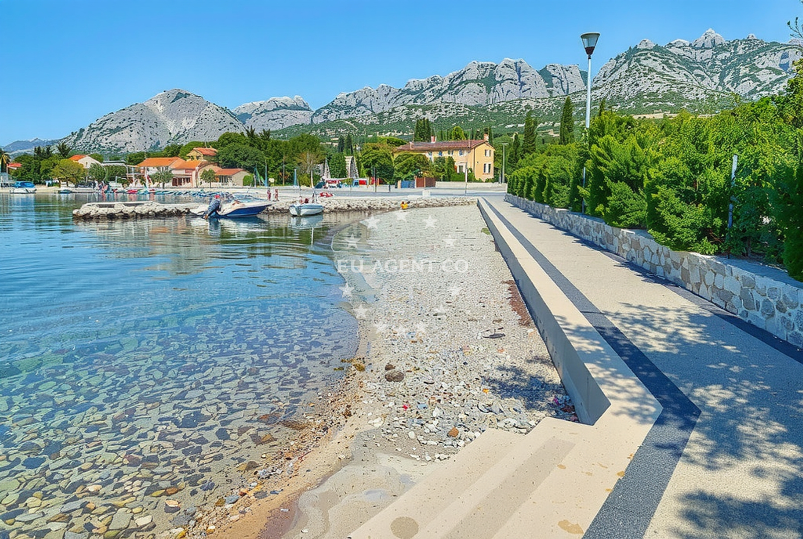
About this beach
Seline centar, Seline
Beach: Seline centar
Location: Seline
Characteristics and facilities
Gravel, concrete / stone slabs
220 m
Beach character
The beach's surface consists of gravel and concrete/stone slabs, which may influence footwear choices for visitors. At 220 meters in length, it provides a modest shoreline for those seeking direct access to the sea. The absence of structured amenities in official records suggests a more natural, unembellished coastal experience. The beach's orientation and surrounding topography would determine its exposure to waves and wind, though specific details about water conditions are not documented in available sources.Swimming and shore
Swimming conditions at Seline centar, Seline Beach are not explicitly detailed in official records. The gravel and stone slab composition of the shore may create uneven footing for swimmers entering or exiting the water. As with many Adriatic beaches, water clarity and temperature would depend on seasonal variations and regional oceanographic patterns, though no specific data is available for this location.Facilities and activities
Official records do not list structured facilities or activities associated with Seline centar, Seline Beach. The beach appears to maintain a natural character without designated amenities such as showers, restrooms, or lifeguard services. Any recreational use would likely be informal, with visitors relying on nearby settlements for services.Access and location
Seline centar, Seline Beach is situated within the village of Seline, a coastal settlement on the island of Brač in Croatia. The beach's coordinates (44.276222° N, 15.476618° E) place it in proximity to the broader Brač coast, which is known for its limestone cliffs and sailing routes. Visitors arriving by land would find the beach accessible via local roads connecting to Seline's main settlement. The Adriatic Sea's influence here creates opportunities for coastal exploration and yacht-based travel in the region.What to expect
Visitors to Seline centar, Seline Beach should expect a shoreline composed of gravel and concrete/stone slabs, extending 220 meters along the coast. The beach does not have formally documented facilities, so visitors may need to rely on nearby settlements for services. The area's natural character suggests a focus on unstructured coastal use, with potential for scenic views of the Adriatic Sea and surrounding landscape.Practical tips
Given the gravel and stone slab surface, visitors may wish to wear sturdy footwear for comfort. The beach's proximity to Seline village means nearby services and accommodations are available for those seeking extended stays or additional amenities.Exploring the coast by yacht
For yacht charter guests, the Seline area offers access to the Brač coast, a region known for its sailing routes and scenic anchorages. The Adriatic Sea's calm waters and limestone coastline make this part of Croatia a popular destination for motor yachts and sailing boats. Nearby marinas and harbors may provide docking options for those exploring the region by sea.Regional Context
The village of Seline on Brač is part of the Split-Dalmatia County, a region with a rich maritime history. The area's coastal geography includes a mix of pebble beaches, cliffs, and bays, reflecting the Adriatic's diverse shoreline. Yacht charter guests may find opportunities to explore nearby islands such as Hvar and Šolta, which are accessible via short sailing trips from the Brač coast.Anchorages in the surrounding area
- Anchorage — vinjerac — 1.3 NM from beach
- Anchorage — maslenica — 5.8 NM from beach
- Anchorage — rtina — 7.7 NM from beach
- Anchorage — novigrad — 7.8 NM from beach
- Anchorage — rtina — 7.8 NM from beach
- Anchorage — ljubac — 7.9 NM from beach
- Anchorage — ljubac — 7.9 NM from beach
- Anchorage — tribanj — 9.5 NM from beach
Distances are straight-line geographic distances, not sailing routes.
Mooring buoys in the surrounding area
- Šibuljina Point — sibuljina point — 6.9 NM from beach
- Jetty — ljubac — 8.0 NM from beach
- Jetty — zadar — 14.2 NM from beach
- Jetty — zadar — 14.2 NM from beach
Distances are straight-line geographic distances, not sailing routes.
Marine fuel stations
- Ina — zadar — 14.3 NM from beach
- Fuel station — sukosan — 15.5 NM from beach
- Ina — preko — ugljan — 17.1 NM from beach
- Ina — biograd na moru — 20.3 NM from beach
Distances are straight-line geographic distances, not sailing routes.
Harbours in the surrounding area
Harbours in the surrounding area include Seline, Vinjerac, and Starigrad Paklenica, positioned at short to moderate distances from Seline centar.
- Seline — 0.1 NM from beach
- Vinjerac — 1.3 NM from beach
- Starigrad Paklenica — 2.0 NM from beach
- Maslenica — 4.3 NM from beach
- Ražanac — razanac — 5.6 NM from beach
- Obrovac — 9.9 NM from beach
Distances are straight-line geographic distances, not sailing routes.
Marinas in the surrounding area
- Marina Zadar — 14.3 NM from beach
- Vitrenjak Zadar — 14.3 NM from beach
- Marina Borik — zadar — 14.5 NM from beach
- Marina Dalmacija — sukosan — 15.4 NM from beach
- Olive Island Marina — sutomiscica — ugljan — 17.0 NM from beach
Distances are straight-line geographic distances, not sailing routes.
Restaurants near the beach
Restaurants near the beach include Restaurant Seline, Gostionica Ivan, and Buffet Paklenica, situated at close proximity to Seline centar.
- Restaurant — seline — 0.0 NM from beach
- Gostionica Ivan — seline — 0.2 NM from beach
- Buffet Paklenica — starigrad paklenica — 1.2 NM from beach
- Restaurant — starigrad paklenica — 1.4 NM from beach
Distances are straight-line geographic distances, not sailing routes.
Navigation guides for the surrounding area
- Starigrad-Paklenica {Velebitski Kanai) — 1.8 NM from beach
- Posedarje (Novigradsko More) — 4.1 NM from beach
- VELESITSKI KANAL (S) — 5.5 NM from beach
- KrusCica and Uvala KrusCica Duboka — 7.9 NM from beach
Distances are straight-line geographic distances, not sailing routes.
Yachts from nearby departure bases
Sailing yachts
- Bavaria 37 Cruiser (Rita) — Zadar Marina — 14.3 NM from departure base to beach
- Bavaria Cruiser 37 (Maia) — Zadar Marina — 14.3 NM from departure base to beach
Catamarans
- Delta F40-XT (Veronchie) — Zadar Marina — 14.3 NM from departure base to beach
- Bali 4.6 (Jako 2) — Zadar Marina — 14.3 NM from departure base to beach
Motor boats
- Merry Fisher 795 () — Novigrad Dalmatia — 6.4 NM from departure base to beach
- Rancraft RM19 (Daycruiser) — Zadar Diklo Port — 13.9 NM from departure base to beach
- Rancraft RS Cinque.5 — Zadar Diklo Port — 13.9 NM from departure base to beach
- Rancraft RM21 (Dugi otok) — Zadar Diklo Port — 13.9 NM from departure base to beach
- Tempest 600 (CAPELLI) — Zadar Marina — 14.3 NM from departure base to beach
- Adriana 44 (Tina II) — Zadar Marina — 14.3 NM from departure base to beach
Distances are straight-line geographic distances, not sailing routes.