Santarel, Lovrečica Beach, Croatia
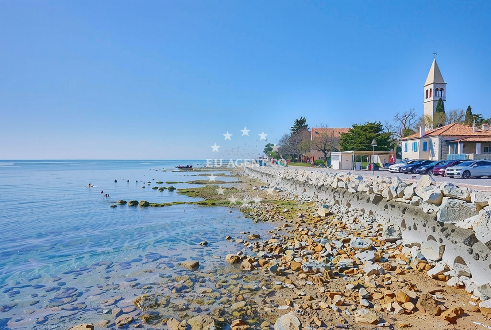
Santarel, Lovrečica Beach lies along the rugged coastline of Croatia's Adriatic region, offering a unique blend of natural terrain and basic amenities. This gravel-and-rock shoreline stretches for approximately 350 meters, creating a landscape that is more suited to leisurely walks than swimming. The beach is served by a nearby restaurant and a caffe bar, providing visitors with opportunities to enjoy meals and refreshments while taking in the coastal views.
About this beach
Santarel, Lovrečica
Beach: Santarel
Location: Lovrečica
Characteristics and facilities
Gravel, rocks
350 m
Restaurant / snack bar
Caffe bar / Drinks stand
Beach character
The beach's defining feature is its gravel and rocky composition, which contrasts with the sandy shores typical of many Mediterranean beaches. This terrain creates a rugged, uneven surface that may pose challenges for barefoot walking but offers a distinctive setting for those seeking a more natural coastal experience. The lack of fine sand means this is not a beach for sunbathing, but rather a place to explore the shoreline's textures and enjoy the surrounding vistas.
Swimming and shore
Due to the gravel and rock composition, Santarel, Lovrečica Beach is not ideal for swimming. The shoreline is characterized by uneven surfaces and limited access to the water, making it more suitable for visitors interested in coastal walks and photography. The rocky terrain creates natural formations that can be explored along the shore, though caution is advised when navigating the beach's uneven surfaces.
Facilities and activities
The beach is equipped with a restaurant and a caffe bar, both located within a short distance from the shoreline. These facilities offer basic dining options and beverages, making it convenient for visitors to enjoy meals while taking in the coastal scenery. No structured recreational activities are listed for the beach, though the natural terrain provides opportunities for informal exploration and photography.
Access and location
Located in the coastal town of Santarel, Lovrečica Beach is positioned along Croatia's Adriatic coastline. The exact coordinates (45.382556°N, 13.536548°E) place it in a region known for its scenic beauty and maritime traditions. While specific transportation details are not provided in the catalog, the beach's proximity to Santarel suggests it is accessible via local roads and pathways typical of coastal settlements in this part of Croatia.
What to expect
Visitors to Santarel, Lovrečica Beach should expect a rugged shoreline composed of gravel and rocks, with limited opportunities for swimming. The beach is served by a restaurant and caffe bar, offering basic dining options. The area is best suited for those seeking a tranquil coastal experience with minimal amenities, rather than a full-featured beach destination. The natural terrain provides a unique setting for walking and photography, though visitors should be prepared for uneven surfaces.
Practical tips
Given the beach's gravel and rocky composition, visitors are advised to wear sturdy footwear for walking along the shoreline. The on-site restaurant and caffe bar may have limited hours, so it is recommended to confirm availability in advance. The beach's lack of fine sand means it is not suitable for sunbathing, but the natural landscape offers opportunities for scenic walks and photography.
Exploring the coast by yacht
The Adriatic coastline near Santarel is a popular region for yacht charter activities, with several marinas and anchorages within reach. While Lovrečica Beach itself is not a designated anchorage, the surrounding area offers sailing opportunities for those exploring the Croatian coast. Euro-Agent's yacht charter services can help visitors arrange trips to this region, allowing them to experience the same coastal scenery from the water.
Regional Context
The area around Santarel is part of Croatia's Dalmatian coast, a region renowned for its dramatic cliffs, clear waters, and historic towns. This stretch of coastline is a common route for yacht charters, with many sailing itineraries passing through nearby ports and bays. The rugged terrain of Lovrečica Beach reflects the natural diversity of this region, which combines rocky shores with more sheltered coves and sandy beaches.
Anchorages in the surrounding area
- Anchorage — lovrecica — 0.4 NM from beach
- Anchorage — lovrecica — 0.5 NM from beach
- Anchorage — krizine — 1.1 NM from beach
- Anchorage — dalja — 1.6 NM from beach
- Anchorage — novigrad istarski — 4.9 NM from beach
- Anchorage — novigrad istarski — 5.3 NM from beach
- Anchorage — kanegra — 6.3 NM from beach
- Anchorage — cervar porat — 6.7 NM from beach
Distances are straight-line geographic distances, not sailing routes.
Mooring buoys in the surrounding area
- Jetty — lovrecica — 0.1 NM from beach
- Jetty — dalja — 1.5 NM from beach
- Buoy field — dalja — 1.6 NM from beach
- Buoy field — umag — 3.4 NM from beach
- Buoy field — novigrad istarski — 3.7 NM from beach
Distances are straight-line geographic distances, not sailing routes.
Marine fuel stations
- Ina — umag — 3.5 NM from beach
- Crodux — novigrad istarski — 4.0 NM from beach
- Ina — porec — 9.8 NM from beach
- Fuel station — porec — 9.8 NM from beach
Distances are straight-line geographic distances, not sailing routes.
Harbours in the surrounding area
- Umag — 3.2 NM from beach
- Novigrad — novigrad istarski — 3.8 NM from beach
- Stella Maris — umag — 4.3 NM from beach
- Mirna — novigrad istarski — 5.1 NM from beach
- Stara Savudrija — 7.2 NM from beach
- Harbour Poreč — harbour porec — 9.6 NM from beach
Distances are straight-line geographic distances, not sailing routes.
Marinas in the surrounding area
- ACI marina Umag — 3.5 NM from beach
- Marina Nautica — novigrad istarski — 3.9 NM from beach
- Marina Červar Porat — marina cervar porat — 6.9 NM from beach
- Marina Poreč — marina porec — 9.8 NM from beach
- Marina Parentium — porec — 10.9 NM from beach
Distances are straight-line geographic distances, not sailing routes.
Restaurants near the beach
- Konoba Nono — umag — 2.7 NM from beach
- Amfora — umag — 3.2 NM from beach
- Restaurant Punta — umag — 3.5 NM from beach
- Lido — umag — 3.5 NM from beach
- Navigare — novigrad istarski — 3.9 NM from beach
- Sidro — novigrad istarski — 4.1 NM from beach
- Čok — cok — novigrad istarski — 4.1 NM from beach
Distances are straight-line geographic distances, not sailing routes.
Navigation guides for the surrounding area
- Umag — 3.4 NM from beach
- Novi grad — 3.9 NM from beach
- Luka Crvar and Marina Crvar-Porat — 6.6 NM from beach
- Pi ran — 8.7 NM from beach
- Poree — 9.7 NM from beach
Distances are straight-line geographic distances, not sailing routes.
Yachts from nearby departure bases
Sailing yachts
- Gib Sea 43 (Leonardo) — Poreč Marina Funtana — 12.6 NM from departure base to beach
- Bavaria 49 (Tortola) — Poreč Marina Funtana — 12.6 NM from departure base to beach
- Bavaria 40 Cruiser (Franzi) — Poreč Marina Funtana — 12.6 NM from departure base to beach
- Bavaria 46 Cruiser (Hansi) — Poreč Marina Funtana — 12.6 NM from departure base to beach
- Bavaria 35 Cruiser (Salsa) — Poreč Marina Funtana — 12.6 NM from departure base to beach
Catamarans
- Lagoon Power 44 (Monteki) — Poreč Marina Funtana — 12.6 NM from departure base to beach
Motor boats
- AC DC Daycruiser 12.0 — Marina Novigrad — 3.9 NM from departure base to beach
- Prestige 46 Fly (Anima Maris) — Marina Novigrad — 3.9 NM from departure base to beach
- Maiora 20 (Sea Heaven) — Marina Novigrad — 3.9 NM from departure base to beach
- Maiora 20 (Sea Heaven) — Marina Novigrad — 3.9 NM from departure base to beach
Distances are straight-line geographic distances, not sailing routes.