Rtina, Vir (Vir) Beach, Croatia
About this beach
Rtina, Vir (Vir)
Beach: Rtina
Location: Vir (Vir)
Characteristics and facilities
Gravel, concrete / stone slabs
70 m
Beach character
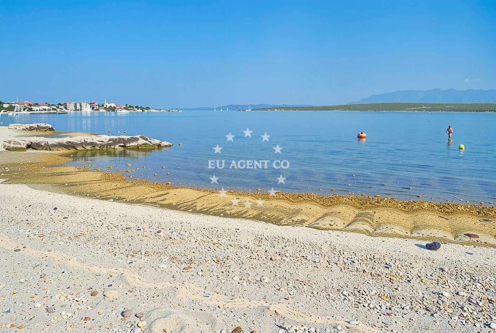
The beach consists of gravel and concrete/stone slabs, creating a distinct terrain that differs from typical sandy shores. Its modest length of 70 meters makes it a compact stretch of coastline. The lack of detailed natural features in the catalog suggests a straightforward, unembellished shoreline without significant rock formations or vegetation along the beachfront.Swimming and shore
Swimming conditions at Rtina, Vir (Vir) Beach are not explicitly documented in the catalog. The gravel and stone composition may affect water access, potentially making it less ideal for swimming compared to sandy beaches. The shore itself appears to be a simple, unadorned stretch of land, with no mention of tidal patterns, underwater topography, or safety markers for swimmers.Facilities and activities
No specific facilities or activities are listed in the catalog for this beach. The absence of structured amenities suggests a minimalistic approach to the site, with no reported services such as showers, restrooms, or seating. Activities associated with the beach are not detailed, though its location on the island of Vir may offer opportunities for coastal walks or boat access.Access and location
Rtina, Vir (Vir) Beach is situated on the island of Vir, which lies close to the Croatian mainland. The island is part of the broader Adriatic coastline, known for its scattered islets and maritime routes. While the exact access routes are not specified in the catalog, Vir's proximity to the mainland suggests potential connections via ferry or boat services from nearby towns such as Supetar or Bol on the island of Brač.What to expect
Visitors to Rtina, Vir (Vir) Beach should expect a short, gravelly shoreline that contrasts with the sandy beaches typical of the Adriatic. The beach's 70-meter length offers limited space for relaxation, and its composition may require appropriate footwear for comfortable walking. As a lesser-known site, it likely remains uncrowded, providing a quiet coastal experience. The surrounding area, part of the Vir islet, is likely to feature the natural simplicity of the Adriatic coastline, with few developed amenities.Practical tips
Given the beach's gravel and stone slab terrain, visitors may wish to wear sturdy shoes for walking along the shore. The beach's brevity means it is best suited for brief visits or as a stopover during broader explorations of the Vir islet. Those seeking more extensive amenities may need to travel to nearby settlements on the mainland or neighboring islands.Exploring the coast by yacht
Rtina, Vir (Vir) Beach lies within a region of the Adriatic Sea that is popular with yacht charter guests. The proximity of Vir to the mainland and its position among the scattered islets of the area make it a potential waypoint for sailors exploring the Dalmatian coast. Euro-Agent offers yacht charters in this region, allowing visitors to navigate from Vir to nearby islands such as Brač, Hvar, and Šolta, or to anchor in the sheltered bays of the area. The surrounding waters are known for their clarity and gentle currents, making them suitable for motor yachts and sailing boats alike.Regional Context and Nearby Settlements
The island of Vir is part of the Šibenik-Knin County in Croatia, situated between the islands of Brač and Hvar. Its proximity to the mainland allows for easy access to the town of Supetar, a popular base for yacht charters and a hub for exploring the central Dalmatian coast. The area around Vir is characterized by its rugged coastline, secluded coves, and a network of maritime routes that connect it to the broader Adriatic sailing circuit.Anchorages in the surrounding area
Anchorages in the surrounding area include options in Vir and Privlaka, offering nearby mooring points.
- Anchorage — vir — 0.5 NM from beach
- Anchorage — privlaka — 1.6 NM from beach
- Anchorage — vir — 1.7 NM from beach
- Anchorage — vir — 1.8 NM from beach
- Anchorage — vir — 2.0 NM from beach
- Anchorage — povljana — pag — 2.3 NM from beach
- Anchorage — privlaka — 2.7 NM from beach
- Anchorage — povljana — pag — 3.1 NM from beach
Distances are straight-line geographic distances, not sailing routes.
Mooring buoys in the surrounding area
- Vir — 1.8 NM from beach
- Punta Skala — petrcane — 6.0 NM from beach
- Jetty — ljubac — 7.4 NM from beach
- Jetty — ugljan — 9.3 NM from beach
- Buoy field — muline — ugljan — 9.4 NM from beach
Distances are straight-line geographic distances, not sailing routes.
Marine fuel stations
Marine fuel stations are situated in Zadar, Ugljan, and other regions, ensuring refueling options for vessels traveling to the area.
- Ina — zadar — 11.3 NM from beach
- Ina — preko — ugljan — 13.2 NM from beach
- Fuel station — sukosan — 16.1 NM from beach
- Ina — zaglav — dugi otok — 20.6 NM from beach
Distances are straight-line geographic distances, not sailing routes.
Harbours in the surrounding area
- Privlaka — 1.7 NM from beach
- Povljana — pag — 3.3 NM from beach
- Nin — 3.6 NM from beach
- Mulo — nin — 4.1 NM from beach
- Miškovići — miskovici — pag — 5.1 NM from beach
- Petrčane — petrcane — 6.5 NM from beach
Distances are straight-line geographic distances, not sailing routes.
Marinas in the surrounding area
- Marina Borik — zadar — 10.4 NM from beach
- Vitrenjak Zadar — 10.6 NM from beach
- Marina Zadar — 11.3 NM from beach
- Olive Island Marina — sutomiscica — ugljan — 11.9 NM from beach
- Marina Preko — ugljan — 12.9 NM from beach
Distances are straight-line geographic distances, not sailing routes.
Restaurants near the beach
Restaurants near the beach include options in Vir and Pag, providing dining choices for visitors.
- Restaurant — vir — 0.3 NM from beach
- Grill Marion — vir — 0.9 NM from beach
- Restaurant — vir — 1.4 NM from beach
- Monica — vir — 1.8 NM from beach
- Viranka — 1.8 NM from beach
- Restaurant — vir — 1.8 NM from beach
- Mornar — povljana — pag — 3.3 NM from beach
Distances are straight-line geographic distances, not sailing routes.
Navigation guides for the surrounding area
Navigation guides for the surrounding area cover locations such as Otok Pag and Ugljan, aiding in route planning near the beach.
- OTOK PAG — 1.6 NM from beach
- Privlaka — 1.6 NM from beach
- KrusCica and Uvala KrusCica Duboka — 9.0 NM from beach
- Muline — 9.4 NM from beach
- Ugljan — 9.7 NM from beach
Distances are straight-line geographic distances, not sailing routes.
Yachts from nearby departure bases
Yachts from nearby departure bases, including Povljana Marina and Zadar, offer access to the beach area.
Sailing yachts
- Bavaria Cruiser 37 (Lupe) — Zadar Marina Borik — 10.4 NM from departure base to beach
- Dufour 460 (ELTHEOLE II) — Zadar Marina Borik — 10.4 NM from departure base to beach
Catamarans
- Leopard 50 (Solaia) — Zadar Marina Borik — 10.4 NM from departure base to beach
Motor yachts
- Prestige 550 Fly (Floria) — Zadar Marina Borik — 10.4 NM from departure base to beach
Motor boats
- Merry Fisher 895 — Povljana Marina — 3.5 NM from departure base to beach
- Rancraft RM21 (Dugi otok) — Zadar Diklo Port — 9.0 NM from departure base to beach
- Rancraft RM19 (Daycruiser) — Zadar Diklo Port — 9.0 NM from departure base to beach
- Rancraft RS Cinque.5 — Zadar Diklo Port — 9.0 NM from departure base to beach
- BWA Sport 22GT (BWA ) — Pag City Port — 9.7 NM from departure base to beach
- Merry Fisher 895 (Joy) — Zadar Marina Borik — 10.4 NM from departure base to beach
Distances are straight-line geographic distances, not sailing routes.