rt Vrtlić, Novalja (Pag) Beach, Croatia
About this beach
rt Vrtlić, Novalja (Pag)
Beach: rt Vrtlić
Location: Novalja (Pag)
Characteristics and facilities
Gravel
500 m
Beach character
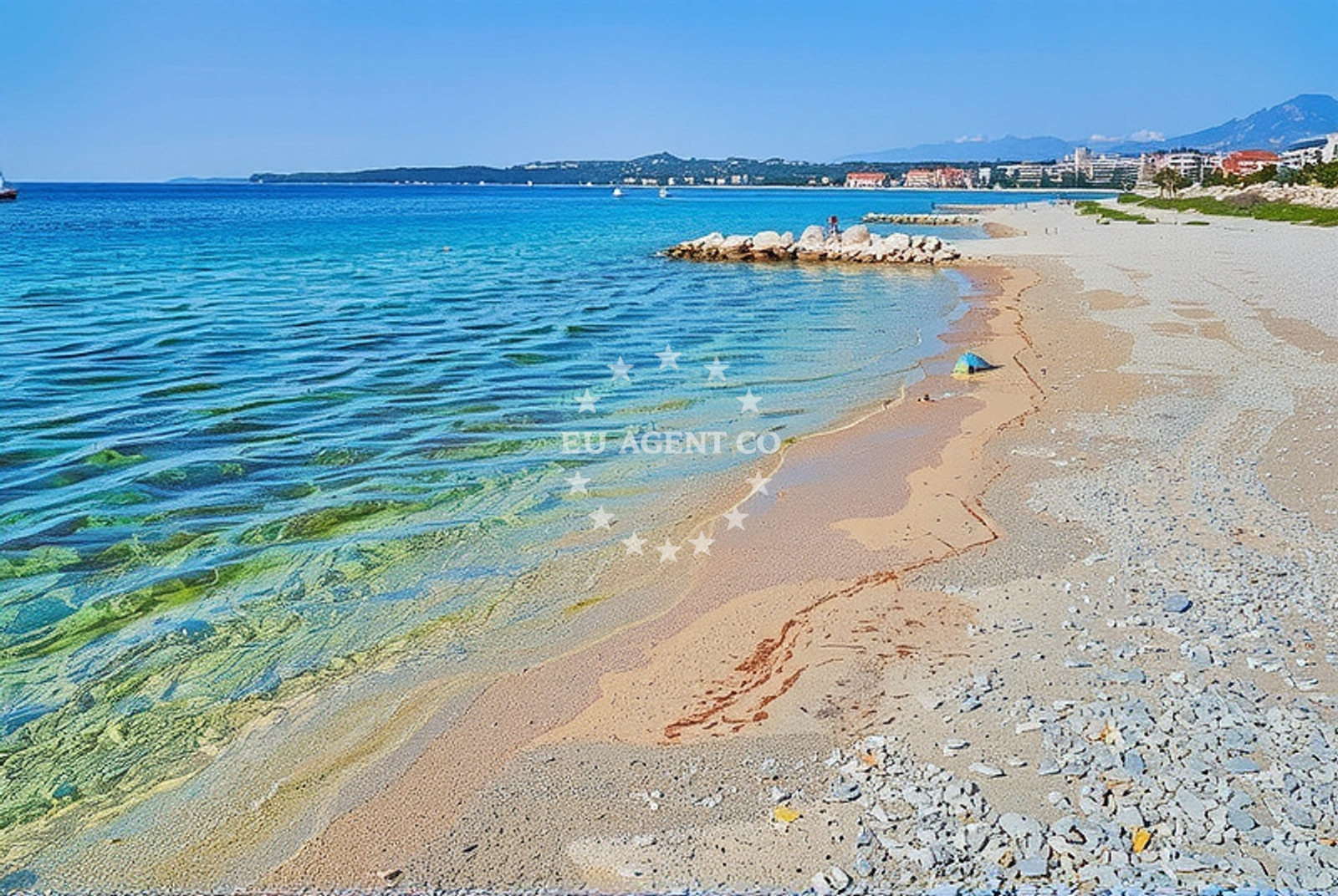
The beach is composed entirely of gravel, a rarity along Pag’s coastline, which is typically known for its pebble-and-sand beaches. This texture makes it unsuitable for swimming but ideal for walking or sunbathing on the shore. The gravel likely results from the island’s limestone geology, which shapes much of Pag’s coastal terrain. The beach’s modest length and lack of infrastructure suggest it is a lesser-known spot, possibly used by locals for casual recreation rather than tourism.Swimming and shore
Swimming is not practical here due to the gravel substrate, which can be uncomfortable for wading. However, the Adriatic Sea’s clarity is evident even from the shore, with turquoise waters visible beyond the rocky outcrops. The beach’s northern exposure means it faces open sea, offering unobstructed views of the horizon. Nearby, the salt pans of Pag—vast, white expanses used for centuries—create a striking visual contrast to the beach’s natural ruggedness.Facilities and activities
There are no formal facilities at rt Vrtlić Beach, such as showers, restrooms, or parking. Its isolation suggests it is not a primary destination for day-trippers. Activities are limited to walking along the shore, photography, and exploring the surrounding landscape. The beach’s proximity to Pag’s salt pans and the island’s interior trails could make it a starting point for short excursions, though no specific paths or guided tours are associated with the site.Access and location
The beach is located on the northern tip of Pag, near the village of Novalja. Pag is accessible by ferry from Zadar or by road via the mainland town of Šibenik. Novalja itself has limited amenities, with most services concentrated in the island’s southern regions. The beach’s remoteness means it is best reached by car, with no marked parking areas or designated access routes. Its position on Pag’s northern coast places it within sailing distance of the Kornati National Park, a network of 89 islands known for their pristine waters and challenging routes for yachts.What to expect
Expect a gravel shoreline that extends 500 meters along Pag’s northern coast. The beach lacks formal amenities, making it a quiet, unassuming spot. The Adriatic Sea’s clarity is visible from the shore, though swimming is impractical. The area’s natural features—limestone cliffs, salt pans, and open sea—define the landscape. This beach is not ideal for families or those seeking structured facilities but may appeal to visitors interested in Pag’s geological and historical context.Practical tips
Wear sturdy footwear for walking on the gravel. Arrive early to avoid crowds, as the beach is not a major tourist destination. Note that there are no lifeguards, restrooms, or parking areas. The surrounding salt pans and interior trails of Pag offer opportunities for exploration beyond the beach itself.Exploring the coast by yacht
For yacht charter guests, the waters near Pag offer diverse sailing opportunities. The Kornati National Park lies just south of the island, with its labyrinth of islands and shallow bays ideal for motor yachts. Pag’s northern coast, including rt Vrtlić Beach, is within reach of yachts anchored in Novalja’s harbor or nearby marinas. The Adriatic’s calm waters and proximity to Zadar, Brac, and Hvar make this region a popular route for charter boats. For availability and booking, visit the Yacht Search page.Pag’s Unique Geography
Pag’s coastline is shaped by its limestone bedrock, creating a landscape of rocky inlets, salt pans, and narrow beaches. The island’s isolation has preserved traditional industries like salt production, visible in the vast white expanses near Novalja. This context adds historical depth to rt Vrtlić Beach, which sits at the edge of this distinctive environment.Anchorages in the surrounding area
- Straško — novalja — pag — 0.6 NM from beach
- Anchorage — novalja — pag — 1.1 NM from beach
- Anchorage — stara novalja — pag — 1.6 NM from beach
- Anchorage — novalja — pag — 1.7 NM from beach
- Anchorage — skunca — pag — 2.1 NM from beach
- Anchorage — novalja — pag — 2.2 NM from beach
- Anchorage — mandre — pag — 2.8 NM from beach
- Anchorage — dabova — pag — 3.2 NM from beach
Distances are straight-line geographic distances, not sailing routes.
Mooring buoys in the surrounding area
Mooring buoys are located in Novalja and other nearby areas on Pag.
- Buoy field — novalja — pag — 0.6 NM from beach
- Drljanda — stara novalja — pag — 3.2 NM from beach
- Jetty — zubovici — pag — 4.9 NM from beach
- Jetty — zubovici — pag — 5.1 NM from beach
- Jetty — jakisnica — pag — 6.6 NM from beach
Distances are straight-line geographic distances, not sailing routes.
Marine fuel stations
Marine fuel stations are situated in Rab and Losinj, located further from the beach.
- Ina — rab — 13.3 NM from beach
- Ina — mali losinj — 17.5 NM from beach
- Adria Oil — mali losinj — 17.8 NM from beach
- Tifon — nerezine — losinj — 21.5 NM from beach
Distances are straight-line geographic distances, not sailing routes.
Harbours in the surrounding area
Harbors can be found in Novalja and other locations on Pag and nearby regions.
- Novalja — pag — 0.4 NM from beach
- Stara Novalja — pag — 2.8 NM from beach
- Žigljen — zigljen — pag — 3.8 NM from beach
- Prizna — 5.2 NM from beach
- Jakišnica — jakisnica — pag — 6.9 NM from beach
- Karlobag — 8.7 NM from beach
Distances are straight-line geographic distances, not sailing routes.
Marinas in the surrounding area
- ACI Marina Šimuni — simuni — pag — 6.0 NM from beach
- ACI Marina Rab — 13.3 NM from beach
- ACI Marina Supetarska Draga — rab — 16.4 NM from beach
- Y/C Marina Mali Lošinj — mali losinj — 17.5 NM from beach
- Marina Lošinj — mali losinj — 17.7 NM from beach
Distances are straight-line geographic distances, not sailing routes.
Restaurants near the beach
Restaurants are located in Novalja, close to the beach.
- Konoba Reful — novalja — pag — 0.6 NM from beach
- Restaurant — novalja — pag — 0.6 NM from beach
- Restaurant — novalja — pag — 0.6 NM from beach
- Antonio — novalja — pag — 0.6 NM from beach
- La Tortilla — novalja — pag — 0.6 NM from beach
- Konoba Grill Matulo — novalja — pag — 0.6 NM from beach
- Restaurant — novalja — pag — 0.6 NM from beach
Distances are straight-line geographic distances, not sailing routes.
Navigation guides for the surrounding area
- Novalja — 0.7 NM from beach
- Caska — 2.3 NM from beach
- Uvala Prizna — 5.4 NM from beach
- Uvala Jakisnica — 6.7 NM from beach
- Uvala Zavratnica — 9.1 NM from beach
Distances are straight-line geographic distances, not sailing routes.
Yachts from nearby departure bases
Yachts depart from Novalja and other bases in Pag and surrounding areas.
Sailing yachts
- First 45 (Egeria) — Šimuni Kolan ACI Marina — 5.9 NM from departure base to beach
- Sun Odyssey 349 (Nara) — Mali Lošinj — 17.5 NM from departure base to beach
- Elan 35 Impression (Essi) — Mali Lošinj — 17.5 NM from departure base to beach
Motor yachts
- Absolute 50 Fly (Acrobat) — Rab ACI Marina — 13.3 NM from departure base to beach
Motor boats
- Balt 818 Titanium (Valentina) — Novalja — 0.6 NM from departure base to beach
- Balt 818 Titanium (Valentina 2) — Novalja — 0.6 NM from departure base to beach
- BWA Sport 22GT (BWA ) — Pag City Port — 10.1 NM from departure base to beach
- Merry Fisher 895 — Povljana Marina — 15.7 NM from departure base to beach
- Antares 36 (Joia) — Mali Lošinj — 17.5 NM from departure base to beach
- Galeon Galia 630 blue — Mali Lošinj — 17.5 NM from departure base to beach
Distances are straight-line geographic distances, not sailing routes.