Rogač istok, Duće Beach, Croatia
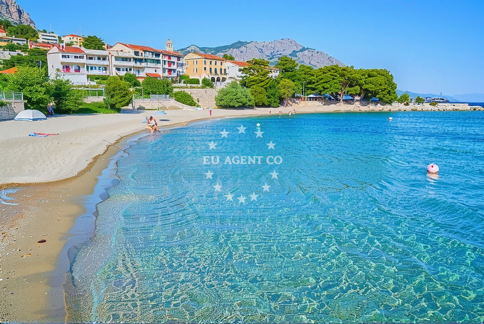
Rogač istok, Duće Beach lies along the eastern shore of the Rogač peninsula in Croatia's Dalmatian coast. This 150-meter stretch of sand offers a straightforward coastal experience with basic amenities catering to day-trippers and casual visitors. Its location within a settlement known for maritime traditions makes it a minor but functional stop for those exploring the region's coastline.
About this beach
Rogač istok, Duće
Beach: Rogač istok
Location: Duće
Characteristics and facilities
Sand
150 m
Restaurant / snack bar
Caffe bar / Drinks stand
Natural shade
shower
Beach character
The beach consists of fine sand, a common feature along Croatia's eastern Adriatic shores. Its relatively short length means it remains uncrowded during off-peak seasons, though proximity to local infrastructure may increase usage during summer months. Natural shade is available along parts of the beach, providing limited relief from direct sunlight. The shoreline appears to be unbroken, with no prominent rock formations or tidal pools noted in available records.
Swimming and shore
As a sand beach with no reported depth measurements, swimming conditions are likely to be shallow near the shore. The absence of specific water quality data means visitors should assume standard Adriatic conditions apply. The beach's orientation toward the open sea suggests it may experience moderate wave activity depending on wind patterns, though no formal hazard warnings are documented for this location.
Facilities and activities
Basic amenities include a restaurant/snack bar and a combined café/drinks stand, suggesting limited food and beverage options for visitors. A shower facility is available, though no details about its maintenance schedule or accessibility are provided. The beach does not appear to host organized activities or rental services, aligning with its description as a straightforward coastal access point rather than a tourist destination.
Access and location
Located in Rogač istok, the beach is part of a coastal area with historical maritime significance. Its position along the Dalmatian coast places it within reach of several Adriatic sailing routes, though no specific marinas or anchorage points are documented for this exact location. Visitors arriving by land would find it integrated with local road networks serving the surrounding settlements.
What to expect
Visitors should expect a functional beach experience with minimal infrastructure. The presence of a restaurant, café, and shower suggests it serves as a service point for local residents and nearby travelers rather than a dedicated tourist attraction. The beach's characteristics align with typical Adriatic coastal profiles, with no unique geological features or exceptional natural conditions reported in available records.
Practical tips
Given the beach's basic amenities, visitors may want to bring personal items not covered by on-site facilities. The lack of detailed accessibility information means those with mobility needs should consider local road conditions before visiting. As with all Adriatic beaches, water safety awareness is recommended despite no formal hazard warnings being documented for this location.
Exploring the coast by yacht
The beach's location along Croatia's eastern coast places it within reach of several yacht charter routes in the Adriatic. While no specific marinas are documented for this exact site, the broader region includes established sailing areas that may interest charter guests exploring the Dalmatian coast. For detailed sailing information, Euro-Agent's beaches map provides regional context about coastal access points.
Regional Context
The Rogač peninsula is part of the Šibenik-Knin County, an area with a long maritime history dating back to the medieval period. Local traditions include fishing and boat-building, which may be reflected in the nearby settlements' infrastructure. The broader region includes several islands and coastal towns that form part of the Adriatic's popular sailing circuits.
Anchorages in the surrounding area
Anchorages near Rogač istok, Duće Beach include options in Postira and Povlja on Brac.
- Anchorage — postira — brac — 4.1 NM from beach
- Anchorage — postira — brac — 4.2 NM from beach
- Konopjikova — postira — brac — 4.5 NM from beach
- Anchorage — splitska — brac — 4.6 NM from beach
- Anchorage — supetar — brac — 6.4 NM from beach
- Tri luke — povlja — brac — 8.4 NM from beach
- Anchorage — povlja — brac — 9.0 NM from beach
- Anchorage — povlja — brac — 9.1 NM from beach
Distances are straight-line geographic distances, not sailing routes.
Mooring buoys in the surrounding area
Mooring buoys and jetties near Rogač istok, Duće Beach include facilities in Postira and Povlja.
- Quay — postira — brac — 4.5 NM from beach
- Jetty — podstrana — 4.6 NM from beach
- Restaurant Pipo buoys — povlja — brac — 8.3 NM from beach
- Restaurant Pipo jetty — povlja — brac — 8.4 NM from beach
- Konoba Rojen jetty — povlja — brac — 8.5 NM from beach
Distances are straight-line geographic distances, not sailing routes.
Marine fuel stations
Marine fuel stations in the area include options in Bol, Split, and Milna on Brac.
- Fuel station — bol — brac — 10.8 NM from beach
- Ina — split — 10.8 NM from beach
- Ina — split — 11.2 NM from beach
- Ina — milna brac — 11.8 NM from beach
Distances are straight-line geographic distances, not sailing routes.
Harbours in the surrounding area
Harbours in the surrounding area include Dugi Rat, Omiš, and Sumpetar near Rogač istok, Duće Beach.
- Dugi Rat — 1.0 NM from beach
- Omiš — omis — 1.3 NM from beach
- Sumpetar — dugi rat — 1.7 NM from beach
- Krilo — jesenice — 3.0 NM from beach
- Postira — brac — 4.1 NM from beach
- Splitska — brac — 4.5 NM from beach
Distances are straight-line geographic distances, not sailing routes.
Marinas in the surrounding area
Marinas in the vicinity include Marina Lav in Podstrana and ACI Marina Split.
- Marina Lav — podstrana — 6.3 NM from beach
- ACI Marina Split — 10.8 NM from beach
- ACI Marina Milna — milna brac — 11.6 NM from beach
- Marina Milna Kanarija — milna brac — 11.7 NM from beach
- Marina Vlaška — milna brac — 11.8 NM from beach
Distances are straight-line geographic distances, not sailing routes.
Restaurants near the beach
Restaurants near Rogač istok, Duće Beach include Konoba Milo in Omiš and Galija in Postira.
- Konoba Milo — omis — 1.3 NM from beach
- Galija — postira — brac — 4.0 NM from beach
- Restaurant — postira — brac — 4.3 NM from beach
- Vala — splitska — brac — 4.6 NM from beach
Distances are straight-line geographic distances, not sailing routes.
Navigation guides for the surrounding area
Navigation guides for the area include Dugi Rat (Uvala Orisac) and Omis near Rogač istok, Duće Beach.
- Dugi Rat (Uvala Orisac) — 0.9 NM from beach
- Omis — 1.6 NM from beach
- Postire — 4.0 NM from beach
- Uvala Spliska (Splitska) — 4.5 NM from beach
- Kairos — 6.2 NM from beach
Distances are straight-line geographic distances, not sailing routes.
Yachts from nearby departure bases
Yachts depart from nearby bases including Omiš City Port, Sumpetar Port, and Dugi Rat Luka Krilo.
Sailing yachts
- Jeanneau 53 (Win Win) — Podstrana Marina Lav — 6.3 NM from departure base to beach
Catamarans
- Lagoon 450 Fly (Falco) — Sumpetar Port — 1.8 NM from departure base to beach
Motor yachts
- Predator 62 (Ena I) — Podstrana Marina Lav — 6.3 NM from departure base to beach
Gulets / Cruisers
- Gulet (PATRONICE) — Omiš City Port — 1.3 NM from departure base to beach
- Gulet (Primorac) — Omiš City Port — 1.4 NM from departure base to beach
- Gulet (Trebenna) — Omiš City Port — 1.4 NM from departure base to beach
- Gulet (Altair) — Sumpetar Port — 1.8 NM from departure base to beach
- Gulet (Cataleya) — Sumpetar Port — 1.8 NM from departure base to beach
- Gulet cruiser (AGORA) — Dugi Rat Luka Krilo — 3.0 NM from departure base to beach
Motor boats
- Scanner 710 (Nerezine) — Podstrana Marina Lav — 6.3 NM from departure base to beach
Distances are straight-line geographic distances, not sailing routes.