Riva (Peć), Brseč Beach, Croatia
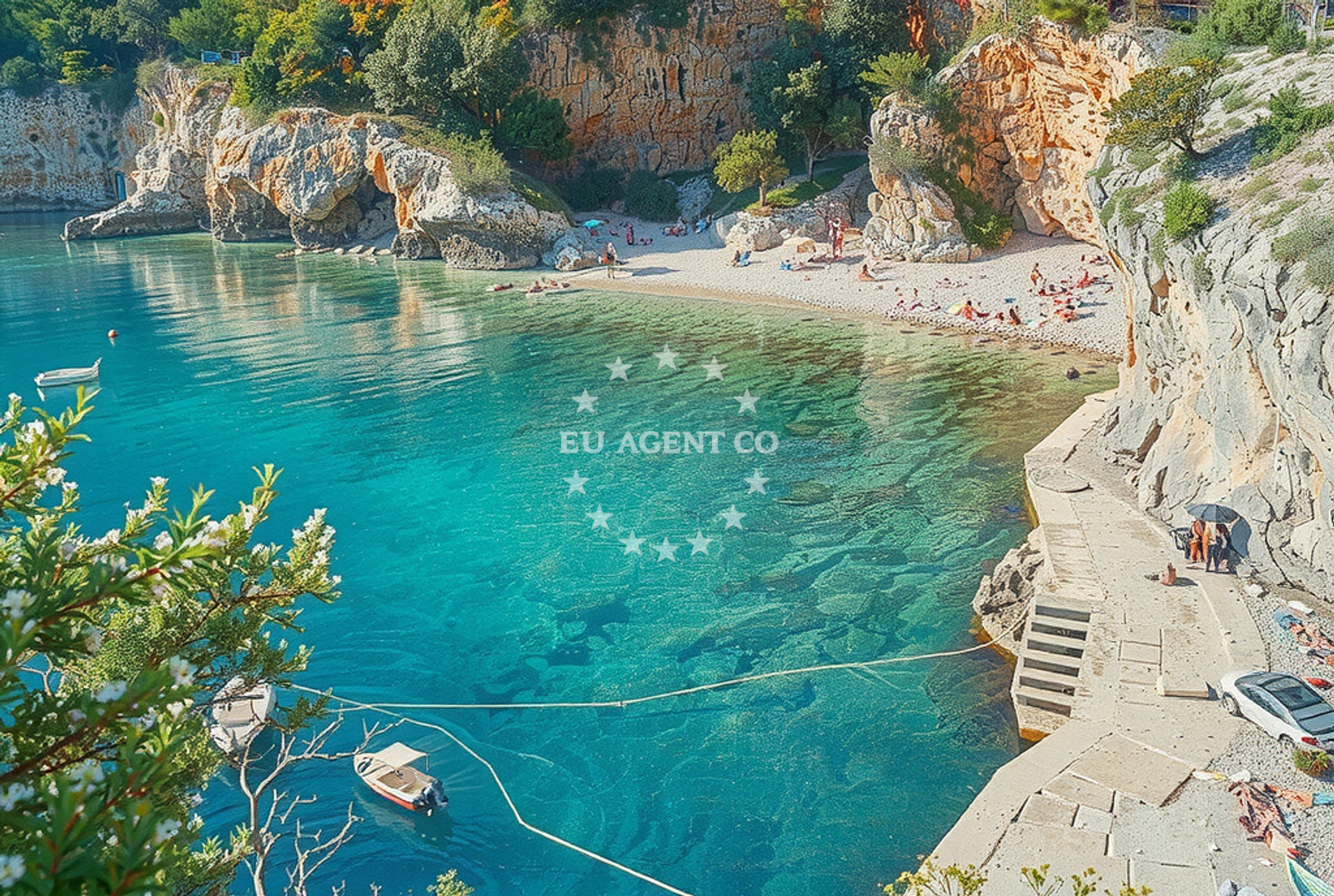
Riva (Peć), Brseč Beach is a short, gravel-and-concrete-slab shoreline situated in the coastal town of Riva, on the Istrian Peninsula. Measuring 60 meters in length, the beach is a modest stretch of shore that offers direct access to the Adriatic Sea. Its proximity to Riva’s historic center and the broader Istrian coastline makes it a practical stop for visitors exploring the region’s maritime heritage and natural landscapes.
About this beach
Riva (Peć), Brseč
Beach: Riva (Peć)
Location: Brseč
Characteristics and facilities
Gravel, concrete / stone slabs
60 m
Beach character
The beach consists of gravel and concrete/stone slabs, forming a compact shoreline that is more suited for brief stops than extended sunbathing. The surface is firm and uniform, with no natural sand or pebbles. The beach’s limited length and lack of amenities make it a functional rather than recreational spot, ideal for quick access to the water or as part of a broader coastal walk. The surrounding area appears to be relatively undeveloped, with no visible structures or facilities directly on the shore.
Swimming and shore
The shore’s gravel and concrete composition suggests limited opportunities for traditional swimming activities, though the beach’s direct access to the sea allows for wading or brief immersion. The Adriatic Sea here is known for its clear waters and moderate temperatures during the summer months, making it suitable for short swims. The lack of natural barriers or sheltered coves means the beach is exposed to open sea conditions, which may influence water movement and comfort levels.
Facilities and activities
No facilities or structured activities are explicitly listed for Brseč Beach. Its primary function appears to be as a transitional or utilitarian shore, possibly serving local residents for fishing, walking, or brief maritime access. The absence of amenities such as showers, restrooms, or seating aligns with its modest scale and the lack of development in the immediate area.
Access and location
Brseč Beach is located in Riva (Peć), a coastal town on the Istrian Peninsula. The beach’s coordinates (45.18249, 14.242309) place it near the town’s historic harbor and within reach of Riva’s main thoroughfares. Visitors arriving by car may find access via local roads leading to the shore, though no specific parking details are available. The beach’s proximity to Riva’s center and its position along the Adriatic coastline make it a logical waypoint for those exploring the region’s maritime routes.
What to expect
Brseč Beach is a short, utilitarian shoreline that offers direct access to the Adriatic Sea. Visitors should expect a firm gravel-and-concrete surface, with no amenities or facilities on-site. The beach’s primary appeal lies in its location within Riva, a historic coastal town, and its connection to the broader Istrian coastline. It is best suited for brief stops, coastal walks, or as part of a larger exploration of the region’s maritime landscape.
Practical tips
Given the beach’s limited facilities, visitors are advised to bring personal items such as towels, sunscreen, and water. The lack of on-site amenities means that any extended stay would require nearby accommodations or facilities in Riva. The beach’s exposed position along the open sea may make it less ideal for children or those seeking fully sheltered conditions.
Exploring the coast by yacht
Brseč Beach’s location in Riva places it within a region renowned for its yacht charter opportunities. The Istrian Peninsula is a popular sailing destination, with marinas and anchorages available along the coast. Yacht charter guests exploring the area may find Brseč Beach a convenient stop for brief landings, coastal excursions, or as part of a route connecting to nearby ports such as Rovinj or Pula. The Adriatic’s calm waters and scenic routes make this area particularly appealing for motor yachts and sailing boats.
Historical and Cultural Context of Riva
Riva, located on the northern coast of Istria, has a long history as a maritime hub. The town’s name derives from the Italian word for 'rivers,' reflecting its position at the confluence of several streams. During the medieval period, Riva was a key port for Venetian trade routes. Today, it retains elements of its maritime past, with historic buildings and a harbor that still serve as a focal point for local and regional activity.
Anchorages in the surrounding area
Anchorages in the surrounding area include Moscenicka Draga, Cres, and Medveja, offering nearby options for mooring.
- Anchorage — moscenicka draga — 3.3 NM from beach
- Stara Porozina — cres — 3.5 NM from beach
- Anchorage — medveja — 5.4 NM from beach
- Anchorage — beli — cres — 6.7 NM from beach
- Remac — rabac — 7.9 NM from beach
- Anchorage — duga luka — 8.9 NM from beach
- Anchorage — sveta marina — 9.7 NM from beach
- Camp Glavotok — krk — 9.8 NM from beach
Distances are straight-line geographic distances, not sailing routes.
Mooring buoys in the surrounding area
Mooring buoys in the surrounding area include Ika and Glavotok on Krk, providing additional anchoring points.
- Ika — 7.6 NM from beach
- Camp Glavotok — krk — 9.9 NM from beach
- Jetty — trget — 12.5 NM from beach
- Jetty — pinezici — krk — 12.6 NM from beach
- Jetty — pinezici — krk — 12.6 NM from beach
Distances are straight-line geographic distances, not sailing routes.
Marine fuel stations
Marine fuel stations are located in Opatija, Krk, and Cres, ensuring refueling options nearby.
- Fuel station — opatija — 9.6 NM from beach
- OMV — krk — 14.2 NM from beach
- Fuel station — cres — 15.2 NM from beach
- Ina — cres — 15.7 NM from beach
Distances are straight-line geographic distances, not sailing routes.
Harbours in the surrounding area
- Brestova — 2.4 NM from beach
- Mošćenička Draga — moscenicka draga — 3.4 NM from beach
- Porozina — cres — 3.6 NM from beach
- Beli — cres — 6.6 NM from beach
- Lovran — 6.7 NM from beach
- Rabac Luka — 7.2 NM from beach
Distances are straight-line geographic distances, not sailing routes.
Marinas in the surrounding area
Marinas in the surrounding area include ACI Marina Opatija and Omišalj Docks on Krk, offering nearby yacht bases.
- ACI Marina Opatija — 8.2 NM from beach
- Marina Admiral — opatija — 9.0 NM from beach
- Omišalj Docks — omisalj — krk — 13.2 NM from beach
- ACI Marina Cres — 15.8 NM from beach
- Šilo — silo — krk — 18.2 NM from beach
Distances are straight-line geographic distances, not sailing routes.
Restaurants near the beach
Restaurants near the beach include Buffet Brestova and Johnson in Mosćenička Draga, providing dining options in the vicinity.
- Buffet Brestova Snacks, Pizza — buffet brestova snacks pizza — 2.4 NM from beach
- Johnson — moscenicka draga — 3.4 NM from beach
- Restaurant — porozina — cres — 3.6 NM from beach
Distances are straight-line geographic distances, not sailing routes.
Navigation guides for the surrounding area
Navigation guides for the surrounding area cover Mosćenička Draga, Medveja, and Uvala Prklog, aiding route planning.
- Moscenicka Draga — 3.3 NM from beach
- Medveja — 5.4 NM from beach
- Uvala Prklog — 8.7 NM from beach
- Opatija (and lciCi) — 9.8 NM from beach
- Uvala Cavlena — 10.7 NM from beach
Distances are straight-line geographic distances, not sailing routes.
Yachts from nearby departure bases
Yachts from nearby departure bases include those departing from Rabac Port and Opatija Marina Admiral, offering sailing options in the region.
Sailing yachts
- Bavaria 30 Cruiser (Ana) — Rabac Port — 7.2 NM from departure base to beach
- Elan 333 (Brina) — Rabac Port — 7.2 NM from departure base to beach
- Elan Impression 40 (Silente) — Rabac Port — 7.2 NM from departure base to beach
- Sun Odyssey 415 (Stariel) — Opatija Marina Admiral — 9.0 NM from departure base to beach
- Bavaria 44 (Scorpion) — Rijeka Port — 11.1 NM from departure base to beach
Catamarans
- Eleuthera 60 (Calima) — Rijeka Port — 11.1 NM from departure base to beach
Motor yachts
- Fleur de Lys (Cadabra) — Rijeka Port — 11.1 NM from departure base to beach
Motor boats
- Merry Fisher 695 (Karlobag) — Ičići ACI Marina Opatija — 8.2 NM from departure base to beach
- Atlantic Sun Cruiser 730 (Lady Blue) — Opatija Marina Admiral — 9.0 NM from departure base to beach
- Merry Fisher 795 (Classic) — Opatija Marina Admiral — 9.0 NM from departure base to beach
Distances are straight-line geographic distances, not sailing routes.