Risika (Krk) Beaches and Coves: A Coastal Exploration, Croatia
About this beach
Risika (Krk): beaches and coves
Beach character
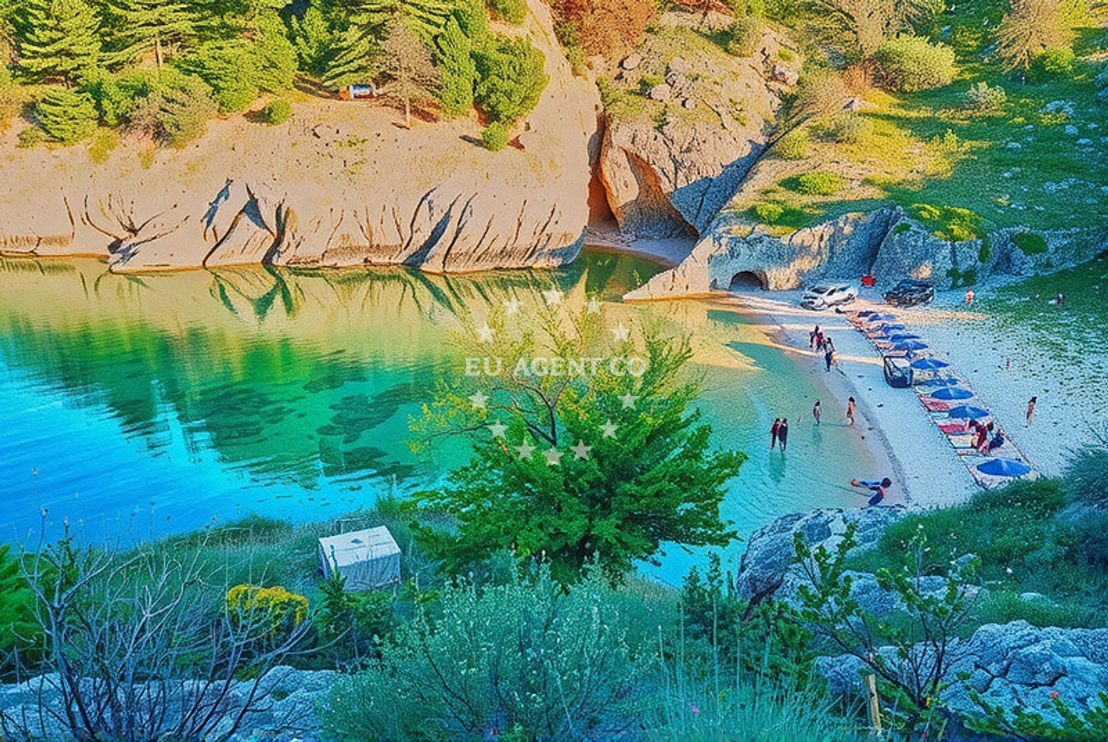
The beaches and coves of Risika are defined by their natural contours, with rocky outcrops and pebbled shores interspersed with patches of sand. The coastline here is shaped by the Adriatic's tides, creating a dynamic interplay between land and sea. The area's topography suggests a mix of exposed and sheltered spots, though specific details about individual coves remain undocumented in official records. Visitors may find sections of the shore that are more accessible, while others require careful navigation due to uneven terrain. The absence of formalized beach facilities means the experience here leans toward raw, unspoiled coastal character.Swimming and shore
Swimming conditions in the Risika area are influenced by the Adriatic's seasonal currents and wind patterns. The waters here are generally clear, with visibility often extending several meters, though underwater topography can vary from shallow shallows near the shore to deeper channels further out. The shore itself is a mix of rock and pebble, which may make barefoot swimming less comfortable. Those seeking a more tranquil experience may find sheltered coves where wave action is reduced, though these areas are not marked in official records. The lack of formalized beach access points means visitors should exercise caution when exploring the shoreline.Facilities and activities
There are no officially documented facilities or services directly associated with the Risika beaches and coves. The area's character is defined by its natural state, with no permanent structures, lifeguard services, or beachside amenities. However, the proximity to Krk town (approximately 15 kilometers away) means visitors can access services such as restaurants, shops, and transportation options in the main settlement. For those interested in activities beyond swimming, the surrounding region offers opportunities for hiking along Krk's coastal trails and exploring the island's historic sites, including the medieval Krk Fortress.Access and location
Risika's coastal area is accessible via Krk Island's road network, with the nearest major road junction located near the village of Risika itself. The area is not served by direct public transportation, meaning visitors typically arrive by private vehicle. For those arriving by sea, the broader Krk region is a common stop for sailors navigating the Adriatic, though no specific anchorages or marinas are marked in the Risika area itself. The coordinates (45.1047117, 14.6465149) place the location within the northern reaches of Krk, where the island's coastline transitions from the more developed western shores to the quieter, more rugged northern and eastern coasts.What to expect
Visitors to Risika's beaches and coves should expect a landscape shaped by nature rather than formalized tourism infrastructure. The area is best suited for those seeking solitude, scenic coastal walks, and a connection to the raw Adriatic environment. The lack of amenities means visitors should plan accordingly, bringing provisions for extended stays on the shore. The region's position on Krk Island places it within reach of the island's cultural and historical attractions, though the coastal experience itself remains centered on natural beauty rather than convenience. For those interested in maritime exploration, the surrounding waters are part of a larger sailing network that includes the Istrian Peninsula and the northern Adriatic.Practical tips
Given the absence of formalized beach access points, visitors are advised to check local conditions before heading to Risika's shores. The terrain can be uneven, so sturdy footwear is recommended for exploring the coastline. Those planning to spend time on the beach should bring water, snacks, and sun protection, as there are no on-site services. For those arriving by car, parking options near the Risika area are limited, requiring careful planning to avoid restricted zones.Exploring the coast by yacht
For sailors and yacht charter guests, the Risika area is positioned within a broader sailing corridor that connects Krk Island to the Istrian Peninsula and the northern Adriatic. While the specific beaches and coves of Risika may not be marked as anchorages, the surrounding waters are part of a well-established route for both short-range and longer-distance cruising. Charter guests exploring this region may find opportunities to dock in Krk's main marinas, such as those in the town of Krk, before venturing to the more secluded northern coast. For those interested in yacht charter options in this area, Euro-Agent's Yacht Search page provides access to vessels available for rental in the broader Adriatic region.Historical and Cultural Context of Krk Island
Krk Island, where Risika is located, has a history dating back to ancient times, with evidence of Roman settlements and medieval fortifications. The island's strategic position in the Adriatic made it a focal point for trade and defense, with the Krk Fortress serving as a key stronghold. Today, the island's cultural heritage is reflected in its architecture, museums, and festivals, offering visitors a blend of history and natural beauty.Anchorages in the surrounding area
Anchorages near Risika (Krk) include options like Anchorage — risika — krk and Sveti Marak — krk.
- Anchorage — krk — 0.7 NM from beach
- Anchorage — risika — krk — 0.8 NM from beach
- Anchorage — krk — 0.9 NM from beach
- Sveti Marak — krk — 1.1 NM from beach
- Anchorage — krk — 1.2 NM from beach
- Anchorage — krk — 1.6 NM from beach
- Vrbnik — krk — 1.9 NM from beach
- Anchorage — silo — krk — 2.4 NM from beach
Distances are straight-line geographic distances, not sailing routes.
Mooring buoys in the surrounding area
Mooring buoys in the area include Jetty — risika — krk, located near the beach.
- Jetty — risika — krk — 0.8 NM from beach
- Buoy field — kornic — 4.0 NM from beach
- Jetty — selce — 4.3 NM from beach
- Jetty — selce — 4.3 NM from beach
- Buoy field — selce — 4.3 NM from beach
Distances are straight-line geographic distances, not sailing routes.
Marine fuel stations
Marine fuel stations in the vicinity include Fuel station — crikvenica, situated a short distance from the beach.
- Fuel station — crikvenica — 4.4 NM from beach
- Flash — krk — 5.8 NM from beach
- Ina — krk — 5.8 NM from beach
- INA — novi vinodolski — 6.1 NM from beach
Distances are straight-line geographic distances, not sailing routes.
Harbours in the surrounding area
Harbours nearby include Crikvenica and Vrbnik — krk, offering access points for visitors.
- Vrbnik — krk — 1.9 NM from beach
- Šilo — silo — krk — 2.7 NM from beach
- Klimno — krk — 3.3 NM from beach
- Čižići — cizici — krk — 3.7 NM from beach
- Selce — 4.3 NM from beach
- Crikvenica — 4.4 NM from beach
Distances are straight-line geographic distances, not sailing routes.
Marinas in the surrounding area
- Šilo — silo — krk — 2.9 NM from beach
- Marina Punat — krk — 4.6 NM from beach
- Marina Novi — novi vinodolski — 6.1 NM from beach
- Mitan Marina — novi vinodolski — 6.9 NM from beach
- Omišalj Docks — omisalj — krk — 7.5 NM from beach
Distances are straight-line geographic distances, not sailing routes.
Restaurants near the beach
Restaurants near the beach include Nada — vrbnik — krk and Restaurant — silo — krk, offering local cuisine.
- Nada — vrbnik — krk — 2.0 NM from beach
- Konoba — vrbnik — krk — 2.1 NM from beach
- Toljanic Gospoj — vrbnik — krk — 2.1 NM from beach
- Restaurant — silo — krk — 2.7 NM from beach
- Restaurant — silo — krk — 2.7 NM from beach
- Restaurant — silo — krk — 2.7 NM from beach
- Oleander — klimno — krk — 3.3 NM from beach
Distances are straight-line geographic distances, not sailing routes.
Navigation guides for the surrounding area
Navigation guides for the area include Uvala Sv. Marak and Vrbnik, aiding in local exploration.
- Uvala Sv. Marak — 1.0 NM from beach
- Vrbnik — 2.0 NM from beach
- Uvala Stipanja {Silo) — 2.9 NM from beach
- Uvala Siana — 4.4 NM from beach
- Se Ice — 4.5 NM from beach
Distances are straight-line geographic distances, not sailing routes.
Yachts from nearby departure bases
Sailing yachts
- Solaris 44 (Trinity) — Krk Marina Punat — 4.6 NM from departure base to beach
- Dehler 38 (Ship Happens) — Krk Marina Punat — 4.6 NM from departure base to beach
Catamarans
- Lagoon 42 (LOLINA) — Krk Marina Punat — 4.6 NM from departure base to beach
- Athena 38 (SWAN) — Krk Marina Punat — 4.6 NM from departure base to beach
Motor yachts
- Galeon 500 Fly (Barbara) — Krk Marina Punat — 4.6 NM from departure base to beach
- Ferretti 460 (Summertime) — Krk Marina Punat — 4.6 NM from departure base to beach
Motor boats
- Barracuda 590 (Solta) — Crikvenica City Port — 4.5 NM from departure base to beach
- Barracuda 590 (Barracuda 12) — Crikvenica City Port — 4.5 NM from departure base to beach
- Beneteau Flyer 9 (Beneteau 9) — Krk Marina Punat — 4.6 NM from departure base to beach
- Atlantis 47 (B 747) — Krk Marina Punat — 4.6 NM from departure base to beach
Distances are straight-line geographic distances, not sailing routes.