Ravanje Zapad, Podaca Beach, Croatia
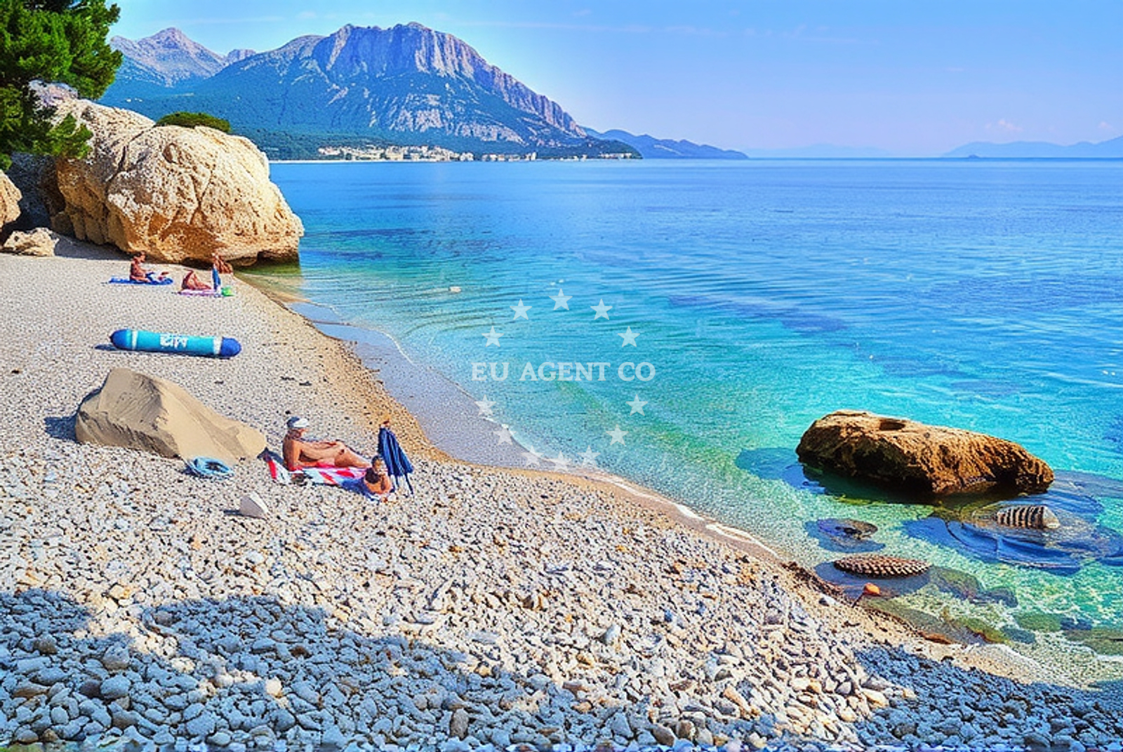
Ravanje Zapad, Podaca Beach is a small coastal stretch located in the village of Podaca on Croatia’s Adriatic coast. Situated in a region known for its rugged terrain and scenic maritime landscapes, the beach offers a quiet alternative to more crowded shores. Its pebbly and gravelly composition defines its character, making it a unique destination for those seeking a less conventional beach experience.
About this beach
Ravanje zapad, Podaca
Beach: Ravanje zapad
Location: Podaca
Characteristics and facilities
Pebbles, gravel
40 m
Beach character
The beach is approximately 40 meters long, with a shoreline composed primarily of pebbles and gravel. This texture creates a distinct contrast to the smooth sandy beaches found elsewhere in the region. The short length means the beach is best suited for solitary relaxation or brief exploration. The lack of formal amenities or infrastructure underscores its natural, unspoiled character.
Swimming and shore
Swimming conditions at Ravanje Zapad are influenced by the pebbly shoreline, which may make wading uncomfortable for some visitors. The beach’s modest size means it is not ideal for extended water activities, but the clear Adriatic waters typical of the region offer visibility for snorkeling or casual swimming. The shore itself is accessible via a short walk from the village of Podaca, though the gravelly surface may require sturdy footwear.
Facilities and activities
No formal facilities such as showers, restrooms, or changing rooms are listed for Ravanje Zapad. The absence of structured amenities aligns with its status as a more remote and naturally preserved coastline. Activities are limited to passive enjoyment of the beach and surrounding landscape, with no recreational structures or organized programs reported.
Access and location
Podaca is a small village on the island of Brač, part of the Split-Dalmatia County in southern Croatia. The beach is accessible via local roads connecting to the village, though specific parking details are not documented. Its location on Brač places it within proximity to other notable Adriatic destinations, including the island of Hvar and the city of Split, which are popular hubs for yacht charter operations.
What to expect
Visitors to Ravanje Zapad should anticipate a minimalist beach experience defined by its pebbly shoreline and limited infrastructure. The beach’s short length and natural setting make it well-suited for those seeking solitude or a brief interlude from more developed coastal areas. The surrounding landscape of Brač, with its limestone cliffs and olive groves, provides a scenic backdrop for exploration beyond the beach itself.
Practical tips
Consider bringing sturdy shoes for traversing the gravelly shoreline and a towel for comfort on the pebbles. Due to the beach’s size, it is advisable to visit during off-peak hours to avoid crowds. The nearby village of Podaca offers basic amenities for visitors, including local shops and restaurants.
Exploring the coast by yacht
For yacht charter guests exploring the Adriatic, Ravanje Zapad’s location on Brač offers a strategic vantage point for sailing between the islands of Hvar, Vis, and the mainland coast. The nearby port of Supetar, a popular marina on Brač, is within a short distance and serves as a common base for charter yachts. Sailors may find the surrounding waters ideal for anchoring, with opportunities to explore the region’s caves, secluded coves, and historic sites.
Regional Context and Nearby Exploration
The island of Brač, where Podaca is located, is renowned for its white stone quarries, hiking trails, and traditional villages. Visitors may wish to combine a visit to Ravanje Zapad with excursions to the island’s main town of Bol, the famous Zlatni Rat beach, or the historic village of Vrisikos. The Adriatic Sea’s calm waters and favorable sailing conditions make it a prime destination for motor yacht and sailboat charters, with numerous anchorages and marinas available along the coast.
Anchorages in the surrounding area
Anchorages in the surrounding area include Drvenik, Ploce, and Hvar, offering various mooring options near Ravanje zapad, Podaca Beach.
- Anchorage — drvenik — 3.2 NM from beach
- Anchorage — ploce — 4.8 NM from beach
- Anchorage — sucuraj — hvar — 5.3 NM from beach
- Anchorage — sucuraj — hvar — 6.2 NM from beach
- Anchorage — sucuraj — hvar — 6.7 NM from beach
- Anchorage — trpanj — 7.0 NM from beach
- Anchorage — selca kod bogomolja — hvar — 7.1 NM from beach
- Anchorage — selca kod bogomolja — hvar — 7.2 NM from beach
Distances are straight-line geographic distances, not sailing routes.
Mooring buoys in the surrounding area
- Brist — 0.8 NM from beach
- Drvenik - Ferry dock — drvenik ferry dock — 3.1 NM from beach
- Jetty — sucuraj — hvar — 5.1 NM from beach
- Konoba Gambo buoys — selca kod bogomolja — hvar — 8.9 NM from beach
- Kraj - Soline — kraj soline — drasnice — 10.3 NM from beach
Distances are straight-line geographic distances, not sailing routes.
Marine fuel stations
- Fuel station — ploce — 7.1 NM from beach
- Fuel station — korcula — 12.1 NM from beach
- Ina — makarska — 16.3 NM from beach
- Fuel station — sumartin — brac — 21.7 NM from beach
Distances are straight-line geographic distances, not sailing routes.
Harbours in the surrounding area
- Zaostrog — 1.5 NM from beach
- Gradac — 1.9 NM from beach
- Drvenik — 3.3 NM from beach
- Sućuraj — sucuraj — hvar — 5.1 NM from beach
- Trpanj — 6.9 NM from beach
- Ploče — ploce — 7.0 NM from beach
Distances are straight-line geographic distances, not sailing routes.
Marinas in the surrounding area
- ACI Marina Korčula — korcula — 12.2 NM from beach
- Marina Lumbarda — korcula — 13.2 NM from beach
- Marina Tučepi — marina tucepi — 13.7 NM from beach
- Marina Ramova — krvavica — 18.6 NM from beach
- Marina Baška Voda — marina baska voda — 21.1 NM from beach
Distances are straight-line geographic distances, not sailing routes.
Navigation guides for the surrounding area
Navigation guides for the surrounding area include Uvala Drvenik and Hvar, assisting in route planning near Ravanje zapad, Podaca Beach.
- Gradac — 2.2 NM from beach
- Uvala Drvenik (Donja Vala) — 2.9 NM from beach
- OTOK HVAR — 4.4 NM from beach
- Trpanj — 6.8 NM from beach
- Place (Kardeljeva) — 7.2 NM from beach
Distances are straight-line geographic distances, not sailing routes.
Yachts from nearby departure bases
Sailing yachts
- Elan 40 Impression (Karleta) — Ploče City Port — 7.1 NM from departure base to beach
- Sun Odyssey 419 (Luka Ploce) — Ploče City Port — 7.1 NM from departure base to beach
- Sun Odyssey 349 (Visnjica) — Ploče City Port — 7.1 NM from departure base to beach
- Salona 44 (SAMOA) — Ploče City Port — 7.1 NM from departure base to beach
- More 55 (MRS. ROBINSON) — Ploče City Port — 7.1 NM from departure base to beach
- Elan 514 Impression (Cesarica III) — Ploče City Port — 7.1 NM from departure base to beach
- Sun Odyssey 349 (Porto Tolero) — Ploče City Port — 7.1 NM from departure base to beach
- Bavaria 40 Cruiser (LADY BUTTERFLY) — Tučepi Port — 13.7 NM from departure base to beach
Catamarans
- Lagoon 450 Fly (Alba Mouse) — Ploče City Port — 7.1 NM from departure base to beach
Motor yachts
- Princess V53 (Chablis) — Makarska Port — 16.1 NM from departure base to beach
Distances are straight-line geographic distances, not sailing routes.