Radnjača, Vir (Vir) Beach, Croatia
4 photos
About this beach
Radnjača, Vir (Vir)
Beach: Radnjača
Location: Vir (Vir)
Characteristics and facilities
Sand, gravel, concrete / stone slabs, rocks
45 m
Natural shade
Beach character
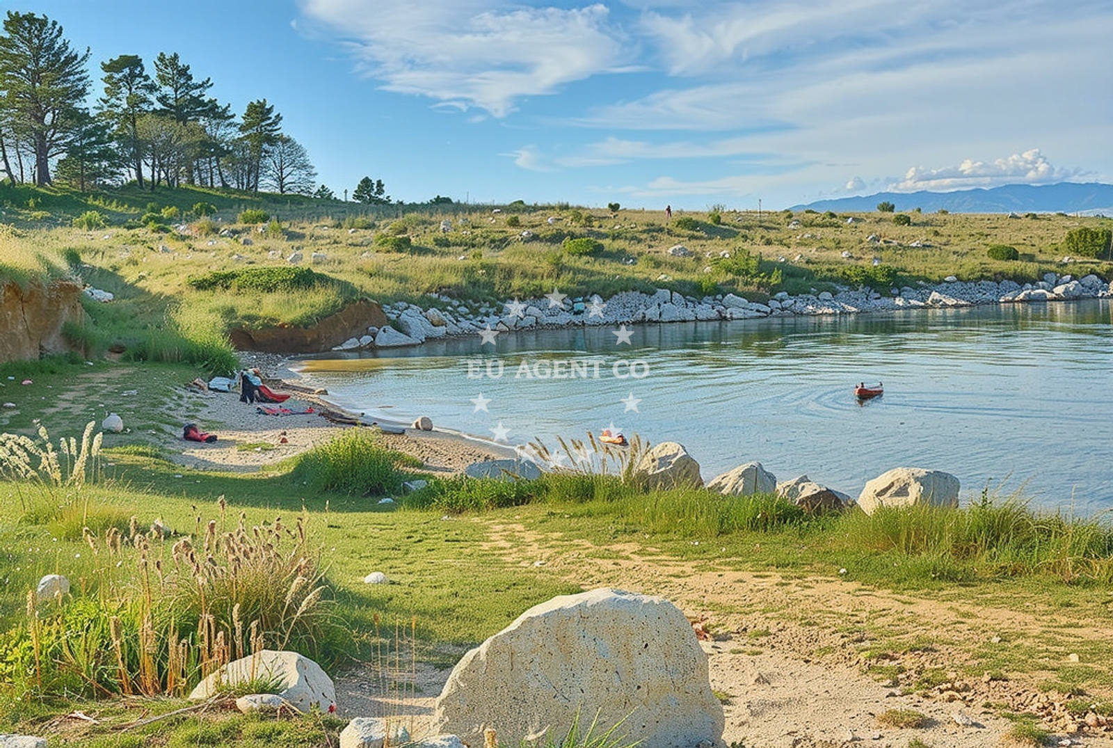
The beach features a combination of sandy areas, gravel, concrete/stone slabs, and rocky sections. This mix of terrain creates a dynamic environment where visitors can find both soft sand for relaxation and more rugged sections for exploration. Natural shade is available from the surrounding landscape, providing relief from direct sunlight. The beach's short length and varied composition make it a compact but distinctive destination.Swimming and shore
The beach's shoreline includes both sandy and rocky sections, which may affect swimming conditions. The gravel and rocky areas suggest the presence of shallower waters near the shore, while the sandy portions likely extend into deeper areas. Visitors should be mindful of the terrain when entering the water, as the rocky sections may pose challenges for swimmers.Facilities and activities
The beach does not have structured facilities such as showers, restrooms, or designated seating areas. The absence of formal amenities means visitors should bring their own supplies. The beach's natural character makes it suitable for casual sunbathing, walking along the shore, and exploring the rocky sections. No specific activities are listed in the beach catalog, but the terrain suggests opportunities for coastal hiking or photography.Access and location
Radnjača Beach is located on the island of Vir, part of the Šibenik-Knin County in Croatia. The coordinates (44.319718, 15.05181) place it on the eastern coast of the island, near the broader Vir archipelago. Access to the beach would require reaching the island of Vir, which is accessible by boat from nearby mainland towns such as Šibenik or Split. The beach's proximity to other islands in the region makes it a potential stop for sailors exploring the Adriatic coast.What to expect
Visitors to Radnjača Beach should expect a compact shoreline with a mix of sand, gravel, and rocky terrain. The beach offers natural shade from its surrounding landscape, which can be a welcome feature during sunny days. Due to the lack of formal facilities, visitors are advised to bring their own supplies for comfort. The beach's short length and varied composition make it a unique but less conventional destination compared to larger, more developed beaches in the region.Practical tips
Given the beach's rocky sections, visitors should wear appropriate footwear for walking along the shore. The natural shade can be a benefit during peak sunlight hours, but visitors should still take standard sun protection measures. The beach's proximity to the island of Vir means it may be more accessible to those already visiting the island or exploring the surrounding Adriatic waters.Exploring the coast by yacht
The area around Vir is a well-known sailing destination in the Adriatic, with clear waters and a network of nearby islands. While Radnjača Beach itself is not described as an anchorage or marina, its location on the island of Vir places it within a region popular with yacht charter guests. Sailors exploring the area may find the beach a convenient stop for a short shore excursion, though specific docking or anchoring details for this beach are not provided in the catalog.Regional Context and Nearby Exploration
The island of Vir is part of the Vir archipelago, a group of islands known for their natural beauty and historical significance. The area is within easy reach of Šibenik, a town on the mainland with a rich cultural heritage and maritime history. Visitors to Radnjača Beach may consider exploring nearby islands such as Šolta or Mljet, which are popular with both tourists and sailors. The surrounding waters are part of the Adriatic Sea, known for its clear waters and favorable sailing conditions.Anchorages in the surrounding area
- Anchorage — lozice — vir — 0.3 NM from beach
- Anchorage — lozice — vir — 0.7 NM from beach
- Anchorage — vir — 1.6 NM from beach
- Anchorage — vir — 1.8 NM from beach
- Anchorage — vir — 2.1 NM from beach
- Anchorage — vir — 2.2 NM from beach
- Anchorage — povljana — pag — 2.5 NM from beach
- Anchorage — vir — 3.3 NM from beach
Distances are straight-line geographic distances, not sailing routes.
Mooring buoys in the surrounding area
- Vir — 2.0 NM from beach
- Punta Skala — petrcane — 8.7 NM from beach
- Jetty — simuni — pag — 9.2 NM from beach
- Jetty — molat — 9.6 NM from beach
- Jetty — sestrunj — 10.5 NM from beach
Distances are straight-line geographic distances, not sailing routes.
Marine fuel stations
- Ina — zadar — 14.3 NM from beach
- Ina — preko — ugljan — 15.8 NM from beach
- Fuel station — sukosan — 19.2 NM from beach
- Ina — zaglav — dugi otok — 22.6 NM from beach
Distances are straight-line geographic distances, not sailing routes.
Harbours in the surrounding area
- Povljana — pag — 2.6 NM from beach
- Privlaka — 4.3 NM from beach
- Košljun — kosljun pag — 4.7 NM from beach
- Nin — 7.1 NM from beach
- Pag — 7.5 NM from beach
- Miškovići — miskovici — pag — 7.6 NM from beach
Distances are straight-line geographic distances, not sailing routes.
Marinas in the surrounding area
- ACI Marina Šimuni — simuni — pag — 10.0 NM from beach
- Marina Borik — zadar — 13.3 NM from beach
- Vitrenjak Zadar — 13.6 NM from beach
- Marina Veli Rat — dugi otok — 13.7 NM from beach
- Marina Zadar — 14.2 NM from beach
Distances are straight-line geographic distances, not sailing routes.
Restaurants near the beach
- Restaurant — vir — 1.9 NM from beach
- Viranka — 1.9 NM from beach
- Monica — vir — 2.0 NM from beach
- Restaurant — vir — 2.3 NM from beach
- Lanterna — povljana — pag — 2.7 NM from beach
- Villa Kaštel — povljana — pag — 2.7 NM from beach
- Grill Marion — vir — 2.7 NM from beach
Distances are straight-line geographic distances, not sailing routes.
Navigation guides for the surrounding area
- OTOK PAG — 2.8 NM from beach
- Privlaka — 4.5 NM from beach
- Luka Jazi — 9.3 NM from beach
- Uvala Bliznica — 10.0 NM from beach
- Uvala Lucina (Molat) Fl.R.3s6m4M — 10.1 NM from beach
Distances are straight-line geographic distances, not sailing routes.
Yachts from nearby departure bases
Sailing yachts
- First 45 (Egeria) — Šimuni Kolan ACI Marina — 10.1 NM from departure base to beach
- Dufour 450 Grand (Tibitoo) — Zadar Marina Borik — 13.3 NM from departure base to beach
Catamarans
- Sunreef 60 (SINATA) — Zadar Marina Borik — 13.3 NM from departure base to beach
Motor yachts
- Prestige 550 Fly (Floria) — Zadar Marina Borik — 13.3 NM from departure base to beach
Motor boats
- Merry Fisher 895 — Povljana Marina — 2.8 NM from departure base to beach
- BWA Sport 22GT (BWA ) — Pag City Port — 7.5 NM from departure base to beach
- Rancraft RM19 (Daycruiser) — Zadar Diklo Port — 12.0 NM from departure base to beach
- Rancraft RM21 (Dugi otok) — Zadar Diklo Port — 12.0 NM from departure base to beach
- Rancraft RS Cinque.5 — Zadar Diklo Port — 12.0 NM from departure base to beach
- Merry Fisher 795 (Jura 3212ZD) — Zadar Marina Borik — 13.3 NM from departure base to beach
Distances are straight-line geographic distances, not sailing routes.
Frequently asked questions
Is there parking available near Radnjača Beach?
The beach catalog does not specify parking availability. Given its location on the island of Vir, visitors should check with local authorities or accommodations for information on nearby parking options.Are there any facilities or services at the beach?
The beach does not have structured facilities such as restrooms, showers, or seating areas. Visitors are advised to bring their own supplies for comfort.Nearby beaches
Porat, Vir (Vir) Beach
Porat
0.3 km
Plaza Lozice
5 Put Biskupljače, Vir
0.4 km
Plaza Skrpinica
21 Ulica Velika Slatina V, Vir
0.7 km
Smratine sredina, Vir (Vir) Beach
Smratine sredina
0.8 km
Smratine istok, Vir (Vir) Beach
Smratine istok
0.8 km
Duboka (Gredina) istok, Vir (Vir) Beach
Duboka (Gredina) istok
1.3 km
Duboka Draga Beach
Ulica Radnjača I, Vir
1.5 km
Sjever, Vir (Vir) Beach
Sjever
1.5 km