Punta Trole, Vrsar Beach, Croatia
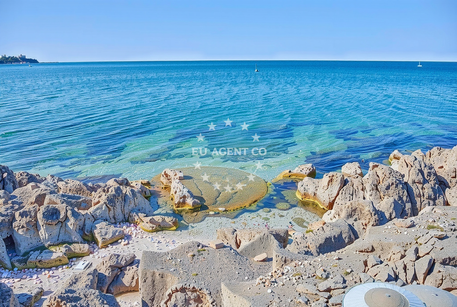
About this beach
Punta Trole, Vrsar
Beach: Punta Trole
Location: Vrsar
Characteristics and facilities
Concrete / stone slabs, rocks
350 m
shower
Beach character
The beach's composition of concrete and stone slabs reflects its integration with the surrounding rocky coastline. This type of shoreline is less common in the region, where many beaches feature fine sand or pebbles. The 350-meter length provides a modest stretch for visitors, though the rocky terrain may limit areas suitable for swimming. The presence of a shower facility suggests an effort to accommodate visitors, though no other amenities are explicitly listed. The beach's character aligns with the natural topography of the Istrian coast, where cliffs and rocky outcrops are prevalent.Swimming and shore
Swimming conditions at Punta Trole, Vrsar Beach are influenced by the rocky and slab-like shoreline. While the beach itself is not ideal for swimming due to the uneven terrain, the surrounding waters of the northern Adriatic are generally calm and suitable for maritime activities. The beach's location along the coast may offer opportunities for walking along the shore or exploring nearby coves. However, the lack of detailed information about water depth or currents means visitors should exercise caution when entering the sea.Facilities and activities
The beach includes a single shower facility, which is the only explicitly mentioned amenity. No other structures, such as restrooms, umbrellas, or sunbeds, are listed in the catalog. Activities associated with the beach are not detailed in the provided data, though the rocky shoreline may encourage walking or photography. The absence of additional facilities means visitors should plan accordingly, bringing personal items such as towels or sunscreen.Access and location
Punta Trole, Vrsar Beach is located in the town of Vrsar, a coastal settlement on the Istrian Peninsula. The beach is accessible via the town's road network, though specific parking details are not provided in the catalog. Vrsar itself is a well-connected destination, with ferry routes to nearby islands and proximity to the city of Rovinj. The beach's location near the Gulf of Trieste places it within a region known for its maritime history and sailing opportunities, though no marinas or anchorages are explicitly mentioned in the data.What to expect
Visitors to Punta Trole, Vrsar Beach should expect a shoreline composed of concrete and stone slabs, which may make it less suitable for swimming but offers a distinct coastal experience. The 350-meter length provides a modest area for exploration, and the presence of a shower facility indicates basic amenities are available. The beach's location in Vrsar, near the Gulf of Trieste, places it within a region popular with sailors and yacht charter guests. However, the lack of detailed information about other facilities means visitors should prepare for a more rustic experience compared to more developed beaches in the area.Practical tips
Given the rocky and slab-like nature of the shoreline, visitors may want to wear sturdy footwear for walking along the beach. The shower facility is available for use, though no other amenities are listed. Those planning to visit should check local conditions for any temporary closures or restrictions, as the beach's facilities are not extensively detailed in the catalog.Exploring the coast by yacht
The northern Adriatic coast, including the area around Vrsar, is a popular sailing destination, with many yachts and motorboats navigating the region's waters. While Punta Trole, Vrsar Beach itself is not marked as an anchorage or marina, its location along the Istrian coast places it within a sailing area that includes numerous harbors and marinas. Yacht charter guests exploring the region may find the surrounding waters appealing, though specific routes or docking options for this exact beach are not detailed in the provided data.Regional Context and Vrsar's Coastal Role
Vrsar is a coastal town in Istria known for its historical significance and proximity to the Gulf of Trieste. The town has long been a hub for maritime activity, with its harbor serving as a stop for both commercial and recreational vessels. The Istrian coast, where Punta Trole is located, is characterized by a mix of rocky shores, bays, and islands, making it a diverse sailing environment. Visitors to the area may also explore nearby attractions such as the town of Rovinj, a popular tourist destination with a well-preserved old town and vibrant cultural scene.
Anchorages in the surrounding area
Anchorages in Rovinj and Funtana offer nearby mooring options for vessels.
- Anchorage — rovinj — 0.8 NM from beach
- Kriz — rovinj — 0.8 NM from beach
- Anchorage — rovinj — 2.1 NM from beach
- Anchorage — funtana — 2.1 NM from beach
- Anchorage — funtana — 2.4 NM from beach
- Anchorage — rovinj — 2.4 NM from beach
- Anchorage — funtana — 3.0 NM from beach
- Anchorage — rovinj — 3.8 NM from beach
Distances are straight-line geographic distances, not sailing routes.
Mooring buoys in the surrounding area
- Buoy field — rovinj — 0.7 NM from beach
- Buoy field — vrsar — 1.4 NM from beach
- Buoy field — vrsar — 1.5 NM from beach
- Buoy field — funtana — 1.7 NM from beach
- Buoy field — rovinj — 2.0 NM from beach
Distances are straight-line geographic distances, not sailing routes.
Marine fuel stations
Marine fuel stations in Vrsar and Poreč ensure refueling convenience for sailors.
- Crodux — vrsar — 1.1 NM from beach
- Crodux — vrsar — 1.1 NM from beach
- Ina — rovinj — 3.0 NM from beach
- Ina — porec — 5.7 NM from beach
Distances are straight-line geographic distances, not sailing routes.
Harbours in the surrounding area
- Vrsar — 1.1 NM from beach
- Amarin — rovinj — 1.7 NM from beach
- Valkanela — funtana — 1.9 NM from beach
- Funtana — 2.9 NM from beach
- Valdibora — rovinj — 2.9 NM from beach
- Rovinj North Harbour — 3.2 NM from beach
Distances are straight-line geographic distances, not sailing routes.
Marinas in the surrounding area
- Marina Valalta — rovinj — 0.6 NM from beach
- Marina Vrsar — 1.2 NM from beach
- Marina Funtana — 2.9 NM from beach
- ACI Marina Rovinj — 3.5 NM from beach
- Marina Parentium — porec — 4.5 NM from beach
Distances are straight-line geographic distances, not sailing routes.
Restaurants near the beach
Restaurants in Vrsar offer dining choices close to the beach.
- Konoba Petra — vrsar — 0.6 NM from beach
- Konoba Amor — vrsar — 1.0 NM from beach
- Pizzeria Fancita — vrsar — 1.0 NM from beach
- Dvi Palme — vrsar — 1.1 NM from beach
- Antoni — vrsar — 1.1 NM from beach
- Azzuro — vrsar — 1.1 NM from beach
- La Rosa 2 — vrsar — 1.1 NM from beach
Distances are straight-line geographic distances, not sailing routes.
Navigation guides for the surrounding area
Navigation guides for Limski Kanai, Poree, and other nearby areas assist in route planning.
- Limski Kanai — 0.3 NM from beach
- Poree — 5.8 NM from beach
- Luka Crvar and Marina Crvar-Porat — 9.0 NM from beach
- Novi grad — 11.5 NM from beach
Distances are straight-line geographic distances, not sailing routes.
Yachts from nearby departure bases
Sailing yachts
- Bavaria 49 (Tortola) — Poreč Marina Funtana — 2.8 NM from departure base to beach
- Bavaria 32 (Vroni) — Poreč Marina Funtana — 2.8 NM from departure base to beach
- Bavaria 46 Cruiser (Hansi) — Poreč Marina Funtana — 2.8 NM from departure base to beach
- Bavaria 40 Cruiser (Franzi) — Poreč Marina Funtana — 2.8 NM from departure base to beach
- Bavaria 46 Cruiser (Barbados) — Poreč Marina Funtana — 2.8 NM from departure base to beach
- Bavaria 44 (Franzi) — Poreč Marina Funtana — 2.8 NM from departure base to beach
- Bavaria 40 (Conny) — Poreč Marina Funtana — 2.8 NM from departure base to beach
- Gib Sea 43 (Leonardo) — Poreč Marina Funtana — 2.8 NM from departure base to beach
- Bavaria 35 Cruiser (Salsa) — Poreč Marina Funtana — 2.8 NM from departure base to beach
Catamarans
- Lagoon Power 44 (Monteki) — Poreč Marina Funtana — 2.8 NM from departure base to beach
Distances are straight-line geographic distances, not sailing routes.