Punta Skala jug, Petrčane Beach, Croatia
About this beach
Punta Skala jug, Petrčane
Beach: Punta Skala jug
Location: Petrčane
Characteristics and facilities
Gravel, concrete / stone slabs
160 m
Restaurant / snack bar
Caffe bar / Drinks stand
Natural shade
Beach character
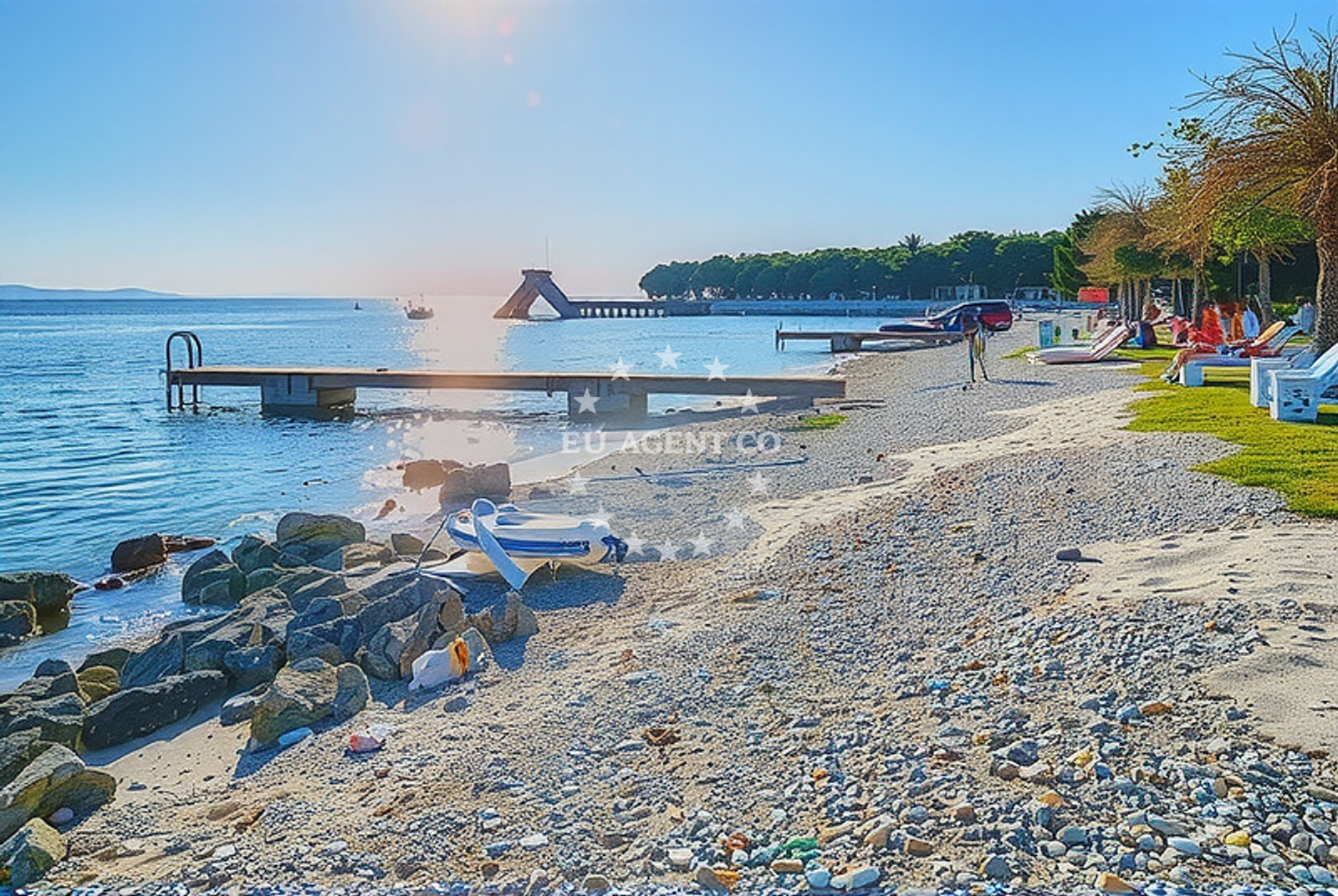
The beach's surface is a mix of gravel and concrete/stone slabs, which may appeal to those seeking a more rugged shoreline experience. The 160-meter length allows for a moderate stretch of beach, though it is not expansive. Natural shade from the surrounding landscape is a notable feature, offering respite from direct sunlight. The presence of a restaurant and caffe bar suggests the beach is frequented by visitors looking for casual dining options.Swimming and shore
While specific details about swimming conditions are not provided in the catalog, the beach's gravel and stone slab composition may indicate a shoreline that is more suited for walking or sunbathing than swimming. The natural shade could be particularly beneficial for those seeking to avoid prolonged sun exposure. The absence of structured amenities like showers or changing rooms implies a more informal beach setting.Facilities and activities
On-site facilities include a restaurant, snack bar, and caffe bar, which cater to visitors seeking light meals or beverages. These amenities suggest the beach is a destination for those looking to combine a seaside visit with casual dining. No specific recreational activities are listed, but the beach's location on the Dalmatian coast may offer opportunities for nearby excursions, such as exploring nearby coves or hiking trails in the surrounding area.Access and location
Punta Skala jug is situated in Petrčane, a village on the island of Brač, part of the Split-Dalmatia County in Croatia. The beach's coordinates (44.191271, 15.148618) place it within a region known for its limestone cliffs and clear waters. Visitors arriving by land would likely access the beach via local roads connecting Petrčane to other parts of Brač. The area's proximity to the Adriatic Sea makes it a potential stop for sailors exploring the Croatian coast.What to expect
Punta Skala jug is a beach that offers a mix of natural and developed features. The gravel and stone slabs create a unique walking surface, while the 160-meter length provides a moderate shoreline. The on-site dining options make it a practical choice for visitors seeking meals without leaving the beach. The natural shade is a key feature for those looking to avoid direct sun exposure. The beach's location in Petrčane, on the island of Brač, connects it to the broader Dalmatian coast, which is known for its scenic landscapes and sailing opportunities.Practical tips
Given the beach's gravel and stone slab surface, consider wearing appropriate footwear for comfort. The on-site dining options may have limited hours, so it's advisable to check availability in advance. The natural shade is a benefit for sun protection, but visitors should still apply sunscreen for exposed skin.Exploring the coast by yacht
The Dalmatian coast, where Petrčane is located, is a popular sailing destination in the Adriatic Sea. Euro-Agent's yacht charter services can connect visitors to this region, offering access to anchorages and marinas along the Croatian coast. While Punta Skala jug itself is not explicitly noted as a marina or anchorage, the surrounding area provides opportunities for yacht-based exploration of Brač and nearby islands.Regional Context: Brač Island and the Dalmatian Coast
Petrčane is a village on Brač, one of the largest islands in the Adriatic. Brač is renowned for its white limestone quarries, which have historically supplied material for the Venetian buildings in Venice. The island's coastline features a mix of pebbly beaches and cliffs, with Punta Skala jug representing one of the more accessible shorelines. The Dalmatian coast, stretching from Split to Dubrovnik, is a hub for yacht charter activity, with numerous marinas and anchorages catering to both motor and sailing yachts.Anchorages in the surrounding area
Nearby anchorage options include Anchorage — petrcane, located just 0.73 nautical miles away.
- Anchorage — petrcane — 0.7 NM from beach
- Diklo — 3.3 NM from beach
- Anchorage — privlaka — 3.4 NM from beach
- Anchorage — ugljan — 3.9 NM from beach
- Anchorage — nin — 4.1 NM from beach
- Anchorage — ceprljanda — ugljan — 4.2 NM from beach
- Puntamika — zadar — 4.3 NM from beach
- Anchorage — ugljan — 4.5 NM from beach
Distances are straight-line geographic distances, not sailing routes.
Mooring buoys in the surrounding area
A mooring buoy field named Punta Skala — petrcane is situated 0.12 nautical miles from the beach.
- Punta Skala — petrcane — 0.1 NM from beach
- Jetty — ugljan — 3.9 NM from beach
- Buoy field — muline — ugljan — 4.6 NM from beach
- Buoy field Muline — ugljan — 4.8 NM from beach
- Jetty — zadar — 4.9 NM from beach
Distances are straight-line geographic distances, not sailing routes.
Marine fuel stations
The closest marine fuel station is Ina — zadar, found 5.6 nautical miles away.
- Ina — zadar — 5.6 NM from beach
- Ina — preko — ugljan — 7.1 NM from beach
- Fuel station — sukosan — 10.5 NM from beach
- Ina — zaglav — dugi otok — 14.5 NM from beach
Distances are straight-line geographic distances, not sailing routes.
Harbours in the surrounding area
A nearby harbor named Petrčane — petrcane is located 0.62 nautical miles from the beach.
- Petrčane — petrcane — 0.6 NM from beach
- Nin — 3.5 NM from beach
- Ugljan — 4.1 NM from beach
- Čeprljanda — ceprljanda — ugljan — 4.2 NM from beach
- Muline — ugljan — 4.6 NM from beach
- Privlaka — 4.6 NM from beach
Distances are straight-line geographic distances, not sailing routes.
Marinas in the surrounding area
Marina Borik — zadar is a marina situated 4.55 nautical miles from the beach.
- Marina Borik — zadar — 4.5 NM from beach
- Vitrenjak Zadar — 4.8 NM from beach
- Marina Zadar — 5.5 NM from beach
- Olive Island Marina — sutomiscica — ugljan — 5.8 NM from beach
- Marina Preko — ugljan — 6.8 NM from beach
Distances are straight-line geographic distances, not sailing routes.
Restaurants near the beach
Branimir — nin is a restaurant located 3.45 nautical miles away.
- Branimir — nin — 3.5 NM from beach
- Tomislav — nin — 3.5 NM from beach
- Trapula — ugljan — 4.1 NM from beach
- Kaleta — ugljan — 4.1 NM from beach
- Apollo — ugljan — 4.3 NM from beach
- Niko — zadar — 4.5 NM from beach
- Mijo — zadar — 4.5 NM from beach
Distances are straight-line geographic distances, not sailing routes.
Navigation guides for the surrounding area
- Ugljan — 4.0 NM from beach
- Ceprljanda — 4.1 NM from beach
- Muline — 4.5 NM from beach
- Privlaka — 4.6 NM from beach
- Lukoran Veli — 5.2 NM from beach
Distances are straight-line geographic distances, not sailing routes.
Yachts from nearby departure bases
Sailing yachts
- Bavaria Cruiser 37 (JULIA) — Zadar Marina Borik — 4.5 NM from departure base to beach
- Dufour 460 (ELTHEOLE II) — Zadar Marina Borik — 4.5 NM from departure base to beach
Catamarans
- Sunreef 60 (SINATA) — Zadar Marina Borik — 4.5 NM from departure base to beach
- Leopard 50 (Solaia) — Zadar Marina Borik — 4.5 NM from departure base to beach
Motor yachts
- Prestige 550 Fly (Floria) — Zadar Marina Borik — 4.5 NM from departure base to beach
- Prestige 460 (Adudu 2) — Zadar Marina Borik — 4.5 NM from departure base to beach
Motor boats
- Rancraft RM21 (Dugi otok) — Zadar Diklo Port — 3.3 NM from departure base to beach
- Rancraft RS Cinque.5 — Zadar Diklo Port — 3.3 NM from departure base to beach
- Rancraft RM19 (Daycruiser) — Zadar Diklo Port — 3.3 NM from departure base to beach
- Antares 9 OB (Queen Mary) — Zadar Marina Borik — 4.5 NM from departure base to beach
Distances are straight-line geographic distances, not sailing routes.