Punta, Selca (Brač) Beach, Croatia
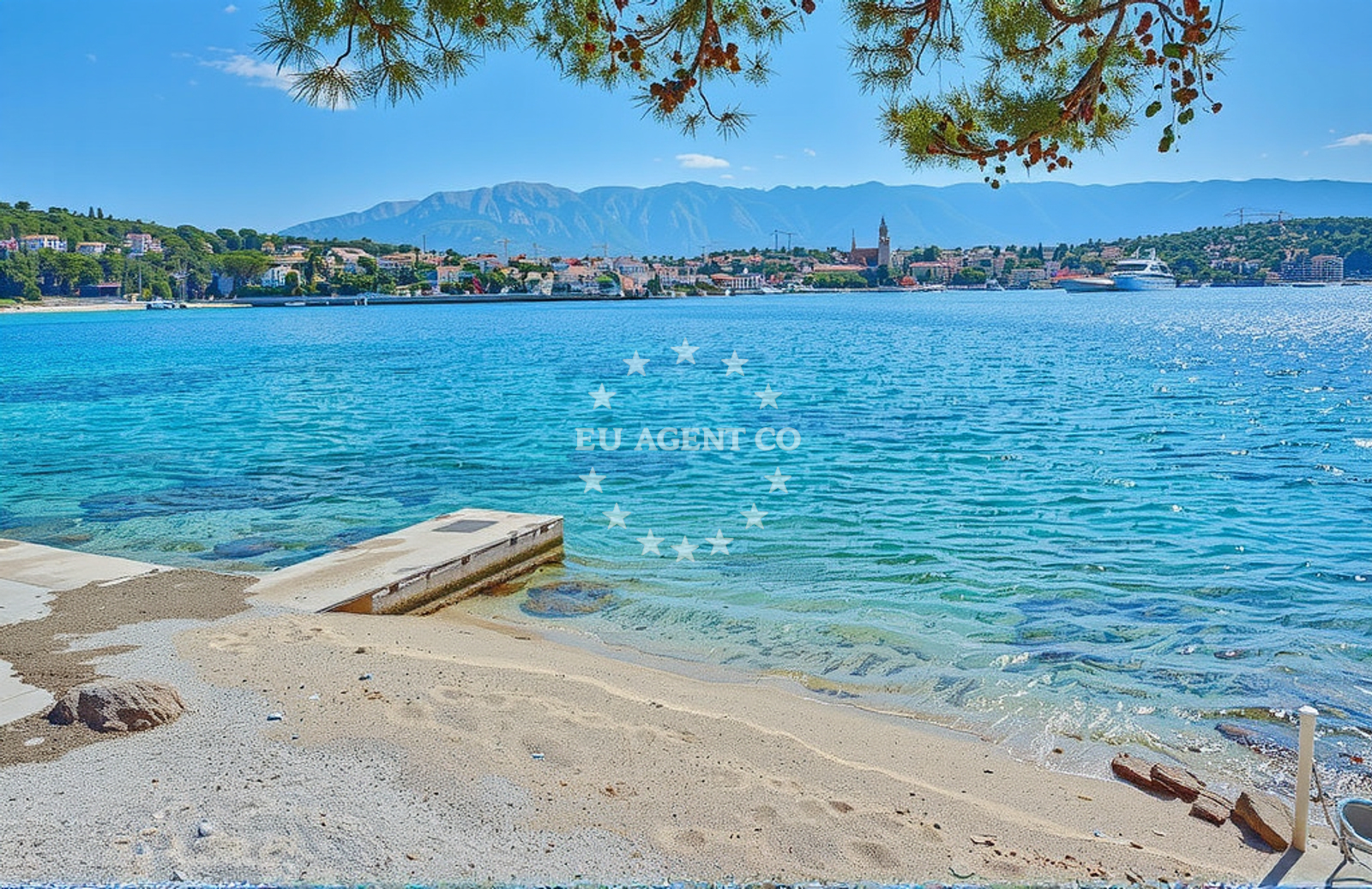
About this beach
Punta, Selca (Brač)
Beach: Punta
Location: Selca (Brač)
Characteristics and facilities
Gravel, concrete / stone slabs, rocks
200 m
Caffe bar / Drinks stand
Natural shade
shower
Beach character
The beach’s character is defined by its rocky and gravelly terrain, which contrasts with the more sandy shores typical of Brač’s western coast. The shoreline features a mix of natural rock formations and concrete/stone slabs, creating a rugged yet accessible environment. The 200-meter length provides a modest but distinct area for visitors. The caffe bar, situated nearby, serves as a focal point for those seeking light meals or beverages. A shower facility is available, though no additional amenities such as toilets or parking are explicitly noted in the beach’s authoritative records.Swimming and shore
Swimming conditions at Punta, Selca (Brač) Beach are influenced by the rocky shoreline. The presence of stones and slabs may create uneven entry points into the water, making it less ideal for young children or those seeking calm, shallow waters. The sea’s depth and currents near the shore are not detailed in the beach’s records, so visitors are advised to exercise caution. The rocky terrain also means that the beach is more suited for those seeking a rugged coastal experience rather than a traditional sandy beach.Facilities and activities
The beach’s facilities are minimal but functional. A caffe bar provides drinks and light snacks, catering to visitors looking for refreshments during their stay. A shower facility is available, though no other amenities such as umbrellas, sunbeds, or changing rooms are mentioned. The beach does not list structured activities or rental services, and no specific events or seasonal programs are noted in the catalog.Access and location
Punta, Selca (Brač) Beach is located in the village of Selca on Brač, accessible via local roads connecting to the island’s main settlements. Brač itself is a popular destination for yacht charter guests, with marinas in Supetar and Bol serving as common bases for exploring the island and surrounding areas. The beach’s proximity to Selca, a quieter alternative to Brač’s more tourist-heavy spots, makes it a potential stop for those seeking a less crowded shoreline.What to expect
Visitors to Punta, Selca (Brač) Beach should expect a rocky and gravelly shoreline with limited amenities. The caffe bar and shower are the primary facilities available, making it a practical but not luxurious option for beachgoers. The beach’s location within Selca offers a quieter alternative to Brač’s more developed areas, though its rugged terrain may not appeal to those seeking soft sand or extensive recreational services.Practical tips
Given the beach’s rocky surface, visitors may want to wear sturdy footwear for walking along the shore. The caffe bar is a convenient spot for refreshments, but there are no additional facilities such as umbrellas or sunbeds. Those planning to swim should be mindful of the uneven entry points into the sea.Exploring the coast by yacht
For yacht charter guests, Punta, Selca (Brač) Beach lies within the sailing region of Brač, a well-known destination in the Adriatic. The island’s marinas, including those in Supetar and Bol, are popular bases for exploring the area’s coastline, nearby islands, and the broader Adriatic Sea. While the beach itself is not a primary anchorage or marina, its location near Selca offers a potential stop for those navigating the eastern coast of Brač.Regional Context: Brač and the Adriatic Sailing Route
Brač is a key island in the Adriatic sailing route, known for its clear waters, limestone cliffs, and historic villages. Yacht charter guests often use Brač as a base to explore the nearby islands of Hvar, Vis, and the Pelješac Peninsula. The island’s eastern coast, where Punta, Selca Beach is located, offers a quieter alternative to the more crowded western shores, though it remains within reach of major sailing hubs.Anchorages in the surrounding area
Anchorages in Sumartin and Povlja on Brač are within a few nautical miles of the beach.
- Anchorage — sumartin — brac — 1.2 NM from beach
- Anchorage — sumartin — brac — 1.7 NM from beach
- Anchorage — povlja — brac — 2.6 NM from beach
- Anchorage — povlja — brac — 3.0 NM from beach
- Anchorage — povlja — brac — 3.3 NM from beach
- Anchorage — povlja — brac — 3.3 NM from beach
- Anchorage — povlja — brac — 3.4 NM from beach
- Anchorage — povlja — brac — 3.6 NM from beach
Distances are straight-line geographic distances, not sailing routes.
Mooring buoys in the surrounding area
Mooring buoys at Povlja and Basko Polje offer nearby options for securing vessels.
- Konoba Rojen jetty — povlja — brac — 4.5 NM from beach
- Restaurant Pipo jetty — povlja — brac — 4.6 NM from beach
- Restaurant Pipo buoys — povlja — brac — 4.7 NM from beach
- Baško Polje — basko polje — baska voda — 5.5 NM from beach
- Quay — krvavica — 5.7 NM from beach
Distances are straight-line geographic distances, not sailing routes.
Marine fuel stations
- Fuel station — sumartin — brac — 0.3 NM from beach
- Ina — makarska — 6.6 NM from beach
- Fuel station — bol — brac — 9.3 NM from beach
- Ina — vrboska — hvar — 10.4 NM from beach
Distances are straight-line geographic distances, not sailing routes.
Harbours in the surrounding area
- Sumartin — brac — 0.3 NM from beach
- Brela — 5.8 NM from beach
- Stomarica — 6.2 NM from beach
- Harbour — makarska — 6.4 NM from beach
- Makarska — 6.7 NM from beach
- Pučišća harbour — pucisca — brac — 6.9 NM from beach
Distances are straight-line geographic distances, not sailing routes.
Marinas in the surrounding area
- Marina Ramova — krvavica — 5.7 NM from beach
- Marina Baška Voda — marina baska voda — 5.7 NM from beach
- Marina Tučepi — marina tucepi — 8.5 NM from beach
- ACI Marina Vrboska — hvar — 10.4 NM from beach
- ACI Marina Milna — milna brac — 18.4 NM from beach
Distances are straight-line geographic distances, not sailing routes.
Restaurants near the beach
Restaurants in Sumartin and Povlja offer dining options close to the beach.
- Konoba Bernardo — sumartin — brac — 0.3 NM from beach
- Stara Uljara — povlja — brac — 3.3 NM from beach
- Kala — povlja — brac — 3.3 NM from beach
- Konoba Rojen — povlja — brac — 4.5 NM from beach
- Hideaway Pipo — povlja — brac — 4.6 NM from beach
Distances are straight-line geographic distances, not sailing routes.
Navigation guides for the surrounding area
Navigation guides for Su martin and Uvala Studena assist in local waters near the beach.
- Su martin — 0.5 NM from beach
- Uvala Studena — 1.1 NM from beach
- Uvala Luka — 4.4 NM from beach
- Pucisca — 6.6 NM from beach
- Mi mice — 7.6 NM from beach
Distances are straight-line geographic distances, not sailing routes.
Yachts from nearby departure bases
Sailing yachts
- Elan Impression 40 (KARLETA) — Baška Voda Port — 5.7 NM from departure base to beach
- D&D Kufner 54 (Komiza) — Baška Voda — 5.7 NM from departure base to beach
- Oceanis 38.1 (Baby Dory) — Baška Voda — 5.7 NM from departure base to beach
- Bavaria 46 Cruiser (Silvanac) — Baška Voda — 5.7 NM from departure base to beach
- Bavaria Cruiser 37 (Baby Panda) — Baška Voda — 5.7 NM from departure base to beach
- Sun Odyssey 409 (ARIES) — Baška Voda — 5.7 NM from departure base to beach
- Bavaria 41 (Seagoll) — Baška Voda — 5.7 NM from departure base to beach
Catamarans
- Lagoon 450 (LAMANTIN) — Baška Voda — 5.7 NM from departure base to beach
Motor yachts
- Canados 86 (Karisma) — Baška Voda — 5.7 NM from departure base to beach
Motor boats
- Pearl Sea 31 Hard Top (Aero) — Baška Voda Port — 5.7 NM from departure base to beach
Distances are straight-line geographic distances, not sailing routes.